Category:LAC-33
Jump to navigation
Jump to search
Contains media showing lunar surface features from LAC quadrangle #33.
- Latitude range: 32° N to 48° N
- Longitude range: 178° E to 158° W
Media in category "LAC-33"
The following 16 files are in this category, out of 16 total.
-
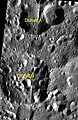 Duner satellite craters map.jpg 586 × 898; 47 KB
-
 Duner-letter.jpg 608 × 473; 145 KB
-
 Guillaume sattelite craters map.jpg 898 × 891; 78 KB
-
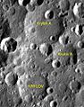 Krylov sattelite craters map.jpg 778 × 987; 67 KB
-
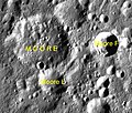 Moore sattelite craters map.jpg 721 × 613; 62 KB
-
 Normal guillaume-clem1.jpg 399 × 400; 27 KB
-
 Normal krylov.jpg 400 × 395; 35 KB
-
 Normal moore-clem1.jpg 400 × 378; 28 KB
-
 Normal Moore-F-Clem.jpg 331 × 400; 28 KB
-
 Normal parsons-clem1.jpg 400 × 382; 26 KB
-
 Normal Winkler-LO-V-053-h1.jpg 368 × 400; 25 KB
-
 Parsons sattelite craters map.jpg 1,240 × 1,166; 206 KB
-
 Perkin LROC.jpg 420 × 420; 61 KB
-
 Winkler sattelite craters map.jpg 588 × 927; 52 KB
-
 Woltjer lunar crater.jpg 457 × 458; 79 KB
-
 Woltjer sattelite craters map.jpg 980 × 898; 74 KB


