Category:Löschteich (Sondermunitionslager Dülmen-Visbeck)
Jump to navigation
Jump to search
| | View all coordinates using: OpenStreetMap |
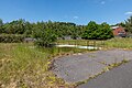
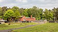
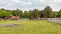
Deutsch: Löschteich im Sondermunitionslager Dülmen-Visbeck
Media in category "Löschteich (Sondermunitionslager Dülmen-Visbeck)"
The following 12 files are in this category, out of 12 total.
-
 Dülmen, Kirchspiel, ehem. Sondermunitionslager Visbeck -- 2022 -- 4473-6.jpg 12,883 × 3,439; 30.71 MB
-
 Dülmen, Kirchspiel, ehem. Sondermunitionslager Visbeck -- 2024 -- 0002.jpg 8,064 × 6,048; 39.24 MB
-
 Dülmen, Kirchspiel, ehem. Sondermunitionslager Visbeck -- 2024 -- 0007-10.jpg 12,662 × 8,233; 80.05 MB
-
 Dülmen, Kirchspiel, ehem. Sondermunitionslager Visbeck, Bereich der US Army -- 2020 -- 7485.jpg 6,586 × 4,391; 23.21 MB
-
 Dülmen, Kirchspiel, ehem. Sondermunitionslager Visbeck, Bunker 26 und 27 -- 2024 -- 0059.jpg 8,064 × 6,048; 38.5 MB
-
 Dülmen, Kirchspiel, ehem. Sondermunitionslager Visbeck, Eingangsbereich -- 2024 -- 4309.jpg 6,642 × 3,736; 19.02 MB
-
 Dülmen, Kirchspiel, ehem. Sondermunitionslager Visbeck, Eingangsbereich -- 2024 -- 4311.jpg 6,683 × 3,759; 17.22 MB
-

-

-
 Dülmen, Kirchspiel, ehem. Sondermunitionslager Visbeck, Stellungssystem -- 2024 -- 0048.jpg 7,462 × 5,597; 27.26 MB
-
 Dülmen, Kirchspiel, ehem. Sondermunitionslager Visbeck, Stellungssystem -- 2024 -- 0057.jpg 8,064 × 6,048; 39.94 MB
-
 Dülmen, Kirchspiel, ehem. Sondermunitionslager Visbeck, Wachturm -- 2024 -- 0025.jpg 4,032 × 3,024; 9.62 MB


