Category:Lærdal
Jump to navigation
Jump to search

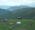
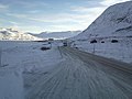
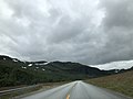
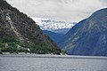
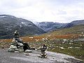
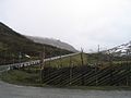
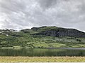
English: Pictures of the municipality Lærdal in the county Vestland in Norway. Near the Lærdalsfjorden
municipality in Vestland, Norway    | |||||
| Upload media | |||||
| Instance of | |||||
|---|---|---|---|---|---|
| Location |
| ||||
| Capital | |||||
| Head of government |
| ||||
| Significant event |
| ||||
| Highest point |
| ||||
| Population |
| ||||
| Area | |||||
| official website | |||||
 | |||||
Subcategories
This category has the following 12 subcategories, out of 12 total.
B
C
F
- Fodnes (8 F)
G
H
L
- Lærdal in art (40 F)
M
- Maristova (23 F)
O
- Olav Bjørkum (2 F)
T
V
- Vindhellavegen (20 F)
Media in category "Lærdal"
The following 52 files are in this category, out of 52 total.
-
 Lærdal komm.svg 400 × 500; 7 KB
-
 .. - panoramio (22).jpg 1,280 × 782; 274 KB
-
 15.11.2013 - panoramio (1).jpg 4,128 × 3,096; 2.27 MB
-
 15.11.2013 - panoramio (2).jpg 3,920 × 2,940; 1.84 MB
-
 2007-06-16 Lærdal.jpg 1,280 × 853; 396 KB
-
 24,5 km ..tunel.jpg 1,280 × 853; 219 KB
-
 Aurlandsfjellet, Norway (Unsplash).jpg 4,476 × 2,984; 1.01 MB
-
 Aurlandsvegen farm (171412).jpg 640 × 427; 300 KB
-
 Aurlandsvegen Skålane.JPG 2,435 × 2,094; 892 KB
-
 Aurlandsvegen toalett.JPG 2,257 × 1,571; 711 KB
-
 Borlaug-Filefjell-P1010392.JPG 2,560 × 1,920; 2.81 MB
-
 Borlaug.jpg 1,183 × 887; 152 KB
-
 Borlaugstunnelen i arbeid juni 2012.jpg 2,183 × 1,579; 776 KB
-
 Broen over Lærdalselva.jpg 3,488 × 2,304; 1.27 MB
-
 Brudedrakt NF.09401-007.jpg 1,431 × 2,317; 867 KB
-
 Center of Lærdalsøyri.jpg 4,032 × 3,024; 5.45 MB
-
 Den Bergenske Kongevei.JPG 3,648 × 2,736; 3.84 MB
-
 Droga 52 ,początek zimy - panoramio.jpg 1,815 × 1,361; 248 KB
-
 E16 i Lornkjørndalen i Lærdal.jpg 4,032 × 3,024; 2.11 MB
-
 E16 rett sør for Nedre Smeddalsvatnet i Lærdal.jpg 4,032 × 3,024; 1.33 MB
-
 Eldrevatnet, Lærdal, Norway - panoramio.jpg 4,896 × 2,756; 6.76 MB
-
 Ferje frå Mannheller til Fodnes.jpg 6,016 × 4,000; 5.31 MB
-
 Ferjer Mannheller Fodnes.jpg 5,907 × 3,692; 3.88 MB
-
 Fodnes mannheller.JPG 3,008 × 2,000; 1.44 MB
-
 Fodnes.JPG 3,008 × 2,000; 1.35 MB
-
 Fodnestunnelen.jpg 1,024 × 1,024; 438 KB
-
 Gram gardsbutikk ostebua, front.jpg 3,072 × 2,304; 4.55 MB
-
 Gram gardsbutikk ostebua, side.jpg 2,976 × 2,208; 4.16 MB
-
 Hemsedalsfjellet Rv52 fylkesgrense.jpg 1,651 × 1,205; 373 KB
-
 Hirtshals - panoramio (1).jpg 2,304 × 3,072; 994 KB
-
 Houses of Lærdalsøyri.jpg 4,032 × 3,024; 5.19 MB
-
-
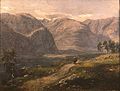 Johan Christian Claussen Dahl - Norske landskapet.jpg 795 × 600; 224 KB
-
 Knipenborg.jpg 3,176 × 1,920; 1.32 MB
-
 Lama i Lærdal.jpg 3,968 × 2,976; 4.91 MB
-
 Latarenka - panoramio - Ala Kot.jpg 800 × 533; 66 KB
-
 Lærdal fra Ljøsne.jpg 2,492 × 1,764; 520 KB
-
 Lærdalen, Norway - Lærdalselvi and Senddalen seen from Road E16 (Panoramio, 15.11.2013).jpg 4,128 × 3,096; 2.25 MB
-
 Lærdals sommervej Kæruld - panoramio.jpg 3,072 × 2,304; 1.42 MB
-
 Masseringsnosi.JPG 3,648 × 2,736; 2.32 MB
-
 Nivla kraftverk under bygging.JPG 2,816 × 2,112; 2.04 MB
-
 Noorwegen 224 (9295602074).jpg 6,000 × 4,000; 12.28 MB
-
 Noorwegen 240 (9292843909).jpg 6,000 × 4,000; 6.26 MB
-
 Norway Aurland Laerdal4.jpg 1,600 × 1,200; 952 KB
-
 Passage to Årdal (2844644857).jpg 2,592 × 1,728; 1,015 KB
-
 Płaskowyż,droga 52 - panoramio.jpg 1,815 × 1,361; 242 KB
-
 Riksveg 52.jpg 1,280 × 960; 134 KB
-
 Sognefjord - panoramio (1).jpg 3,008 × 2,000; 1.17 MB
-
 Store Jukleeggi.jpg 2,592 × 1,944; 1,019 KB
-
 Svettebottshøgdene.jpg 2,629 × 1,745; 5.25 MB
-
 Utsikt over Nedre Smeddalsvatnet fra E16 ved Drysja i Lærdal.jpg 4,032 × 3,024; 2.4 MB
-
 Villakssenter01.jpg 1,500 × 799; 193 KB
.jpg)
.jpg)
.jpg)


.jpg)
.jpg)


.jpg)


.jpg)


.jpg)
.jpg)

.jpg)


.jpg)


