Category:Kuttanad
region in Kerala, India  | |||||
| Upload media | |||||
| Instance of | |||||
|---|---|---|---|---|---|
| Location | |||||
| Elevation above sea level |
| ||||
| Different from | |||||
 | |||||
Kuttanadu (Malayalam: കുട്ടനാട്) in Kerala, India, is the region with the lowest altitude in India, with 500 square kilometres of the region below sea level. Its elevation ranges from 0.6 m above to 2.2 metres below sea level. Most of the area is covered with water throughout the year. Kuttanadu is one of the few places in the world where farming is carried out below sea level. The Greater Kuttanad region spread across the districts of Alappuzha, Pathanamthitta, and Kottayam. The Lower Kuttanad region itself has a population of 1.8 million and comes under the Alappuzha district. Four major Kerala rivers, the Pampa, Meenachil, Achankovil and Manimala rivers flow into Kuttanadu. Crops grown in Kuttanadu include rice, bananas, casava and yams.
Subcategories
This category has the following 5 subcategories, out of 5 total.
Media in category "Kuttanad"
The following 15 files are in this category, out of 15 total.
-
 A bit of fishing for the dinner!.jpg 4,469 × 2,277; 2.72 MB
-
 A view Kuttanad( Aleppey Dt. , Kerala ) backwaters from the Aleppey - Changanassery road.jpg 4,608 × 2,448; 1.87 MB
-
 BACKWATERS OF KUTTANAD.jpg 735 × 350; 69 KB
-
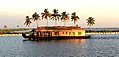
 HOUSEBOAT IN KUTTANAD LAKE IN ALAPPUZHA,KERALA.jpg 470 × 230; 49 KB
-
 Kuttanad beauty.jpg 4,096 × 2,214; 3.38 MB
-
 Kuttanad kerala.jpg 4,096 × 3,072; 3.01 MB
-
 Kuttanad package board.jpg 3,264 × 2,448; 2.21 MB
-
 Kuttanad Pagebanner.jpg 5,049 × 720; 1.68 MB
-
 Kuttanad sunset.jpg 4,096 × 3,072; 1.96 MB
-
 KUTTANAD-PERFECT TOURIST DESTINATION IN KERALA,INDIA.jpg 800 × 603; 141 KB
-
 Kuttanadan beauty.jpg 3,907 × 1,760; 1.6 MB
-
 Kuttanadan lakes.jpg 3,576 × 2,003; 1.17 MB
-
 Plie and Slab Bund at Kuttanadu.JPG 4,000 × 3,000; 3.35 MB
-
 Rice fields of Kuttanad.jpg 720 × 405; 91 KB
-
 Unique foot bridges of Kuttanad , Aleppy District, Kerala.jpg 3,215 × 1,625; 1.05 MB

_backwaters_from_the_Aleppey_-_Changanassery_road.jpg)


