Category:Kuststigen
Jump to navigation
Jump to search
hiking trail along the Swedish West Coast  Kuststigen trail marker | |||||
| Upload media | |||||
| Instance of | |||||
|---|---|---|---|---|---|
| Location |
| ||||
| Operator |
| ||||
| Length |
| ||||
| official website | |||||
| |||||
Svenska: Kuststigen är en vandringled längs Sveriges västkust. Leden går från Tjörn till Oslo och är uppdelad på 38 etapper. [1]
English: The Coastal Trail is a hiking trail along the Swedish West Coast. The trail goes from Tjörn to Oslo and is divided into 38 stages.
Subcategories
This category has the following 15 subcategories, out of 15 total.
Media in category "Kuststigen"
The following 42 files are in this category, out of 42 total.
-
 A boy taking bags of PET bottles to the recycling deposit at Tempo, Brodalen.jpg 4,792 × 3,224; 10.72 MB
-
 A couple on a jetty at Röhälla beach, Govik.jpg 5,184 × 3,151; 12.46 MB
-
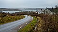
 Bohuslän Coast Trail through Govik.jpg 3,283 × 4,104; 13.24 MB
-
 Brodalen och bron.JPG 2,048 × 1,536; 671 KB
-
 Crossing ahead on Backa road, Immestad 2.jpg 4,925 × 3,283; 14.21 MB
-
 Crossing ahead on Backa road, Immestad.jpg 4,860 × 3,239; 12.2 MB
-
 Foggy, rainy day in Holländaröd 1.jpg 4,814 × 3,209; 12.05 MB
-
 Foggy, rainy day in Holländaröd 2.jpg 4,925 × 2,770; 12.61 MB
-
 Foggy, rainy day in Holländaröd 3.jpg 4,925 × 2,770; 13.17 MB
-
 Foggy, rainy day in Holländaröd 4.jpg 4,925 × 3,283; 14.01 MB
-
 Hermanö.jpg 2,016 × 1,512; 1.19 MB
-
 Horse chestnut trees in Brodalen 1.jpg 3,132 × 3,882; 10.97 MB
-
 Horse chestnut trees in Brodalen 2.jpg 4,613 × 3,050; 12.76 MB
-
 Houses in Draget, Malmön 2.jpg 4,925 × 2,770; 8.05 MB
-
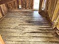 Klåvanekojan - interior.jpg 4,032 × 3,024; 4.94 MB
-
 Klåvanekojan 01.jpg 4,032 × 3,024; 5.57 MB
-
 Klåvanekojan 03.jpg 4,608 × 3,456; 6.8 MB
-
 Klåvanekojan 04.jpg 4,000 × 3,000; 5.75 MB
-
 Marsellekojan - backside 01.jpg 4,032 × 3,024; 6.52 MB
-
 Marsellekojan - frontside.jpg 4,032 × 3,024; 6.12 MB
-
 Marsellekojan - interior.jpg 4,608 × 3,456; 5.23 MB
-
 Plant by the pathway in Stångehuvud 1.jpg 4,896 × 3,263; 16.84 MB
-
 Road at the Cobbler's Cliff.jpg 4,925 × 3,283; 16 MB
-
 Round hay bales in Brodalen 2.jpg 4,925 × 3,283; 13.56 MB
-
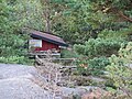
 Rödskojan vindskydd.jpg 4,032 × 3,024; 5.49 MB
-
 Sign for Kuststigen hiking trail on Göteborgsvägen bridge.jpg 4,701 × 3,055; 7.53 MB
-
 Skagerrak beyond the cliffs of Väjern, Kungshamn 2.jpg 4,925 × 2,770; 8.95 MB
-
 Skagerrak beyond the cliffs of Väjern, Kungshamn.jpg 4,925 × 3,283; 10.64 MB
-
 Stenbrottskojan - interior.jpg 4,032 × 3,024; 4.22 MB
-
 Stenbrottskojan - overview 1.jpg 4,032 × 3,024; 6.24 MB
-
 Stenbrottskojan - overview 2.jpg 4,000 × 3,000; 5.65 MB
-
 Victoria Path in Stångehuvud nature reserve 1.jpg 4,925 × 3,283; 15.08 MB
-
 Victoria Path in Stångehuvud nature reserve 2.jpg 4,882 × 2,746; 13.36 MB
-
 Victoria Path in Stångehuvud nature reserve 3.jpg 4,506 × 3,005; 13.29 MB
-
 Victoria Path in Stångehuvud nature reserve 4.jpg 4,925 × 2,770; 12.81 MB
-
 View from Rödskojan.jpg 4,032 × 3,024; 4.5 MB
-
 View from Stenbrottskojan.jpg 4,032 × 3,024; 5.15 MB
-
 Winter view over Skagerrak from Väjern, Kungshamn.jpg 5,369 × 3,085; 10.46 MB
-
 Åbyfjorden vid Nordens Ark 1.jpg 4,000 × 2,796; 9.47 MB
-
 Åbyfjorden vid Nordens Ark 2.jpg 4,000 × 3,000; 9.16 MB
-
 Åbyfjorden vid Nordens Ark 3.jpg 4,000 × 3,000; 9.2 MB
-
 Åbyfjorden vid Nordens Ark 4.jpg 4,000 × 3,059; 8.97 MB


