Category:Kusatsu, Gunma
Jump to navigation
Jump to search

日本語: 日本国群馬県吾妻郡草津町に関するカテゴリ。
town in Agatsuma district, Gunma prefecture, Japan    | |||||
| Upload media | |||||
| Instance of | |||||
|---|---|---|---|---|---|
| Location |
| ||||
| Legal form |
| ||||
| Inception |
| ||||
| Highest point | |||||
| Population |
| ||||
| Area |
| ||||
| Replaces |
| ||||
| official website | |||||
 | |||||
Subcategories
This category has the following 14 subcategories, out of 14 total.
1
H
- Hotels in Kusatsu, Gunma (9 F)
J
- Jofu Falls (2 F)
K
- Kuryū Rakusen'en Sanatorium (2 F)
- Kusatsu Onsen Ski Resort (6 F)
- Kōsen-ji (Kusatsu) (5 F)
N
- Night in Kusatsu, Gunma (4 F)
O
- Ōsen Falls (3 F)
S
- Shirane Kazan Ropeway (5 F)
- Streets in Kusatsu, Gunma (17 F)
Y
- Yamada Pass (14 F)
Media in category "Kusatsu, Gunma"
The following 31 files are in this category, out of 31 total.
-
 Population distribution of Kusatsu, Gunma, Japan.svg 512 × 256; 22 KB
-
 BT↓↑湯畑 - panoramio.jpg 4,000 × 6,016; 13.03 MB
-
 Emblem of Kusatsu, Gunma.jpg 259 × 250; 14 KB
-
 Emblem of Kusatsu, Gunma.svg 412 × 416; 995 bytes
-
 Flag of Kusatsu Gunma.JPG 324 × 216; 11 KB
-
 Flag of Kusatsu Gunma.svg 900 × 600; 1 KB
-
 Hutsugyou no kusatsuonnsenn.JPG 5,472 × 3,648; 3.98 MB
-
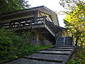
 Inn in kusatsu.jpg 600 × 394; 99 KB
-
 Japanese serow near Kusatsu.jpg 4,320 × 3,240; 3.5 MB
-
 Jr-rosa-bonet932.JPG 562 × 377; 70 KB
-
 Karlovy Vary sign of its sister cities.jpg 3,024 × 4,032; 1.51 MB
-
 Kusatsu Anamori-Inari Jinja.JPG 2,048 × 1,536; 1.72 MB
-
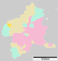 Kusatsu in Gunma Prefecture Ja.svg 501 × 523; 11 KB
-
 Kusatsu Machi.jpg 6,036 × 3,717; 4.59 MB
-
 Kusatsu town office.JPG 3,420 × 2,736; 2.83 MB
-
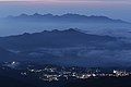
 Kusatsu town seen from near Shibutoge (Gunma, Japan) 01.jpg 6,048 × 4,024; 10 MB
-
 Kusatsu town seen from near Shibutoge (Gunma, Japan) 02.jpg 6,048 × 4,024; 9.88 MB
-
 Kusatsu Visitor Center.JPG 2,048 × 1,536; 1.72 MB
-
 Mary Cornwall Legh Monument.jpg 2,048 × 1,536; 1.54 MB
-
 Michinoeki kusatsu undojaya park.jpg 1,280 × 960; 301 KB
-
 St Barnabus' Church, Kusatsu.jpg 2,048 × 1,536; 1.27 MB
-
 St. Margaret's Home, Kusatsu.jpg 2,048 × 1,536; 1.53 MB
-
 Yaseinokamosika.jpg 2,141 × 1,640; 975 KB
-
 カビ - panoramio.jpg 2,848 × 4,272; 4.73 MB
-
 国道292 渋峠 20130708 - panoramio.jpg 2,736 × 1,824; 3.02 MB
-
 湯畑の空 - panoramio.jpg 6,016 × 4,000; 7.8 MB
-
 湯釜の近くの山より - panoramio.jpg 2,848 × 4,272; 3.89 MB
-
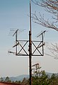 草津テレビの受信点設備.jpeg 1,000 × 1,460; 372 KB
-
 草津中継局.jpg 1,521 × 1,141; 846 KB
-
 草津穴守稲荷神社 - panoramio.jpg 3,648 × 2,736; 1.49 MB
-
 西之河原の西の道路端から湧き出る温泉 - panoramio.jpg 4,176 × 2,784; 4.84 MB


_01.jpg)
_02.jpg)


