Category:Kurgans in Bačka
Jump to navigation
Jump to search
This media gallery is part of the "Kurgans in Serbia" project of the Wikipedia in Serbian language.
It is a subcategory of Category:Kurgans in Serbia
Media in category "Kurgans in Bačka"
The following 200 files are in this category, out of 253 total.
(previous page) (next page)-
 A kurgan on the way; in Vojvodina, Serbia.jpg 2,298 × 1,657; 375 KB
-
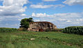
 Abandoned old farm, in the field.JPG 1,876 × 960; 337 KB
-
 Abandoned old farm, possibly built on a kurgan.JPG 1,556 × 850; 257 KB
-
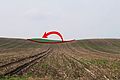
 Almost there (in search of kurgan).jpg 1,028 × 1,342; 163 KB
-
 An old earth mound with three peaks (distant view).jpg 1,655 × 993; 208 KB
-
 An old hill, in Gakovo, destroyed by dirt mining.jpg 1,500 × 998; 356 KB
-
 And how much the landscape was made desolate.jpg 1,500 × 998; 233 KB
-
 Anonimous kurgan near Nadalj, Serbia.jpg 1,577 × 1,170; 287 KB
-
 Anonimous mound near Aleksa Santic, Serbia.JPG 1,496 × 821; 376 KB
-
 Anonymous companion of kurgan Kanasz.jpg 1,500 × 998; 413 KB
-
 Anonymous kurgan Tornjos (Serbia) viewed from east.JPG 1,861 × 967; 525 KB
-
 Anonymous kurgan Tornjos, Serbia.JPG 2,381 × 1,524; 1.05 MB
-
 Aristolochia clematitis, at the base of hillfort, Horgos, Serbia.JPG 1,014 × 1,352; 512 KB
-
 At the base of hillfort Vaskapu in Horgos, Serbia.jpg 1,584 × 1,133; 482 KB
-
 At the top of hillfort Vaskapu in Horgos, Serbia.jpg 1,585 × 1,189; 604 KB
-
 At the top of hillforth Vaskapu in Horgos, Serbia (view towards NW).JPG 1,187 × 1,526; 471 KB
-
 Austro-Hungarian trigonometrical pyramid at Kevi, Vojvodina, Serbia.JPG 2,562 × 1,678; 456 KB
-
 BAC811 manja jurisina.jpg 3,025 × 1,244; 679 KB
-
 Batka, nasip na Tisi.jpg 2,400 × 1,598; 1.23 MB
-
 Bisecting road by kurgan Pivar, in Serbia.JPG 1,800 × 1,181; 471 KB
-
 Budzak, cc.1860, Horgos, Serbia.png 650 × 391; 117 KB
-
 Bóbán-kereszt, Csákó-halom, Oromhegyes.jpg 2,433 × 3,656; 1.91 MB
-
 Calvary Hill (Kalvaria) in Kanjiza, Serbia.jpg 1,458 × 977; 349 KB
-
 Ciglana Male Pijace 1.jpg 2,809 × 1,767; 1.01 MB
-
 Ciglana Male Pijace 2.jpg 3,648 × 2,136; 1.48 MB
-
 Ciglana Male Pijace 3.jpg 3,630 × 2,286; 1.41 MB
-
 Ciglana Male Pijace 4.jpg 2,807 × 1,766; 1.39 MB
-
 Ciglana Male Pijace 5.jpg 2,135 × 1,622; 667 KB
-
 Ciglana Male Pijace 6.jpg 2,809 × 1,944; 933 KB
-
 Ciglana Male Pijace 7.jpg 1,871 × 1,402; 795 KB
-
 Clay pottery scrap on kurgan.jpg 2,592 × 3,872; 3.39 MB
-
 Climbing the Kamaras kurgan, Serbia.JPG 1,500 × 998; 515 KB
-
 Common Hawthorn (Crataegus monogyna) bush in the saline steppe.jpg 3,872 × 2,592; 1.75 MB
-
 Csákó halom, Vajdaság.jpg 3,629 × 2,433; 1.33 MB
-
 Doline, kanjiža (talasast predeo, Telečka lesna visoravan).jpg 1,733 × 1,164; 336 KB
-
 Doline, Serbia, a broad hill.jpg 1,541 × 1,018; 446 KB
-
 Dry, ploughed banks of old Danube backwater.jpg 1,500 × 998; 363 KB
-
 Dve humke Žabalj.jpg 5,434 × 2,582; 2.74 MB
-
 Green Kurgan.jpg 4,147 × 2,540; 1.63 MB
-
 Hill forth Vaskapu at Horgos, Serbia.JPG 3,201 × 1,065; 1.19 MB
-
 Humka "Stari Žabalj" BAC811.jpg 2,584 × 1,737; 901 KB
-
 Humka "Stari Žabalj".jpg 3,872 × 2,592; 1.58 MB
-
 Humka ciglana Male Pijace.jpg 1,500 × 998; 278 KB
-
 Humka Pap, gledana iz voza.jpg 2,207 × 1,477; 399 KB
-
 Humka sa vikendicom.jpg 1,784 × 1,025; 232 KB
-
 Humka Varju, panorama.jpg 3,999 × 1,070; 526 KB
-
 Humka Zako - Csákó halom, panoramic view.jpg 3,604 × 817; 769 KB
-
 Humka Zako - Csákó halom.jpg 3,001 × 1,971; 1.48 MB
-
 Humke Vitez i Pap.jpg 1,464 × 789; 436 KB
-
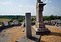
 Hussar monument at kurgan Zako.jpg 1,630 × 2,450; 978 KB
-
 In search of the kurgans - nice day for walk.JPG 1,203 × 763; 308 KB
-
 Jurishina humka.jpg 2,717 × 1,228; 828 KB
-
 Jurišina humka BAC810.jpg 2,981 × 2,038; 1.46 MB
-
 Jurišina humka površina1.jpg 3,872 × 2,592; 1.67 MB
-
 Jurišina humka površina2.jpg 2,592 × 3,872; 2.89 MB
-
 Kamaras Kurgan in Horgos, Serbia.jpg 5,799 × 1,680; 2.95 MB
-
 Kanász-halom, Rasztina - rálátás a Mecsekre.jpg 1,500 × 998; 334 KB
-
 Kanász-halom, Rasztina.jpg 1,500 × 998; 307 KB
-
 Kanász-halom.jpg 1,500 × 998; 431 KB
-
 Knocked out stone marker at kurgan Čuka.jpg 1,500 × 998; 463 KB
-
 Krivaja kurgan, Mišićevo (highres).jpg 4,189 × 2,782; 2.24 MB
-
 Krivaja kurgan, Mišićevo.jpg 1,500 × 998; 446 KB
-
 Kurgan "Stari Žabalj" distant.jpg 1,861 × 974; 531 KB
-
 Kurgan "Stari Žabalj" panoramic.jpg 7,159 × 2,716; 3.69 MB
-
 Kurgan 'Kanász' at Rasztina, a trigonometric point.jpg 1,500 × 998; 498 KB
-
 Kurgan (Humka Pap), distant view.jpg 2,799 × 1,503; 245 KB
-
 Kurgan at 'Rauscherbuckel'.jpg 1,500 × 998; 475 KB
-
 Kurgan Batka, possibly mislocated or formerly flattened.jpg 2,011 × 1,333; 587 KB
-
 Kurgan Bela humka, Vojvodina, panoramic view.JPG 3,886 × 1,290; 425 KB
-
 Kurgan Bela humka, Vojvodina, with note.JPG 1,470 × 893; 125 KB
-
 Kurgan Bela humka, Vojvodina.jpg 1,738 × 1,164; 200 KB
-
 Kurgan Budzak In Horgos, Serbia.JPG 3,018 × 1,047; 611 KB
-
 Kurgan Chuka, near Stanisic, Serbia (closeup view).JPG 1,754 × 1,032; 599 KB
-
 Kurgan Chuka, near Stanisic, Serbia (its remote view).JPG 2,358 × 994; 409 KB
-
 Kurgan Chuka, near Stanisic, Serbia (on the top).JPG 669 × 1,009; 248 KB
-
 Kurgan Chuka, near Stanisic, Serbia (section schematic).png 1,206 × 612; 205 KB
-
 Kurgan Chuka, near Stanisic, Serbia (view from south).JPG 1,200 × 799; 383 KB
-
 Kurgan Chuka, near Stanisic, Serbia (view from top towards east).JPG 2,450 × 1,596; 918 KB
-
 Kurgan Chuka, near Stanisic, Serbia (viewed from east).JPG 2,163 × 562; 382 KB
-
 Kurgan Chuka, near Stanisic, Serbia.jpg 1,553 × 903; 336 KB
-
 Kurgan Chuka, Vojvodina, Serbia.JPG 1,067 × 711; 251 KB
-
 Kurgan cut by a road, near Stanisic, Serbia (panoramic).JPG 3,240 × 767; 888 KB
-
 Kurgan cut by a road, near Stanisic, Serbia (top view).jpg 1,948 × 742; 462 KB
-
 Kurgan cut by a road, near Stanisic, Serbia (view from east).JPG 1,726 × 983; 554 KB
-
 Kurgan cut by a road, near Stanisic, Serbia.jpg 1,291 × 925; 361 KB
-
 Kurgan Feherova humka 1.jpg 1,547 × 1,029; 217 KB
-
 Kurgan Feherova humka 2.jpg 2,975 × 1,998; 686 KB
-
 Kurgan Kamaras in Horgos, Serbia.JPG 2,883 × 1,008; 603 KB
-
 Kurgan Kamaras, Horgos, Serbia.JPG 2,365 × 1,071; 621 KB
-
 Kurgan Kamaras, Serbia - plant cover.JPG 3,656 × 2,383; 2.32 MB
-
 Kurgan Kanasz 01.jpg 1,500 × 998; 251 KB
-
 Kurgan Kanasz 02.jpg 1,500 × 998; 411 KB
-
 Kurgan Kanasz 03.jpg 1,500 × 998; 359 KB
-
 Kurgan Kanasz 04.jpg 1,500 × 998; 436 KB
-
 Kurgan Krivaja 01, Mišićevo.jpg 1,500 × 998; 382 KB
-
 Kurgan Krivaja 02, Mišićevo.jpg 1,500 × 998; 353 KB
-
 Kurgan Mali Pesak.jpg 2,787 × 1,521; 472 KB
-
 Kurgan near Gakovo (very destroyed).jpg 1,500 × 998; 382 KB
-
 Kurgan near Pecello, Vojvodina, Serbia.JPG 2,198 × 956; 254 KB
-
 Kurgan No.1 at 'Rauscherbuckel'.jpg 1,500 × 998; 485 KB
-
 Kurgan No.2 at 'Rauscherbuckel', near Gakovo.jpg 1,500 × 998; 294 KB
-
 Kurgan No.2 at 'Rauscherbuckel'.jpg 1,500 × 998; 339 KB
-
 Kurgan No.3 at 'Rauscherbuckel' closeup.jpg 1,500 × 998; 350 KB
-
 Kurgan No.3 at 'Rauscherbuckel' with No.2 peeking in from right.jpg 1,500 × 998; 395 KB
-
 Kurgan No.3 at 'Rauscherbuckel'.jpg 1,500 × 998; 315 KB
-
 Kurgan pap gradnja.jpg 2,736 × 1,824; 1.22 MB
-
 Kurgan Pap, near Senta (typical earthworks trail).jpg 2,998 × 1,822; 1.34 MB
-
 Kurgan Pap, viewed from the Subotica-Senta train.jpg 1,669 × 1,117; 300 KB
-
 Kurgan Papp.jpg 2,401 × 1,598; 707 KB
-
 Kurgan Perleg, at distance.jpg 2,909 × 1,984; 1.09 MB
-
 Kurgan Perleg, view from the road.jpg 3,001 × 1,998; 1.24 MB
-
 Kurgan Perleg.jpg 3,656 × 2,325; 1.74 MB
-
 Kurgan Pivar on old map (c.1880).png 1,514 × 617; 437 KB
-
 Kurgan Prokes BAC238, panorama.jpg 3,587 × 1,302; 1.09 MB
-
 Kurgan Prokes BAC238, panoramiv view.jpg 3,513 × 1,302; 1.05 MB
-
 Kurgan Prokes BAC238, the path to.jpg 1,588 × 1,034; 421 KB
-
 Kurgan Prokes BAC238, view from east.jpg 2,549 × 1,270; 635 KB
-
 Kurgan Prokes BAC238.jpg 1,737 × 1,202; 659 KB
-
 Kurgan Sombor, Mostonga.jpg 1,500 × 998; 466 KB
-
 Kurgan Three peaks hill in Kanjiza, Vojvodina (front view).jpg 1,363 × 827; 151 KB
-
 Kurgan Three peaks hill in Kanjiza, Vojvodina (panorama).jpg 1,262 × 767; 174 KB
-
 Kurgan Tornjos (Serbia) - digging attempt, another view.JPG 1,656 × 1,181; 881 KB
-
 Kurgan Tornjos (Serbia) - digging attempt.JPG 1,800 × 1,199; 983 KB
-
 Kurgan Tornjos (Serbia) - panorama.JPG 2,860 × 947; 970 KB
-
 Kurgan Tornjos (Serbia) - view towards north-east.JPG 2,455 × 1,490; 963 KB
-
 Kurgan Tornjos (Serbia) - view towards west.JPG 2,391 × 1,321; 718 KB
-
 Kurgan Tornjos, Serbia - population St John's wort (Hypericum perforatum).JPG 3,001 × 1,998; 2.33 MB
-
 Kurgan Tornjos, Serbia - stock of St John's wort (Hypericum perforatum).JPG 2,403 × 3,521; 2.53 MB
-
 Kurgan Tornjos, Serbia.JPG 2,436 × 1,425; 1.04 MB
-
 Kurgan Trešnjevac, west, anonimous.jpg 1,524 × 943; 273 KB
-
 Kurgan vegetation (patches of Woodland Sage) Horgos, Serbia.JPG 2,011 × 1,339; 903 KB
-
 Kurgan vegetation, Woodland Sage, Horgos, Serbia.JPG 1,598 × 2,401; 892 KB
-
 Kurgan Zabina humka (Beka halom), Serbia.JPG 2,011 × 1,336; 281 KB
-
 Kurgan Zabina humka, Serbia, view from north.jpg 1,868 × 1,102; 319 KB
-
 Kurgan Zako from distance.jpg 5,456 × 3,632; 3.58 MB
-
 Kurgan Zako trigpoint and view.jpg 1,473 × 998; 403 KB
-
 Kurgan Zako trigpoint.jpg 3,560 × 2,433; 2.02 MB
-
 Kurgan Zako, the memorial plaques.jpg 4,201 × 2,797; 2.45 MB
-
 Kurgan Zako, view.jpg 5,456 × 3,632; 3.31 MB
-
 Kurgan Čuka in sunset.jpg 1,500 × 998; 281 KB
-
 Kurgan Čuka, near Stanišić in Serbia.jpg 1,500 × 998; 388 KB
-
 Kurgan, near Stanišić in Serbia.jpg 1,500 × 998; 246 KB
-
 Kurgan, pair of Krivaja kurgan, Mišićevo.jpg 1,500 × 998; 395 KB
-
 Kurgans at Krivaja, Mišićevo (panoramic).jpg 8,192 × 1,856; 5.06 MB
-
 Kurgans at Pivnice.jpg 1,932 × 1,225; 375 KB
-
 Kurgans Pap and Zako, old map around 1850.png 1,143 × 795; 480 KB
-
 Kurgans Pivar and Kalocsai on old map (c.1783).jpg 1,096 × 690; 271 KB
-
 Loess plateau Telečka, eastern side.jpg 3,656 × 2,433; 2.27 MB
-
 Mecsek mountains from kurgan Čuka.jpg 4,632 × 2,780; 1.16 MB
-
 Of the road, near kurgan Papp.jpg 1,419 × 944; 285 KB
-
 Old kurgan near Skenderevo, Serbia.JPG 1,732 × 745; 171 KB
-
 Old mound in Supljak, Vojvodina (Debelo brdo).JPG 1,500 × 732; 163 KB
-
 Old road at at 'Rauscherbuckel'.jpg 1,500 × 998; 503 KB
-
 Old road junction in Vojvodina, Serbia with a roadside cross.jpg 1,308 × 713; 275 KB
-
 Old triangulation pyramid, Doline.jpg 1,297 × 854; 215 KB
-
 Old triangulation pyramid, from Austro-Hungarian times.jpg 2,594 × 1,701; 498 KB
-
 On the way to kurgan Tornjos, Serbia.jpg 1,725 × 1,024; 612 KB
-
 One of the Avar cemetery locations in Horgos, Serbia.JPG 2,001 × 1,295; 581 KB
-

-
 Pannonic saline grass formation on the Tisza plain.jpg 2,883 × 1,986; 1.38 MB
-
 Panorama of the three kurgana at 'Rauscherbuckel'.jpg 1,500 × 339; 166 KB
-
 Panoramic view of Rastina with the kurgans.jpg 5,043 × 1,446; 1.59 MB
-
 Panoramski pogled na humku Čako iz pravca Jaroša.jpg 3,230 × 1,534; 846 KB
-
 Paphalom 001.jpg 2,395 × 1,610; 584 KB
-
 Paphalom 002.jpg 2,736 × 1,710; 737 KB
-
 Paphalom 003.jpg 1,842 × 1,023; 211 KB
-
 Perleg-halom.jpg 3,542 × 2,433; 2.05 MB
-
 Pivar kurgan, near Tornjoš in Serbia.JPG 2,891 × 1,301; 1.32 MB
-
 Pivar kurgan, Serbia, closer view.JPG 2,590 × 1,082; 1.05 MB
-
 Pivar kurgan, Serbia, panoramic other.JPG 3,024 × 1,199; 1,021 KB
-
 Pivar kurgan, Serbia, panoramic.JPG 3,635 × 896; 1.05 MB
-
 Plaque in memory of the 1st Senta Battle.jpg 1,600 × 1,065; 749 KB
-
 Plaque in memory of the battle against Turks.jpg 2,309 × 1,620; 1.27 MB
-
 Plaque in memory of the charter-letter of Maria Theresa.jpg 1,600 × 1,065; 434 KB
-
 Plaque in memory of the first allovance of trading at the Tisza terminal.jpg 1,600 × 1,065; 351 KB
-
 Plaque in memory of the first Turkish-Ottoman census.jpg 1,600 × 1,065; 489 KB
-
 Plaque in memory of the first written mention of the settlement, in 1093.jpg 1,600 × 1,065; 430 KB
-
 Plaque in memory of the founding of Kanjiža.jpg 1,600 × 1,065; 502 KB
-

-
 Plaque in memory of the local first allowed open fair.jpg 1,600 × 1,065; 409 KB
-
 Plaque in memory of the period after the Battle of Mohács.jpg 1,600 × 1,065; 466 KB
-
 Pocskai halom, Becse.jpg 1,764 × 1,204; 540 KB
-
 Pogled na humku Čako iz pravca Jaroša.jpg 5,448 × 3,632; 2.71 MB
-
 Point located! (in search of kurgan).jpg 1,047 × 1,550; 198 KB
-
 Potiska linija (humke).svg 1,052 × 1,488; 115 KB
-
 Pottery fragments, at kurgan.jpg 732 × 976; 325 KB
-
 Prelek-humka1.jpg 2,401 × 1,598; 1.04 MB
-
 Prelek-humka2.jpg 2,401 × 1,598; 1.03 MB
-
 Remains of an old earth mound with a cross (detail).jpg 1,193 × 804; 190 KB
-
 Remains of an old earth mound with a cross.jpg 1,472 × 935; 215 KB
-
 Ribarski trg 001.jpg 1,824 × 2,736; 1.34 MB
-
 Ribarski trg 002.jpg 1,549 × 1,057; 446 KB
-
 Ribarski trg 003.jpg 1,743 × 2,670; 1.24 MB
-
 Ribarski trg 004.jpg 1,524 × 1,368; 795 KB
-
 Ribarski trg 005.jpg 2,736 × 1,824; 2.72 MB
-
 Ribarski trg 006.jpg 2,736 × 1,824; 1.46 MB
-
 Ribarski trg 007.jpg 1,824 × 2,736; 1.39 MB
-
 Rimski šanac Bečej 007.jpg 2,728 × 1,816; 1.04 MB
-
 Saline grassland on the Tisza plain.jpg 1,924 × 904; 268 KB
-
 Sunlit green kurgan.jpg 2,594 × 1,778; 1.1 MB


.jpg)
.jpg)


_viewed_from_east.JPG)


.JPG)


_in_Kanjiza,_Serbia.jpg)


_bush_in_the_saline_steppe.jpg)

.jpg)


.jpg)


,_distant_view.jpg)


.JPG)
.JPG)
.JPG)
.png)
.JPG)
.JPG)


.JPG)


.jpg)


.jpg)


.jpg)
.jpg)
_-_digging_attempt,_another_view.JPG)
_-_digging_attempt.JPG)
_-_view_towards_north-east.JPG)
_-_view_towards_west.JPG)
.JPG)
.JPG)


_Horgos,_Serbia.JPG)

,_Serbia.JPG)


.jpg)


.JPG)


_as_an_estate_of_Pannonhalma_Abbey,_until_1240.jpg)


.jpg)
.svg)


.jpg)


.JPG)
.JPG)
.jpg)
.png)
_-_panorama.JPG)
.jpg)