Category:Kugelherrnstraße 21
Jump to navigation
Jump to search
This is the category of the Hessian Kulturdenkmal (cultural monument) with the ID Unknown? (Wikidata)
|
| Object location | | View all coordinates using: OpenStreetMap |
|---|
building in Germany .jpg) | |||||
| Upload media | |||||
| Instance of | |||||
|---|---|---|---|---|---|
| Location | Königstein im Taunus, Hochtaunuskreis, Darmstadt Government Region, Hesse, Germany | ||||
| Street address |
| ||||
| Heritage designation | |||||
 | |||||
Media in category "Kugelherrnstraße 21"
The following 2 files are in this category, out of 2 total.
-
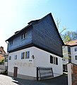 Königstein, Kugelherrnstraße 21 (1).jpg 4,510 × 4,972; 13.4 MB
-
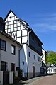 Königstein, Kugelherrnstraße 21.JPG 3,232 × 4,928; 6.29 MB
