Category:Kronenburger See
Jump to navigation
Jump to search
| Object location | | View all coordinates using: OpenStreetMap |
|---|
detention basin   | |||||
| Upload media | |||||
| Instance of | |||||
|---|---|---|---|---|---|
| Location |
| ||||
 | |||||
Subcategories
This category has the following 2 subcategories, out of 2 total.
Media in category "Kronenburger See"
The following 55 files are in this category, out of 55 total.
-
 Eifelpark Kronenburger See-0049.jpg 4,032 × 2,268; 9.09 MB
-

-

-
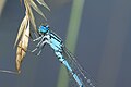
 Enallagma cyathigerum (Gemeine Becherjungfer) at Kronenburger See, Eifel, Germany 2015 -8358.jpg 5,184 × 3,456; 11.59 MB
-

-

-

-

-

-
-

-
 Freizeitzentrum Kronenburger See - geo.hlipp.de - 6483.jpg 640 × 480; 135 KB
-
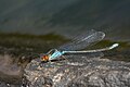
 Granatauge (Erythromma) Kronenburger See, Eifel, Germany 2015 -8547.jpg 3,724 × 2,483; 5.26 MB
-
 Granatauge (Erythromma) Kronenburger See, Eifel, Germany 2015 -8551.jpg 3,970 × 2,647; 6.3 MB
-
 Granatauge (Erythromma) Kronenburger See, Eifel, Germany 2015 -8554.jpg 5,184 × 3,456; 10.13 MB
-
 Granatauge (Erythromma) Kronenburger See, Eifel, Germany 2015 -8558.jpg 5,184 × 3,456; 9.41 MB
-
 Granatauge (Erythromma) Kronenburger See, Eifel, Germany 2015 -8560.jpg 5,184 × 3,456; 9.36 MB
-
 Granatauge (Erythromma) Kronenburger See, Eifel, Germany 2015 -8562.jpg 3,493 × 2,329; 4.38 MB
-
 Granatauge (Erythromma) Kronenburger See, Eifel, Germany 2015 -8565.jpg 3,793 × 2,529; 5.6 MB
-
 Granatauge (Erythromma) Kronenburger See, Eifel, Germany 2015 -8569.jpg 3,675 × 2,450; 5.27 MB
-
 Granatauge (Erythromma) Kronenburger See, Eifel, Germany 2015 -8570.jpg 2,432 × 1,621; 2.65 MB
-
 Granatauge (Erythromma) Kronenburger See, Eifel, Germany 2015 -8582.jpg 3,990 × 2,660; 6.32 MB
-
 Granatauge (Erythromma) Kronenburger See, Eifel, Germany 2015 -8589.jpg 5,184 × 3,456; 10.32 MB
-
 Granatauge (Erythromma) Kronenburger See, Eifel, Germany 2015 -8591.jpg 3,790 × 2,527; 5.96 MB
-
 Granatauge (Erythromma) Kronenburger See, Eifel, Germany 2015 -8611.jpg 3,019 × 2,013; 3.53 MB
-
 Hauptstau, Kronenburger See - geo.hlipp.de - 6391.jpg 640 × 480; 74 KB
-
 Herbst am Kronenburger See - geo.hlipp.de - 6390.jpg 640 × 480; 104 KB
-
 Kronenburg Staudamm.jpg 4,896 × 3,672; 6.49 MB
-
 Kronenburger See - 2.jpg 4,320 × 3,240; 5.58 MB
-
 Kronenburger See - Badebereich-7986-88.jpg 11,490 × 3,246; 30.31 MB
-
 Kronenburger See - Bootsvermietung-7841-43.jpg 10,200 × 3,015; 19.32 MB
-
 Kronenburger See - geo.hlipp.de - 6385.jpg 640 × 480; 94 KB
-
 Kronenburger See 001x.jpg 6,016 × 3,384; 6.86 MB
-
 Kronenburger See mit Staumauer-7859.jpg 5,184 × 2,916; 10.6 MB
-
 Kronenburger See mit Staumauer-7860.jpg 5,184 × 2,916; 9.06 MB
-
 Kronenburger See mit Staumauer-7861.jpg 5,184 × 2,916; 12.01 MB
-
 Kronenburger See mit Staumauer-7870.jpg 5,184 × 2,916; 11.2 MB
-
 Kronenburger See mit Staumauer-7871.jpg 5,184 × 2,916; 10.12 MB
-
 Kronenburger See Rundwanderweg - geo.hlipp.de - 6387.jpg 640 × 480; 131 KB
-
 Kronenburger See, Blick auf das Freibad-7823.jpg 5,184 × 2,916; 12.41 MB
-
 Kronenburger See, Blick auf das Freibad-7839.jpg 5,184 × 2,916; 14.99 MB
-
 Kronenburger See, Luftbild-0046.jpg 3,986 × 2,242; 6.36 MB
-
 Kronenburger See, Luftbild-0047.jpg 4,032 × 2,268; 6.6 MB
-
 Kronenburger See, Rundwanderweg - geo.hlipp.de - 6482.jpg 640 × 480; 123 KB
-
 Kronenburger See, Straße über die Staumauer-8003.jpg 5,184 × 2,916; 9.11 MB
-
Kronenburger See.webm 4 min 42 s, 3,840 × 2,160; 150.67 MB
-
 Kronenburger-see-04.jpg 2,272 × 1,704; 995 KB
-
 Kylltalsperre, Kronenburgerhuette - geo.hlipp.de - 6378.jpg 640 × 480; 118 KB
-
 Panoramablick von der Burgruine Kronenburg zum Kronenburger See 6784-86.jpg 6,254 × 2,195; 13.36 MB
-
 Rundwanderweg, Kronenburger See - geo.hlipp.de - 6481.jpg 640 × 480; 137 KB
-
 Stauanlage Kronenburg - Stausee und Staudamm-7836-38.jpg 12,182 × 3,171; 20.68 MB
-
 Staudamm, Kronenburgersee - geo.hlipp.de - 6379.jpg 640 × 480; 114 KB
-
 Vogelbeobachtungsstation Kronenburger See-9311.jpg 6,124 × 3,445; 16.93 MB
-
 Vorstau, Kronenburger See - geo.hlipp.de - 6389.jpg 640 × 480; 115 KB
-
 WSG vom Steg 2015.jpg 1,280 × 960; 484 KB

_at_Kronenburger_See,_Eifel,_Germany_2015_-8321.jpg)
_at_Kronenburger_See,_Eifel,_Germany_2015_-8351.jpg)
_at_Kronenburger_See,_Eifel,_Germany_2015_-8358.jpg)
_at_Kronenburger_See,_Eifel,_Germany_2015_-8386.jpg)
_at_Kronenburger_See,_Eifel,_Germany_2015_-8395.jpg)
_at_Kronenburger_See,_Eifel,_Germany_2015_-8407.jpg)
_at_Kronenburger_See,_Eifel,_Germany_2015_-8429.jpg)
_at_Kronenburger_See,_Eifel,_Germany_2015_-8598.jpg)
_at_Kronenburger_See,_Eifel,_Germany_2015_-8605.jpg)
_at_Kronenburger_See,_Eifel,_Germany_2015_-8606.jpg)

_Kronenburger_See,_Eifel,_Germany_2015_-8547.jpg)
_Kronenburger_See,_Eifel,_Germany_2015_-8551.jpg)
_Kronenburger_See,_Eifel,_Germany_2015_-8554.jpg)
_Kronenburger_See,_Eifel,_Germany_2015_-8558.jpg)
_Kronenburger_See,_Eifel,_Germany_2015_-8560.jpg)
_Kronenburger_See,_Eifel,_Germany_2015_-8562.jpg)
_Kronenburger_See,_Eifel,_Germany_2015_-8565.jpg)
_Kronenburger_See,_Eifel,_Germany_2015_-8569.jpg)
_Kronenburger_See,_Eifel,_Germany_2015_-8570.jpg)
_Kronenburger_See,_Eifel,_Germany_2015_-8582.jpg)
_Kronenburger_See,_Eifel,_Germany_2015_-8589.jpg)
_Kronenburger_See,_Eifel,_Germany_2015_-8591.jpg)
_Kronenburger_See,_Eifel,_Germany_2015_-8611.jpg)


