Category:Kriegerdenkmal 1870/71 (Pirna)
Jump to navigation
Jump to search
| Object location | | View all coordinates using: OpenStreetMap |
|---|
| Upload media | |||||
| Instance of | |||||
|---|---|---|---|---|---|
| Location | Pirna, Sächsische Schweiz-Osterzgebirge, Saxony, Germany | ||||
 | |||||
Media in category "Kriegerdenkmal 1870/71 (Pirna)"
The following 4 files are in this category, out of 4 total.
-
 05880-Pirna-1905-Kriegerdenkmal-Brück & Sohn Kunstverlag.jpg 1,512 × 1,000; 593 KB
-
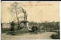 07878-Pirna-1906-Kriegerdenkmal in den Anlagen-Brück & Sohn Kunstverlag.jpg 1,514 × 1,000; 513 KB
-
 12776-Pirna-1911-Kriegerdenkmal im Friedenspark-Brück & Sohn Kunstverlag.jpg 1,454 × 935; 920 KB
-
 12969-Pirna-1911-Kriegerdenkmal im Friedenspark-Brück & Sohn Kunstverlag.jpg 1,523 × 1,000; 637 KB


