Category:Kriegerdenkmal (Oberhöchstadt)
Jump to navigation
Jump to search
| Object location | | View all coordinates using: OpenStreetMap |
|---|
Media in category "Kriegerdenkmal (Oberhöchstadt)"
The following 4 files are in this category, out of 4 total.
-
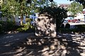
 Oberhöchstadt, Kriegerdenkmal vor der Kirche (1).JPG 3,264 × 4,928; 8.15 MB
-
 Oberhöchstadt, Kriegerdenkmal vor der Kirche (2).JPG 4,928 × 3,264; 8.64 MB
-
 Oberhöchstadt, Kriegerdenkmal vor der Kirche (3).JPG 4,928 × 3,264; 8.21 MB
-
 Oberhöchstadt, Kriegerdenkmal vor der Kirche.JPG 4,928 × 3,264; 7.95 MB
.JPG)
.JPG)
.JPG)
