Category:Kreuzweg (Zeuzleben)
Jump to navigation
Jump to search
| Object location | | View all coordinates using: OpenStreetMap |
|---|
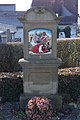
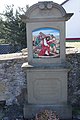
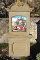
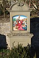
This is the category of the Bavarian Baudenkmal (cultural heritage monument) with the ID D-6-78-193-185 (Wikidata)
|
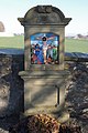
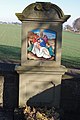
Deutsch: Kreuzweg, 14 Stationen, Aufsatz mit Rundbogengiebel und erneuerten Kreuzwegbildern über Sockel, Sandstein, um 1900. Oberes Tor, im Friedhof, Zeuzleben, Markt Werneck, Unterfranken, Deutschland
Media in category "Kreuzweg (Zeuzleben)"
The following 14 files are in this category, out of 14 total.
-
 Kreuzweg Zeuzleben 2016 (01).jpg 2,480 × 3,720; 3.46 MB
-
 Kreuzweg Zeuzleben 2016 (02).jpg 2,745 × 3,965; 3.97 MB
-
 Kreuzweg Zeuzleben 2016 (03).jpg 2,939 × 4,409; 5.01 MB
-
 Kreuzweg Zeuzleben 2016 (04).jpg 2,766 × 4,151; 4.47 MB
-
 Kreuzweg Zeuzleben 2016 (05).jpg 2,983 × 4,474; 5 MB
-
 Kreuzweg Zeuzleben 2016 (06).jpg 2,968 × 4,452; 4.58 MB
-
 Kreuzweg Zeuzleben 2016 (07).jpg 2,787 × 4,180; 4.3 MB
-
 Kreuzweg Zeuzleben 2016 (08).jpg 2,863 × 4,294; 4.3 MB
-
 Kreuzweg Zeuzleben 2016 (09).jpg 2,977 × 4,465; 4.8 MB
-
 Kreuzweg Zeuzleben 2016 (10).jpg 2,759 × 4,138; 4.22 MB
-
 Kreuzweg Zeuzleben 2016 (11).jpg 2,936 × 4,403; 4.52 MB
-
 Kreuzweg Zeuzleben 2016 (12).jpg 2,883 × 4,324; 4.41 MB
-
 Kreuzweg Zeuzleben 2016 (13).jpg 2,725 × 4,087; 3.38 MB
-
 Kreuzweg Zeuzleben 2016 (14).jpg 2,952 × 4,428; 4.84 MB
.jpg)
.jpg)
.jpg)
.jpg)
.jpg)
.jpg)
.jpg)
.jpg)
.jpg)
.jpg)
.jpg)
.jpg)
.jpg)
.jpg)