Category:Kreuzkopf (Allgäu Alps)
Jump to navigation
Jump to search
mountain of the Allgäu Alps at the border of Bavaria, Germany, and Tyrol, Austria | |||||
| Upload media | |||||
| Instance of | |||||
|---|---|---|---|---|---|
| Location |
| ||||
| Mountain range |
| ||||
| Elevation above sea level |
| ||||
 | |||||
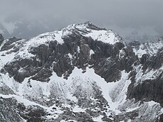
Deutsch: Der Kreuzkopf ist ein 2287 Meter hoher Berggipfel in den Allgäuer Alpen, über den die Grenze zwischen Deutschland (Bayern) und Österreich (Tirol) verläuft.
English: The Kreuzkopf (2287 m) is a mountain in the Allgäu Alps, situated on the border between Germany (Bavaria) and Austria (Tyrol).
Media in category "Kreuzkopf (Allgäu Alps)"
The following 4 files are in this category, out of 4 total.
-
Hochvogel allgaeu.jpg 2,560 × 1,920; 898 KB
-
Kreuzkopf from Northeast.JPG 4,000 × 3,000; 3.23 MB
-
MK58111 Hochvogel.jpg 5,472 × 3,648; 14.24 MB
-
Prinz-Luitpold-Haus mit Weittalkopf Kreuzkopf Wiedemer from Northeast.JPG 3,840 × 2,160; 2.05 MB


