Category:Kraftwerk Schilling
Jump to navigation
Jump to search
| Object location | | View all coordinates using: OpenStreetMap |
|---|
former petroleum power station in Stade, Germany  | |||||
| Upload media | |||||
| Instance of | |||||
|---|---|---|---|---|---|
| Location | Stade, Lower Saxony, Germany | ||||
 | |||||
Media in category "Kraftwerk Schilling"
The following 8 files are in this category, out of 8 total.
-
 Abgaskamin des Kraftwerk Schilling in Stade Nahaufnahme.jpg 1,098 × 1,656; 388 KB
-
 Abgaskamin des Kraftwerk Schilling in Stade.jpg 1,092 × 1,700; 424 KB
-
 Elbblick vom Schornstein.JPG 1,452 × 2,091; 521 KB
-
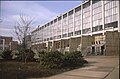 Kraftwerk Schilling der NWK in Stade, Maschinenaus.jpg 1,653 × 1,088; 631 KB
-
 Kraftwerk Schilling der NWK in Stade.jpg 1,687 × 1,093; 600 KB
-
 Kraftwerksblöcke Schilling.JPG 2,133 × 1,464; 569 KB
-
 Schornstein Schilling.JPG 2,127 × 1,463; 610 KB
-
 Öltanks Schilling.JPG 2,115 × 1,442; 551 KB


