Category:Kozakai, Aichi
Jump to navigation
Jump to search
- 日本語: 小坂井町(こざかいちょう)は、愛知県の南東部にあった町。現在は、合併により豊川市小坂井町・篠束町・宿町・平井町・伊奈町・美園1~3丁目となる。
dissolved municipality in Hoi district, Aichi prefecture, Japan | |||||
| Upload media | |||||
| Instance of | |||||
|---|---|---|---|---|---|
| Location | Hoi District, Aichi Prefecture, Japan | ||||
| Inception |
| ||||
| Dissolved, abolished or demolished date |
| ||||
| Area |
| ||||
| Replaces |
| ||||
| Replaced by |
| ||||
 | |||||
Subcategories
This category has the following 5 subcategories, out of 5 total.
Media in category "Kozakai, Aichi"
The following 14 files are in this category, out of 14 total.
-
Emblem of Kozakai, Aichi (1972–2010).svg 500 × 500; 300 bytes
-
Flag of Kozakai Aichi.png 362 × 217; 9 KB
-
Flag of Kozakai, Aichi (1972–2010).svg 600 × 400; 363 bytes
-
Kozakai Aichi chapter.gif 110 × 60; 596 bytes
-
Aichi-kozakai-town.svg 561 × 506; 26 KB
-
Demography23603.svg 512 × 256; 22 KB
-
Foemer Sanbishi (headquarters 2).jpg 2,272 × 1,704; 997 KB
-
Former Sanbishi (headquarters 1).jpg 2,272 × 1,704; 881 KB
-
Hirai Junction wiring diagram.png 800 × 452; 63 KB
-
Hirai s g penpen.PNG 978 × 553; 16 KB
-
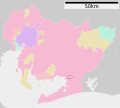
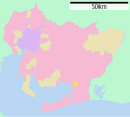
Kozakai in Aichi Prefecture Ja.svg 539 × 484; 24 KB
-
MT-Kozakai-branch-line-poles.jpg 832 × 624; 201 KB
-
地図-愛知県小坂井町-2006.png 300 × 205; 6 KB
-
基礎自治体位置図 23603.svg 539 × 484; 10 KB


