Category:Kostolné námestie, Tornaľa
Jump to navigation
Jump to search
Slovenčina: Kostolné námestie
Magyar: Templom tér
| Object location | | View all coordinates using: OpenStreetMap |
|---|
Subcategories
This category has only the following subcategory.
L
Media in category "Kostolné námestie, Tornaľa"
The following 9 files are in this category, out of 9 total.
-
 Church of Najsvätejšieho srdca Ježišovho - panoramio.jpg 4,000 × 3,000; 5.06 MB
-
 Church of Najsvätejšieho srdca Ježišovho 2 - panoramio.jpg 3,968 × 2,232; 2.04 MB
-
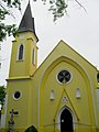
 Tornalja036.JPG 2,592 × 1,944; 1.41 MB
-
 Tornalja037.JPG 1,944 × 2,592; 774 KB
-
 Tornalja038.JPG 1,944 × 2,592; 803 KB
-
 Tornalja039.JPG 2,592 × 1,944; 1.41 MB
-
 Tornalja040.JPG 1,944 × 2,592; 591 KB
-
 Tornalja041.JPG 2,592 × 1,944; 1.41 MB
-
 Tornalja043.JPG 1,812 × 1,216; 587 KB


