Category:Kosterijstraat 1, Havelte
Jump to navigation
Jump to search
| Object location | | View all coordinates using: OpenStreetMap |
|---|
 | |||||
| Upload media | |||||
| Instance of |
| ||||
|---|---|---|---|---|---|
| Location | Havelte, Drenthe, Netherlands | ||||
| Street address |
| ||||
| Located on street |
| ||||
| Heritage designation |
| ||||
 | |||||
|
This is a category about rijksmonument number 21025
|
| Address |
|
Media in category "Kosterijstraat 1, Havelte"
The following 23 files are in this category, out of 23 total.
-
 Achter- en zijgevel nr. F 161-9 - Havelte - 20438659 - RCE.jpg 1,200 × 900; 133 KB
-
 Achter- en zijgevel nr. F 269-25 - Havelte - 20438650 - RCE.jpg 1,200 × 900; 128 KB
-
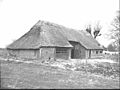
 Havelte 21025.jpg 3,888 × 2,592; 4.54 MB
-
 Houten muuranker nr. F 156-8 - Havelte - 20438662 - RCE.jpg 1,200 × 900; 97 KB
-
 Houten muuranker nr. F 156-9 - Havelte - 20438663 - RCE.jpg 1,200 × 900; 95 KB
-
 Metselwerk nr. F 161-7 - Havelte - 20438664 - RCE.jpg 1,200 × 900; 228 KB
-
 Voor- en zijgevel nr. F 161-8 - Havelte - 20438665 - RCE.jpg 1,200 × 900; 169 KB
-
 Voor- en zijgevel nr. F 268-12 - Havelte - 20438653 - RCE.jpg 1,200 × 900; 137 KB
-
 Voorgevel - Havelte - 20103603 - RCE.jpg 1,197 × 1,200; 506 KB
-
 Voorgevel nr. F 156-6 - Havelte - 20438660 - RCE.jpg 1,200 × 900; 146 KB
-
 Voorgevel nr. F 161-10 - Havelte - 20438652 - RCE.jpg 1,200 × 900; 191 KB
-
 Voorgevel nr. F 268-13 - Havelte - 20438646 - RCE.jpg 1,200 × 900; 170 KB
-
 Voorgevel nr. F 70-7 - Havelte - 20438649 - RCE.jpg 1,200 × 900; 151 KB
-
 Zij- en achtergevel nr. F 161-6 - Havelte - 20438658 - RCE.jpg 1,200 × 900; 150 KB
-
 Zij- en achtergevel nr. F 268-10 - Havelte - 20438655 - RCE.jpg 1,200 × 900; 170 KB
-
 Zij- en achtergevel nr. F 268-9 - Havelte - 20438656 - RCE.jpg 1,200 × 900; 142 KB
-
 Zij- en voorgevel nr. F 156-7 - Havelte - 20438661 - RCE.jpg 1,200 × 900; 128 KB
-
 Zij- en voorgevel nr. F 268-14 - Havelte - 20438651 - RCE.jpg 1,200 × 900; 179 KB
-
 Zij- en voorgevel nr. F 70-11 - Havelte - 20438647 - RCE.jpg 1,200 × 900; 160 KB
-
 Zij- en voorgevel nr. F 70-9 - Havelte - 20438648 - RCE.jpg 1,200 × 900; 172 KB
-
 Zijgevel nr. F 161-11 - Havelte - 20438657 - RCE.jpg 1,200 × 900; 141 KB
-
 Zijgevel nr. F 268-11 - Havelte - 20438654 - RCE.jpg 1,200 × 900; 139 KB
-
 Zijgevelj nr. F 269-24 - Havelte - 20438666 - RCE.jpg 1,200 × 900; 130 KB


