Category:Korte Voorhout 1, The Hague
Jump to navigation
Jump to search
| Object location | | View all coordinates using: OpenStreetMap |
|---|
building in The Hague, Netherlands  | |||||
| Upload media | |||||
| Instance of | |||||
|---|---|---|---|---|---|
| Location | The Hague, South Holland, Netherlands | ||||
| Located on street |
| ||||
| Heritage designation |
| ||||
 | |||||
|
This is a category about rijksmonument number 17645
|
| Address |
|
Media in category "Korte Voorhout 1, The Hague"
The following 6 files are in this category, out of 6 total.
-
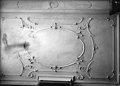
 Plafond - 's-Gravenhage - 20090920 - RCE.jpg 1,200 × 851; 155 KB
-
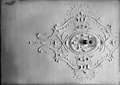
 Plafonds - 's-Gravenhage - 20090921 - RCE.jpg 1,200 × 858; 145 KB
-
 Plafonds - 's-Gravenhage - 20090922 - RCE.jpg 1,200 × 850; 162 KB
-
 Plafonds - 's-Gravenhage - 20090923 - RCE.jpg 1,200 × 850; 152 KB
-
 Plafonds - 's-Gravenhage - 20090924 - RCE.jpg 1,200 × 850; 189 KB
-
 Rm17645.JPG 2,736 × 3,648; 1.87 MB


