Category:Korean-language maps
Jump to navigation
Jump to search
Subcategories
This category has the following 7 subcategories, out of 7 total.
Media in category "Korean-language maps"
The following 73 files are in this category, out of 73 total.
-
 2012년 태국 남부 폭탄 테러 지도.jpg 690 × 426; 125 KB
-
 Afghanistan provinces korean.png 1,000 × 768; 36 KB
-
 Arcidiocesi e sedi-k.jpg 914 × 1,067; 154 KB
-
 Azawad map-korean.jpg 660 × 706; 124 KB
-
 Bolivia-dosi.png 1,500 × 1,671; 424 KB
-
 Canada Roman Catholic dioceses map ko.png 2,000 × 1,814; 1.38 MB
-
 Catholic dioceses of Spain-map.png 2,000 × 1,516; 927 KB
-
 Catholic Dioceses-Austria.png 1,500 × 776; 392 KB
-
 Ceska-MAP.png 5,000 × 2,869; 2.94 MB
-
 Colombia-map.png 5,000 × 6,895; 5.86 MB
-
 Colonization 1945 ko.png 1,438 × 657; 3.61 MB
-
 Deutsch WCh.png 436 × 545; 29 KB
-
 Diocese of gemany map.png 800 × 1,096; 426 KB
-
 Diocese of slovenia.png 1,467 × 956; 343 KB
-
 East Sea ko.png 600 × 600; 579 KB
-
 England and Wales ca-map.png 1,243 × 1,586; 586 KB
-
 Euro2008 Venues.PNG 660 × 300; 4 KB
-
 FDP-선거구-2009.png 822 × 938; 311 KB
-
 Grand canyon area map.png 1,308 × 1,044; 1.14 MB
-
 Grand Canyon Shuttle Lines.jpg 1,800 × 1,200; 778 KB
-
 Italiana -map.png 2,000 × 2,380; 1.05 MB
-
 Korean Revised Edition Map 1.jpg 5,444 × 3,806; 9.41 MB
-
 Korean Revised Edition Map 2.jpg 3,806 × 5,338; 8.99 MB
-
 Korean Revised Edition Map 3.jpg 3,936 × 5,479; 9.2 MB
-
 Korean Revised Edition Map 5.jpg 3,842 × 5,362; 8.48 MB
-
 Korean Revised Edition Map 6.jpg 5,397 × 3,901; 8.18 MB
-
 Kwong-sang-do.png 2,976 × 4,000; 6.87 MB
-
 Lepanto map.png 723 × 593; 135 KB
-
 Lithuania-disi-map.png 1,500 × 1,107; 388 KB
-
 Location-of-Liancourt-rocks-ko.png 640 × 320; 58 KB
-
 Luoyang-map.png 5,000 × 4,912; 1.46 MB
-
 Map of Canada (Korean Ver.).png 3,304 × 2,748; 2.06 MB
-
 Map of USA with state names-ko.png 2,130 × 1,317; 433 KB
-
 Mexico of prin- map.png 2,500 × 1,657; 1.05 MB
-
 México-map.png 5,000 × 3,294; 2.82 MB
-
 Nagranggun.jpg 290 × 270; 49 KB
-
 Nagrangun2.jpg 290 × 270; 42 KB
-
 New Zealand-map.png 5,000 × 7,064; 2.79 MB
-
 New-Cheoingu-map.png 5,000 × 5,534; 3.19 MB
-
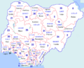 Nigeria-map1.png 2,500 × 2,050; 1.74 MB
-
 North-Korea-missile-launch-in-20060705-ko.png 485 × 375; 93 KB
-
 Ostelbien (ko).png 1,222 × 1,024; 301 KB
-
 Poland-catholic map.png 2,500 × 2,408; 1.22 MB
-
 Polska-MAP.png 5,000 × 4,710; 3.01 MB
-
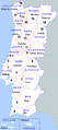 Portugal-map.png 2,500 × 5,613; 2.1 MB
-
 Provincias of brasil.png 1,500 × 1,538; 771 KB
-
 Présidentielle française 2012 premier tour-korean.png 636 × 604; 75 KB
-
 Sea of Japan East Sea ko.png 600 × 600; 482 KB
-
 Shaoxīng-map.png 800 × 724; 188 KB
-
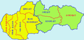 Slovacia-dosi-map.png 1,974 × 940; 198 KB
-
 Slovacia-dosi-map2.png 1,654 × 952; 153 KB
-
 Sofia Capital map.png 2,000 × 2,100; 858 KB
-
 Spain.d-map.png 4,297 × 3,257; 2.63 MB
-
 Sverige -map.png 2,500 × 5,666; 4.29 MB
-
 Taiwan-map.png 800 × 1,002; 450 KB
-
 Tsushima battle map-ko.svg 899 × 634; 151 KB
-
 Uruguay-map.png 5,000 × 5,358; 4.65 MB
-
 USA NewYork Connecticut NewJersey location map ko.svg 1,300 × 700; 1.41 MB
-
 Venezuela-ㅡmap.png 5,000 × 4,419; 2.5 MB
-
 Vietnam map ko.png 4,593 × 9,440; 4.74 MB
-
 Vietnam Topography ko.png 1,320 × 2,075; 2.88 MB
-
 VietnameseRegions korean.png 300 × 443; 30 KB
-
 WSNM Map.jpg 1,206 × 955; 465 KB
-
 Xuzhou-map.png 5,000 × 3,335; 2.01 MB
-
 טקלובן קוראנית.png 300 × 350; 25 KB
-
 강동6주.png 761 × 1,243; 151 KB
-
 나고르노카라바흐 공화국의 위치.png 595 × 387; 50 KB
-
 볼테라.png 250 × 267; 32 KB
-
 셩경젼셔 지도 1.jpg 922 × 1,206; 495 KB
-
 셩경젼셔 지도 2.jpg 1,087 × 832; 444 KB
-
 인스부르크 지도.png 400 × 240; 7 KB
-
 자유시참변 지도.png 1,914 × 843; 2.41 MB
-
 현재의 나고르노카라바흐.png 595 × 387; 55 KB


.png)


.png)


