Category:Konviktstraße 11 (Bonn)
Jump to navigation
Jump to search
| Object location | | View all coordinates using: OpenStreetMap |
|---|
  | |||||
| Upload media | |||||
| Instance of | |||||
|---|---|---|---|---|---|
| Location | Bonn-Zentrum, Bonn, Cologne Government Region, North Rhine-Westphalia, Germany | ||||
| Located on street |
| ||||
| Occupant |
| ||||
| Heritage designation | |||||
| Inception |
| ||||
| Dissolved, abolished or demolished date |
| ||||
| Different from | |||||
 | |||||
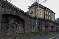
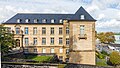
| This category shows a heritage building in Germany, located in the North Rhine-Westphalian city Bonn (no. A 172). |
Subcategories
This category has only the following subcategory.
S
Media in category "Konviktstraße 11 (Bonn)"
The following 15 files are in this category, out of 15 total.
-
 2010-04-02 Bonn Hotel Beethoven Baugrube.jpg 3,626 × 1,755; 3.03 MB
-
 2018-03-18-bonn-alter-zoll-04.jpg 5,184 × 3,456; 9.56 MB
-
 2018-03-18-bonn-rheinisches-oberbergamt-01.jpg 5,184 × 3,456; 9.56 MB
-
 2018-03-18-bonn-rheinisches-oberbergamt-02.jpg 3,119 × 5,183; 9.35 MB
-
 2018-03-18-bonn-rheinisches-oberbergamt-03.jpg 5,184 × 3,456; 8.6 MB
-
 2018-03-18-bonn-rheinisches-oberbergamt-04.jpg 5,184 × 3,456; 9.88 MB
-
 2018-03-18-bonn-rheinisches-oberbergamt-05.jpg 5,184 × 3,456; 9.41 MB
-
 2018-03-18-bonn-rheinisches-oberbergamt-06.jpg 3,456 × 5,184; 9.02 MB
-
 2018-05-26-bonn-rheinisches-oberbergamt-01.jpg 3,249 × 4,538; 8.36 MB
-
 Bonn Oberbergamt 1903.jpg 1,486 × 932; 500 KB
-
 Bonn-Zentrum Konviktstraße 11 Ehem. Oberbergamt.jpg 4,151 × 2,875; 3.56 MB
-
 Bonn-Zentrum Konviktstraße 11 Oberbergamt 1907.jpg 1,509 × 959; 312 KB
-
 Oberbergamt Bonn, Konviktstraße 11-40149.jpg 5,047 × 2,839; 10.02 MB
-
 Oberbergamt Bonn, Konviktstraße 11-40150.jpg 4,193 × 3,145; 8.82 MB
-
 Oberbergamt Bonn, Konviktstraße 11-40151.jpg 3,803 × 3,803; 9.64 MB


