Category:Konrad-Adenauer-Ufer 67 (Köln)
Jump to navigation
Jump to search
| Object location | | View all coordinates using: OpenStreetMap |
|---|
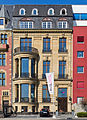
This is the category for an architectural monument.
It is on the list of cultural monuments of Köln, no. 7653.
It is on the list of cultural monuments of Köln, no. 7653.
Media in category "Konrad-Adenauer-Ufer 67 (Köln)"
The following 2 files are in this category, out of 2 total.
-
 Geschäftshaus Konrad-Adenauer-Ufer 67-0218.jpg 2,366 × 3,269; 5.45 MB
-
 Köln-Neustadt-Nord Konrad-Adenauer-Ufer 67.jpg 2,832 × 4,614; 2.73 MB

