Category:Konny Lane (Moscow)
Jump to navigation
Jump to search
| Object location | | View all coordinates using: OpenStreetMap |
|---|
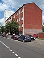
street in Yakimanka District, Russia  | |||||
| Upload media | |||||
| Instance of | |||||
|---|---|---|---|---|---|
| Location | Yakimanka District, Central Administrative Okrug, Moscow, Russia | ||||
| Length |
| ||||
 | |||||
Media in category "Konny Lane (Moscow)"
The following 7 files are in this category, out of 7 total.
-
 Moscow, Konny Lane 12 Jan 2009 01.JPG 1,200 × 1,600; 971 KB
-
 Moscow, Konny Lane 12 Jan 2009 03.JPG 1,200 × 1,200; 845 KB
-
 Конный переулок.JPG 3,648 × 2,736; 3.49 MB
-
 Moscow, Konny Lane 14 detail Jan 2009.JPG 1,015 × 1,500; 581 KB
-
 Moscow, Konny Lane 14 July 2008.JPG 1,200 × 1,600; 643 KB
-
 Moscow, Konny Lane 31-7 July 2010 02.JPG 1,600 × 1,217; 653 KB
-
 Donskoy District, Moscow, Russia - panoramio (54).jpg 2,048 × 1,536; 661 KB


.jpg)