Category:Koninginnegracht 58, The Hague
Jump to navigation
Jump to search
| Object location | | View all coordinates using: OpenStreetMap |
|---|
 | |||||
| Upload media | |||||
| Instance of | |||||
|---|---|---|---|---|---|
| Location | The Hague, South Holland, Netherlands | ||||
| Street address |
| ||||
| Located on street | |||||
| Architectural style | |||||
| Heritage designation |
| ||||
 | |||||
|
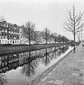
This is a category about rijksmonument number 476038
|
| Address |
|
Media in category "Koninginnegracht 58, The Hague"
The following 4 files are in this category, out of 4 total.
-
 Den Haag - Koninginnegracht 58.JPG 2,321 × 3,098; 2.8 MB
-
 Overzicht - 's-Gravenhage - 20089055 - RCE.jpg 1,183 × 1,200; 337 KB
-
 Voorgevels - 's-Gravenhage - 20088990 - RCE.jpg 1,190 × 1,200; 386 KB
-
 Voorgevels - 's-Gravenhage - 20088991 - RCE.jpg 1,190 × 1,200; 344 KB


