Category:Koepoortsbrug (Enkhuizen)
Jump to navigation
Jump to search
| Object location | | View all coordinates using: OpenStreetMap |
|---|
Media in category "Koepoortsbrug (Enkhuizen)"
The following 6 files are in this category, out of 6 total.
-
 Koe-poort.jpg 3,854 × 2,787; 1.88 MB
-
 Koepoort met Koepoortsbrug Enkhuizen.jpg 4,896 × 3,672; 2.11 MB
-
 Koepoort reproductie van prentbriefkaart - Enkhuizen - 20070236 - RCE.jpg 1,200 × 934; 297 KB
-
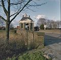 Overzicht veldzijde - Enkhuizen - 20356727 - RCE.jpg 1,200 × 1,192; 317 KB
-
 Overzicht veldzijde - Enkhuizen - 20356728 - RCE.jpg 1,194 × 1,200; 311 KB
-


