Category:Koepelkerk, Arkel
Jump to navigation
Jump to search
| Object location | | View all coordinates using: OpenStreetMap |
|---|
church building in Giessenlanden, Netherlands  | |||||
| Upload media | |||||
| Instance of | |||||
|---|---|---|---|---|---|
| Location | Arkel, Molenlanden, South Holland, Netherlands | ||||
| Street address |
| ||||
| Located on street |
| ||||
| Heritage designation |
| ||||
| Inception |
| ||||
| Significant event |
| ||||
 | |||||
Nederlands: Koepelkerk - anno 1855
|
This is a category about rijksmonument number 8282
|
| Address |
|
Media in category "Koepelkerk, Arkel"
The following 17 files are in this category, out of 17 total.
-
 1855, exterieur aanzicht - Arkel - 20024283 - RCE.jpg 806 × 1,200; 224 KB
-
 Aanzicht - Arkel - 20024282 - RCE.jpg 1,200 × 1,198; 320 KB
-
 Arkel Hervormde Kerk..jpg 4,770 × 3,177; 4.7 MB
-
 Exterieur - Arkel - 20024285 - RCE.jpg 953 × 1,200; 290 KB
-
 Exterieur - Arkel - 20024286 - RCE.jpg 953 × 1,200; 249 KB
-
 Interieur met orgel - Arkel - 20024287 - RCE.jpg 953 × 1,200; 162 KB
-
 Interieur met orgel - Arkel - 20024288 - RCE.jpg 1,200 × 956; 158 KB
-
 Interieur met preekstoel - Arkel - 20024289 - RCE.jpg 955 × 1,200; 151 KB
-
 INTERIEUR, AVONDMAALSSTEL - Arkel - 20276761 - RCE.jpg 1,191 × 1,200; 134 KB
-
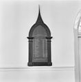
 INTERIEUR, OFFERBUS (19DE EEUW) - Arkel - 20276763 - RCE.jpg 1,200 × 1,199; 114 KB
-
 INTERIEUR, ORGEL - Arkel - 20275352 - RCE.jpg 1,200 × 1,195; 218 KB
-
 INTERIEUR, PREDIKANTENBORD - Arkel - 20275351 - RCE.jpg 1,181 × 1,200; 124 KB
-
 INTERIEUR, PREEKSTOEL, LEZENAAR - Arkel - 20275341 - RCE.jpg 1,195 × 1,200; 189 KB
-

-
 INTERIEUR, ZILVEREN AVONDMAALSBEKERS (17DE EEUW) - Arkel - 20276760 - RCE.jpg 1,193 × 1,200; 214 KB
-
 Koepelkerk - Arkel.jpg 534 × 800; 356 KB
-
 Overzicht exterieur - Arkel - 20024284 - RCE.jpg 938 × 1,200; 338 KB


_-_Arkel_-_20276763_-_RCE.jpg)


_-_Arkel_-_20276762_-_RCE.jpg)
_-_Arkel_-_20276760_-_RCE.jpg)
