Category:Koło Forest
Jump to navigation
Jump to search
Polski: Lasek na Kole, obszar leśny na warszawskiej Woli
| Object location | | View all coordinates using: OpenStreetMap |
|---|
 | |||||
| Upload media | |||||
| Audio | |||||
|---|---|---|---|---|---|
| Instance of | |||||
| Location | Wola, Warsaw, Masovian Voivodeship, Poland | ||||
| Area |
| ||||
 | |||||
Media in category "Koło Forest"
The following 16 files are in this category, out of 16 total.
-
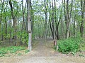
 Alejka w lasku - wejście - panoramio.jpg 1,200 × 1,600; 1.01 MB
-
 Lasek na kole na przedłużeniu majakowskiego.jpg 4,608 × 3,456; 4.49 MB
-
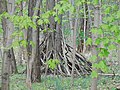 Lasek na kole szałas.jpg 4,608 × 3,456; 3.97 MB
-
 Lasek na Kole w Warszawie 2017.jpg 7,360 × 4,912; 7.91 MB
-
 Lasek na kole ścieżka między majakowskiego a długomiła.jpg 4,608 × 3,456; 4.66 MB
-
 Lasek na kole ścieżka między majakowskiego a prymasa tysiąclecia.jpg 4,608 × 3,456; 4.37 MB
-
 Lasek na kole ścieżka wzdłuż prymasa tysiąclecia.jpg 4,608 × 3,456; 4.63 MB
-
LW11-Kolo.mp3 28 min 52 s; 26.42 MB
-
 Park na Kole, Warsaw (2).JPG 2,048 × 1,360; 692 KB
-
 Park na Kole, Warsaw (3).JPG 2,048 × 1,360; 639 KB
-
 Park na Kole, Warsaw (4).JPG 2,048 × 1,311; 876 KB
-
 Park na Kole, Warsaw (5).JPG 2,048 × 1,360; 705 KB
-
 Park na Kole, Warsaw.JPG 2,048 × 1,360; 638 KB
-
 POL Lasek na Kole.jpg 1,200 × 898; 145 KB
-
 Ulica dobrogniewa przy dahlbergha.jpg 4,508 × 3,416; 3.86 MB
-
 Wejście do lasku na kole od ulicy dobrogniewa.jpg 4,608 × 3,456; 4.86 MB


.JPG)
.JPG)
.JPG)
.JPG)


