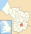
Category:Knowle (Bristol ward)
Jump to navigation
Jump to search
electoral ward of the unitary authority of Bristol | |||||
| Upload media | |||||
| Instance of |
| ||||
|---|---|---|---|---|---|
| Location | City of Bristol, South West England, England | ||||
| Different from | |||||
| |||||
Subcategories
This category has the following 2 subcategories, out of 2 total.
M
S
Media in category "Knowle (Bristol ward)"
The following 38 files are in this category, out of 38 total.
-
A Georgian postbox - geograph.org.uk - 6469267.jpg 2,472 × 3,296; 1.7 MB
-
A tower at the top of Talbot Road - geograph.org.uk - 6459662.jpg 3,296 × 2,472; 1.87 MB
-
A wooden owl - geograph.org.uk - 6469199.jpg 2,472 × 3,296; 1.83 MB
-
Bristol knowle.png 702 × 780; 149 KB
-
Broadwalk Shopping Centre, Knowle - geograph.org.uk - 6124905.jpg 3,636 × 2,595; 1.34 MB
-
Bus stop on Wells Road - geograph.org.uk - 6123785.jpg 4,000 × 3,000; 2.53 MB
-
Callington Road dew pond - geograph.org.uk - 6469217.jpg 3,296 × 2,472; 1.89 MB
-
Callington Road Local Nature Reserve - geograph.org.uk - 6469234.jpg 3,296 × 2,472; 1.91 MB
-
Dias de los Perros - geograph.org.uk - 5911182.jpg 4,000 × 3,000; 2.9 MB
-
From one food provider to another - geograph.org.uk - 6170751.jpg 3,296 × 2,472; 3.39 MB
-
Jubilee Swimming Pool, entrance.jpg 3,264 × 2,448; 4 MB
-
Jubilee Swimming Pool, from north-east.jpg 3,264 × 2,448; 3.16 MB
-
Keeping the brook in line - geograph.org.uk - 6469324.jpg 3,296 × 2,472; 1.82 MB
-
Knowle Bristol UK ward map.svg 1,138 × 1,266; 709 KB
-
Knowle Park Post Office - geograph.org.uk - 1358651.jpg 640 × 480; 71 KB
-
Knowlechurch.jpg 480 × 640; 111 KB
-
Long Ashton , Bristol Scenery - geograph.org.uk - 6520366.jpg 5,847 × 3,899; 5.67 MB
-
NCN Millennium Milepost MP809 Knowle Bristol.jpeg 1,024 × 768; 190 KB
-
Odd neighbours - geograph.org.uk - 6459736.jpg 3,296 × 2,472; 1.88 MB
-
Old graves, Arnos Vale Cemetery - geograph.org.uk - 5911285.jpg 4,000 × 3,000; 2.9 MB
-
Post box BS4 1148 (8004445929).jpg 2,683 × 3,586; 1.68 MB
-
Post box BS4 146 (8390551492).jpg 3,000 × 4,000; 4.79 MB
-
Post box BS4 164 (8390553442).jpg 3,000 × 4,000; 4.81 MB
-
Putting up a new sign - geograph.org.uk - 6170764.jpg 3,296 × 2,472; 3.24 MB
-
Sage's bakery - geograph.org.uk - 6170734.jpg 2,472 × 3,296; 3.06 MB
-
Socially distant - geograph.org.uk - 6469250.jpg 3,296 × 2,472; 1.9 MB
-
Speilman Centre, Arnos Vale Cemetery - geograph.org.uk - 5911279.jpg 4,000 × 3,000; 2.39 MB
-
St Gerard Majella - geograph.org.uk - 6459720.jpg 3,296 × 2,472; 1.94 MB
-
Started on the VE 75 Day festivities - geograph.org.uk - 6469254.jpg 3,296 × 2,472; 1.77 MB
-
The brook at the back of Broadfield Road - geograph.org.uk - 6469316.jpg 2,472 × 3,296; 1.79 MB
-
The tower on the hill - geograph.org.uk - 6459742.jpg 2,472 × 3,296; 1.82 MB
-
Totterdown Baptist Church - geograph.org.uk - 6870008.jpg 1,024 × 768; 188 KB
-
Two graves, Arnos Vale Cemetery - geograph.org.uk - 5911289.jpg 4,000 × 3,000; 2.61 MB
-
Wells Road - geograph.org.uk - 6123788.jpg 4,000 × 3,000; 2.4 MB
-
Wells Road, Knowle - geograph.org.uk - 5707994.jpg 640 × 344; 78 KB
-
Wells Road, Knowle - geograph.org.uk - 5708000.jpg 3,735 × 2,484; 1.16 MB
-
Wells Road, Knowle - geograph.org.uk - 5708058.jpg 3,690 × 1,865; 577 KB


