Category:Knott Rigg
Jump to navigation
Jump to search
English: Knott Rigg is a fell at the head of the Newlands Valley in the English Lake District. It is situated some 8.5 kilometres south west of Keswick, Cumbria and has a modest height of 556 metres (1825 feet). Its name is derived from the Old English language and means “hill on a knobbly ridge”. Because of its moderate height, the fell fails to be listed on any significant hill lists but it does merit a separate chapter in Alfred Wainwright’s Pictorial Guide to the Lakeland Fells.
mountain in United Kingdom  | |||||
| Upload media | |||||
| Instance of | |||||
|---|---|---|---|---|---|
| Location |
| ||||
| Mountain range | |||||
| Topographic prominence |
| ||||
| Elevation above sea level |
| ||||
| Parent peak |
| ||||
 | |||||
Media in category "Knott Rigg"
The following 15 files are in this category, out of 15 total.
-
 Addacomb Beck - geograph.org.uk - 860488.jpg 640 × 480; 63 KB
-
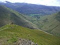
 Ard Crags from Knott Rigg.jpg 1,390 × 991; 64 KB
-
 Knott Rigg from Rigg Beck.jpg 3,648 × 2,736; 2.83 MB
-
 Knott Rigg from Wandope.jpg 1,016 × 725; 108 KB
-
 Knott Rigg Ridge - geograph.org.uk - 1090000.jpg 640 × 480; 67 KB
-

-
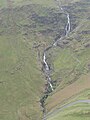 Moss Force from slopes of Knott Rigg.jpg 2,736 × 3,648; 3.27 MB
-
 On Knott Rigg - geograph.org.uk - 860483.jpg 640 × 480; 55 KB
-
 On Knott Rigg - geograph.org.uk - 860486.jpg 640 × 480; 60 KB
-
 Path off Knott Rigg - geograph.org.uk - 900515.jpg 473 × 640; 90 KB
-
 Road bridge and Knott Rigg - geograph.org.uk - 211826.jpg 640 × 480; 130 KB
-
 Summit Cairn, Knott Rigg - geograph.org.uk - 497408.jpg 640 × 480; 112 KB
-
 View south from slopes of Knott Rigg.JPG 3,648 × 2,736; 3.91 MB
-
 Footpath to Knott Rigg - geograph.org.uk - 563608.jpg 640 × 480; 173 KB
-
 On Knott Rigg - geograph.org.uk - 497401.jpg 640 × 480; 89 KB


