Category:Knott, Caldbeck
Jump to navigation
Jump to search
English: Knott is a hill in the civil parish of Caldbeck, in the Eden district, in the county of Cumbria, England.
mountain in United Kingdom  | |||||
| Upload media | |||||
| Instance of | |||||
|---|---|---|---|---|---|
| Location |
| ||||
| Mountain range | |||||
| Topographic prominence |
| ||||
| Elevation above sea level |
| ||||
| Parent peak | |||||
 | |||||
Media in category "Knott, Caldbeck"
The following 21 files are in this category, out of 21 total.
-
 A595 near Thwaites church - geograph.org.uk - 1098411.jpg 640 × 400; 66 KB
-
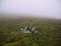 Cairn, Knott - geograph.org.uk - 654040.jpg 640 × 480; 54 KB
-
 Fields rising towards Knott Hill - geograph.org.uk - 1098390.jpg 640 × 392; 64 KB
-
 From Knott - geograph.org.uk - 898651.jpg 640 × 480; 54 KB
-
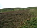
 Gently sloping hillside - geograph.org.uk - 1060751.jpg 640 × 480; 114 KB
-
 Knott from Lingy Hut.jpg 640 × 480; 91 KB
-
 Knott Hill - geograph.org.uk - 61064.jpg 640 × 480; 87 KB
-
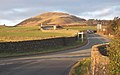
 Knott Hill from the A595 - geograph.org.uk - 1097995.jpg 640 × 425; 84 KB
-
 Knott sketch map.JPG 512 × 384; 24 KB
-
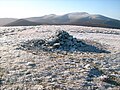
 Knott Summit - geograph.org.uk - 1544553.jpg 640 × 480; 105 KB
-
 Knott Summit - geograph.org.uk - 74383.jpg 640 × 480; 99 KB
-
 North side of Knock - geograph.org.uk - 1024113.jpg 640 × 480; 61 KB
-
 Orton Stone Circle and Knott - geograph.org.uk - 162436.jpg 640 × 480; 84 KB
-
 Rigg - geograph.org.uk - 1024088.jpg 640 × 480; 48 KB
-
 Summit Cairn, Knott - geograph.org.uk - 645734.jpg 640 × 480; 68 KB
-

-
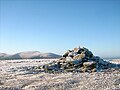
 The summit cairn of Knott - geograph.org.uk - 1060576.jpg 640 × 480; 91 KB
-
 The summit cairn of Knott - geograph.org.uk - 1060609.jpg 640 × 480; 135 KB
-
 The summit cairn of Knott - geograph.org.uk - 1060653.jpg 640 × 480; 131 KB
-
 The summit cairn of Knott - geograph.org.uk - 1061331.jpg 640 × 480; 79 KB
-
 Winter Sunlight. - geograph.org.uk - 113430.jpg 640 × 480; 29 KB


