Category:Knätte kyrka
Jump to navigation
Jump to search
| Object location | | View all coordinates using: OpenStreetMap |
|---|
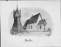
church building in Ulricehamn Municipality, Västra Götaland County, Sweden  | |||||
| Upload media | |||||
| Instance of | |||||
|---|---|---|---|---|---|
| Location | Ulricehamn Municipality, Västra Götaland County, Sweden | ||||
| Diocese | |||||
| Has use |
| ||||
| Occupant | |||||
| Heritage designation |
| ||||
 | |||||
Svenska: Knätte kyrka tillhör Redvägs församling i Skara stift i Ulricehamns kommun.
|
This is a category about an ecclesiastical monument in Sweden, number 21300000003218 in the RAÄ buildings database.
|
|
This is a category about a protected building in Sweden, number 21400000443861 in the RAÄ buildings database.
|
Media in category "Knätte kyrka"
The following 22 files are in this category, out of 22 total.
-
 Knätte kyrka - KMB - 16000200160219.jpg 783 × 600; 64 KB
-
 Knätte kyrka - KMB - 16000200160220.jpg 788 × 600; 43 KB
-
 Knätte kyrka - KMB - 16000200160224.jpg 759 × 600; 74 KB
-
 Knätte kyrka - KMB - 16000200160225.jpg 834 × 600; 81 KB
-
 Knätte kyrka - KMB - 16000200160227.jpg 342 × 600; 28 KB
-
 Knätte kyrka - KMB - 16000200160228.jpg 804 × 600; 59 KB
-
 Knätte kyrka - KMB - 16000200160229.jpg 458 × 600; 34 KB
-
 Knätte kyrka - KMB - 16000200160230.jpg 455 × 600; 43 KB
-
 Knätte kyrka - KMB - 16000200160231.jpg 439 × 600; 41 KB
-
 Knätte kyrka - KMB - 16000200160232.jpg 817 × 600; 79 KB
-
 Knätte kyrka - KMB - 16000200160237.jpg 434 × 600; 53 KB
-
 Knätte kyrka - KMB - 16000200160246.jpg 818 × 600; 120 KB
-
 Knätte kyrka - KMB - 16000200160247.jpg 439 × 600; 46 KB
-
 Knätte kyrka - KMB - 16000200160248.jpg 829 × 600; 135 KB
-
 Knätte kyrka - KMB - 16000200160249.jpg 316 × 600; 22 KB
-
 Knätte kyrka - KMB - 16000200160250.jpg 442 × 600; 39 KB
-
 Knätte kyrka - KMB - 16000200160251.jpg 441 × 600; 44 KB
-
 Knätte kyrka - KMB - 16000200160252.jpg 437 × 600; 53 KB
-
 Knätte kyrka 01.jpg 4,051 × 2,513; 1.9 MB
-
 Knätte kyrka 02.jpg 3,242 × 2,747; 1.82 MB
-
 Knätte kyrka 03.jpg 4,928 × 3,264; 1.89 MB
-
 Knätte kyrka 05.jpg 3,663 × 1,947; 1.78 MB


