Category:Kloster St. Claren (Weißenfels)
Jump to navigation
Jump to search
| Object location | | View all coordinates using: OpenStreetMap |
|---|
 | |||||
| Upload media | |||||
| Instance of | |||||
|---|---|---|---|---|---|
| Location | Weißenfels, Burgenlandkreis, Saxony-Anhalt, Germany | ||||
| Heritage designation | |||||
| Inception |
| ||||
| Dissolved, abolished or demolished date |
| ||||
 | |||||
This is the category of the Saxony-Anhalt Kulturdenkmal (cultural heritage monument) with the ID 09411346 (Wikidata)
|
Subcategories
This category has the following 2 subcategories, out of 2 total.
B
F
- Friedhofskapelle (Weißenfels) (10 F)
Media in category "Kloster St. Claren (Weißenfels)"
The following 34 files are in this category, out of 34 total.
-
 03107-Weißenfels-1903-Lehrerseminar-Brück & Sohn Kunstverlag.jpg 1,543 × 1,000; 612 KB
-
 21216-Weißenfels-1919-Klostergarten-Brück & Sohn Kunstverlag.jpg 1,526 × 1,000; 736 KB
-

-
 21221-Weißenfels-1919-Klostergarten-Brück & Sohn Kunstverlag.jpg 1,514 × 1,000; 754 KB
-
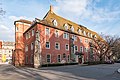 Am Kloster 2 Weißenfels 20180315 001.jpg 4,827 × 3,222; 9.8 MB
-
 Am Kloster 2 Weißenfels 20180315 002.jpg 5,797 × 3,870; 12.9 MB
-
 Am Kloster 2 Weißenfels 20180315 003.jpg 3,868 × 5,794; 11.89 MB
-
 Am Kloster 2 Weißenfels 20180315 004.jpg 6,016 × 4,016; 14.11 MB
-
 Klarissenkirche Weißenfels.jpg 530 × 425; 39 KB
-
 Klarissenkirche Weißenfels2.jpg 790 × 353; 38 KB
-
 Klarissenkirche Weißenfels3.jpg 765 × 374; 36 KB
-
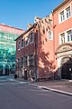 Klosterstraße 2 Weißenfels 20180702 001.jpg 4,016 × 6,016; 12.45 MB
-
 Klosterstraße 2 Weißenfels 20180702 002.jpg 6,016 × 4,016; 13.52 MB
-
 Klosterstraße 2 Weißenfels 20180702 003.jpg 4,015 × 6,015; 14.27 MB
-
 Klosterstraße 2 Weißenfels 20180702 004.jpg 6,016 × 4,016; 13.59 MB
-
 St-claren.JPG 1,024 × 768; 297 KB
-

-
 Weißenfels, Am Kloster 2, Saalstraße 10-20151105-001.jpg 6,033 × 4,027; 13.57 MB
-
 Weißenfels, Am Kloster 2, Saalstraße 10-20151105-002.jpg 6,033 × 4,027; 11.08 MB
-
 Weißenfels, Am Kloster 2, Saalstraße 10-20151105-003.jpg 4,027 × 6,033; 10.38 MB
-
 Weißenfels, Kloster St. Claren, Portal.jpg 3,456 × 5,184; 6.24 MB
-
 Weißenfels, monastery St. Claren, portal.jpg 3,426 × 4,157; 3.82 MB
-
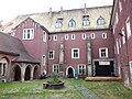
 WeißenfelsKloster.JPG 3,648 × 2,736; 1.41 MB
-
 WeißenfelsPortalKloster.JPG 2,661 × 3,585; 1.24 MB
-
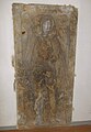
 WSF-Clarissen1.JPG 2,311 × 1,792; 723 KB
-
 WSF-Clarissen10.JPG 3,573 × 2,653; 1.39 MB
-
 WSF-Clarissen2.JPG 3,648 × 2,736; 992 KB
-
 WSF-Clarissen3.JPG 3,648 × 2,736; 1.04 MB
-
 WSF-Clarissen4.JPG 3,648 × 2,736; 1.76 MB
-
 WSF-Clarissen5.JPG 3,648 × 2,736; 1.8 MB
-
 WSF-Clarissen6.JPG 1,721 × 2,745; 645 KB
-
 WSF-Clarissen7.JPG 2,329 × 3,369; 886 KB
-
 WSF-Clarissen8.JPG 2,736 × 3,648; 1.2 MB
-
 WSF-Clarissen9.JPG 2,257 × 3,125; 786 KB


