Category:Kloster Schönthal (Schweiz)
Jump to navigation
Jump to search
| Object location | | View all coordinates using: OpenStreetMap |
|---|
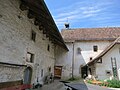
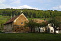
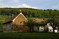
former monastery in Langenbruck in the canton of Basel-Landschaft, Switzerland  | |||||
| Upload media | |||||
| Instance of | |||||
|---|---|---|---|---|---|
| Part of | |||||
| Location | Langenbruck, Waldenburg District, Basel-Landschaft, Switzerland | ||||
| Street address |
| ||||
| Heritage designation | |||||
 | |||||
Subcategories
This category has only the following subcategory.
S
Media in category "Kloster Schönthal (Schweiz)"
The following 28 files are in this category, out of 28 total.
-
 CA KGS 1441 Schöntal Nebel.JPG 4,752 × 3,168; 5.27 MB
-
 Hof grosser Wald 17.Jhr.JPG 2,816 × 2,112; 2.26 MB
-
 Hof kleiner Wald 1617.JPG 2,816 × 2,112; 1.27 MB
-
 Hofgut Gross-Wald.JPG 2,816 × 2,112; 2.22 MB
-
 Kloster Schoenthal.JPG 2,592 × 1,944; 2.29 MB
-
 Kloster Schöntal Innenhof 02.JPG 2,816 × 2,112; 1.42 MB
-
 Kloster Schönthal BL01.JPG 2,816 × 2,112; 2.09 MB
-
 Kloster Schönthal BL02.JPG 2,816 × 2,112; 2.05 MB
-
 Kloster Schönthal BL03.JPG 2,112 × 2,816; 2.15 MB
-
 Kloster Schönthal BL04.JPG 2,816 × 2,112; 2.07 MB
-
 Kloster Schönthal BL05.JPG 2,816 × 2,112; 2.13 MB
-
 Kloster Schönthal Hof.jpg 2,816 × 2,112; 1.67 MB
-
 Kloster Schönthal Innenhof.JPG 2,816 × 2,112; 1.66 MB
-
 Kloster Schönthal West 03.JPG 2,816 × 2,112; 2.53 MB
-
 Kloster Schönthal West.JPG 2,112 × 2,816; 2.19 MB
-
 Kloster Schönthal.jpg 500 × 333; 52 KB
-
 Klosterkirche Schönthal Tor.JPG 2,112 × 2,816; 1.13 MB
-
 Klosterkirche Schönthal.JPG 2,112 × 2,816; 1.06 MB
-
 Langenbruck-Kloster.jpg 700 × 463; 97 KB
-
 Langenbruck-Schoental.jpg 400 × 600; 76 KB
-
 Schönthal Westfassade.JPG 2,112 × 2,816; 1.76 MB
-
 Schönthal Westportal.JPG 2,112 × 2,816; 2.33 MB
-
 Schönthal01.JPG 2,816 × 2,112; 1.69 MB
-
 Schönthal02.JPG 2,816 × 2,112; 1.66 MB
-
 Sculpture at schoenthal pict 0001.jpg 1,280 × 1,024; 380 KB
-
 Sculpture at Schoenthal-entrance-gallery 009.jpg 3,264 × 2,448; 1.16 MB
-
 Sculpture at Schoenthal-josephson 018.jpg 3,264 × 2,448; 1.38 MB
-
 Zentralbibliothek Zürich - Schöntahl - 991107025429705501.jpg 2,225 × 2,578; 946 KB


