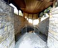
Category:Kloster Rulle
Jump to navigation
Jump to search
| Object location | | View all coordinates using: OpenStreetMap |
|---|
| Upload media | |||||
| Instance of |
| ||||
|---|---|---|---|---|---|
| Location | Lower Saxony, Germany | ||||
| Inception |
| ||||
| Dissolved, abolished or demolished date |
| ||||
 | |||||
Subcategories
This category has the following 2 subcategories, out of 2 total.
K
M
- Marienbrunnen (Rulle) (3 F)
Media in category "Kloster Rulle"
The following 61 files are in this category, out of 61 total.
-
21 Wallfahrtskirche in Rulle.jpg 4,621 × 3,301; 5.64 MB
-
22 Wallenhorst OT Rulle - St. Johannes - Wallfahrtskirche.jpg 12,557 × 5,720; 15.1 MB
-
23 Johannes Kirche in Rulle - Eingang zur Marienkappelle - Pforte der Barmherzigkeit.jpg 2,228 × 2,701; 2.56 MB
-
24 Pforte der Barmherzigkeit.jpg 2,364 × 1,805; 1.46 MB
-
25 Wallfahrtskirche in Rulle.jpg 7,916 × 5,943; 14.65 MB
-
26 Rückseite der Wallfahrtskirche St. Johannes in Rulle.jpg 5,948 × 3,560; 7.71 MB
-
27 Johannes Kirche in Rulle - Außenaltar.jpg 5,959 × 4,042; 10.26 MB
-
28 Johannes Kirche in Rulle - Außenaltar.jpg 5,608 × 3,551; 6.99 MB
-
31 Marienbrunnen in Rulle - Gebäude von außen.jpg 4,670 × 3,698; 7.85 MB
-
32 Marienbrunnen in Rulle - Blick in den Eingang.jpg 2,448 × 3,264; 3.55 MB
-
33 Marienbrunnen in Rulle - Blick in den Eingang.jpg 7,745 × 6,486; 16.05 MB
-
34 Marienbrunnen in Rulle - Blick auf das Wasser.jpg 2,448 × 3,264; 2.86 MB
-
35 Marienbrunnen in Rulle - Blick auf das Wasser.jpg 3,264 × 2,448; 2.38 MB
-
36 Wappen im Marienbrunnen.jpg 4,124 × 3,614; 6.28 MB
-
41 Haus Mariafrieden - neben der Johanneskirche in Rulle.jpg 6,368 × 3,280; 8.11 MB
-
42 Haus Mariafrieden - neben der Johanneskirche in Rulle.jpg 5,386 × 3,258; 6.83 MB
-
62 Kirche St. Johannes in Rulle.jpg 16,979 × 6,700; 30 MB
-
Kloster Rulle 01.jpg 2,848 × 4,272; 3.79 MB
-
Kloster Rulle 02.jpg 2,848 × 4,272; 4.54 MB
-
Kloster Rulle 03.jpg 4,272 × 2,848; 4.88 MB
-
Kloster Rulle 04.jpg 2,848 × 4,272; 4.69 MB
-
Kloster Rulle 05.jpg 2,848 × 4,272; 3.54 MB
-
Kloster Rulle 06.jpg 4,272 × 2,848; 4.45 MB
-
Kloster Rulle 07.jpg 2,848 × 4,272; 4.54 MB
-
Kloster Rulle 08.jpg 4,272 × 2,848; 4.69 MB
-
Kloster Rulle 09.jpg 2,848 × 4,272; 4.11 MB
-
Kloster Rulle 10.jpg 4,272 × 2,848; 4.6 MB
-
Kloster Rulle 11.jpg 4,272 × 2,848; 4.8 MB
-
Kloster Rulle 12.jpg 2,848 × 4,272; 3.99 MB
-
Kloster Rulle 13.jpg 2,848 × 4,272; 3.55 MB
-
Kloster Rulle 14.jpg 2,848 × 4,272; 6.11 MB
-
Kloster Rulle 15.jpg 2,848 × 4,272; 2.93 MB
-
Kloster Rulle 16.jpg 2,848 × 4,272; 6.55 MB
-
Kloster Rulle 17.jpg 2,848 × 4,272; 5.4 MB
-
Kloster Rulle 18.jpg 3,941 × 2,824; 5.49 MB
-
Kloster Rulle 19.jpg 4,272 × 2,848; 4.59 MB
-
Kloster Rulle 20.jpg 4,272 × 2,848; 4.48 MB
-
Kloster Rulle 21.jpg 2,848 × 4,272; 5.14 MB
-
Kloster Rulle 22.jpg 2,848 × 4,272; 4.37 MB
-
Kloster Rulle 23.jpg 2,848 × 4,272; 4.14 MB
-
Kloster Rulle 24.jpg 2,848 × 4,272; 4.52 MB
-
Kloster Rulle 25.jpg 2,848 × 4,272; 4.45 MB
-
Kloster Rulle 26.jpg 2,848 × 4,272; 4.34 MB
-
Kloster Rulle 27.jpg 2,848 × 4,272; 4.3 MB
-
Kloster Rulle 28.jpg 2,848 × 4,272; 4.48 MB
-
Kloster Rulle 29.jpg 2,848 × 4,272; 4.23 MB
-
Kloster Rulle 30.jpg 4,272 × 2,848; 6.19 MB
-
Kloster Rulle 31.jpg 2,848 × 4,272; 4.71 MB
-
Kloster Rulle 32.jpg 4,272 × 2,848; 6.27 MB
-
Kloster Rulle 33.jpg 2,848 × 4,272; 4.64 MB
-
Kloster Rulle 34.jpg 2,848 × 4,272; 3.73 MB
-
Kloster Rulle 35.jpg 2,848 × 4,272; 4.17 MB
-
Kloster Rulle 36.jpg 2,848 × 4,272; 4.62 MB
-
Kloster Rulle 37.jpg 2,848 × 4,272; 3.94 MB
-
Kloster Rulle 38.jpg 2,848 × 4,272; 4.71 MB
-
Kloster Rulle 39.jpg 2,848 × 4,272; 6.04 MB
-
Kloster Rulle 40.jpg 4,272 × 2,848; 5.17 MB
-
Kloster Rulle 41.jpg 4,272 × 2,848; 5.16 MB
-
Klosterkirche Rulle 2021.jpg 4,608 × 2,128; 2.23 MB
-
Schlusssteinscheibe ehem. Klosterkirche Marienbrunn Rulle (1300).jpg 3,024 × 4,032; 4.85 MB
-
WallenhorstRulleKirche.jpg 3,072 × 2,048; 1.18 MB
Categories:
- Churches in Wallenhorst
- Churches in Dekanat Osnabrück-Nord
- Churches in Lower Saxony built in 1930
- Heimatstil architecture in Lower Saxony
- Heimatstil churches in Germany
- Monasteries in Landkreis Osnabrück
- Roman Catholic churches in Landkreis Osnabrück
- Cistercian abbeys in Lower Saxony
- Heimatschutz architecture in Germany


