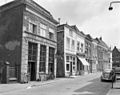
Category:Klinkerstraat 9, Grave
Jump to navigation
Jump to search
| Object location | | View all coordinates using: OpenStreetMap |
|---|
house in Grave, Netherlands  | |||||
| Upload media | |||||
| Instance of | |||||
|---|---|---|---|---|---|
| Location | Grave, Land van Cuijk, North Brabant, Netherlands | ||||
| Street address |
| ||||
| Located on street | |||||
| Heritage designation |
| ||||
 | |||||
|
This is a category about rijksmonument number 17262
|
| Address |
|
Media in category "Klinkerstraat 9, Grave"
The following 4 files are in this category, out of 4 total.
-
 Bovenlicht - Grave - 20084106 - RCE.jpg 788 × 1,200; 141 KB
-
 Buitendeur met bovenlicht - Grave - 20084105 - RCE.jpg 951 × 1,200; 204 KB
-
 En lager, overzicht - Grave - 20084107 - RCE.jpg 1,200 × 951; 241 KB
-
 Grave Rijksmonument 17262 Klinkerstraat 9.JPG 2,736 × 3,648; 3.1 MB


