Category:Kliff Reddevitzer Höft
Jump to navigation
Jump to search
| Object location | | View all coordinates using: OpenStreetMap |
|---|
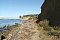
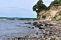
Kliff Reddevitzer Höft, Kliff und Geotop G2 278 im Landkreis Vorpommern-Rügen, Mecklenburg-Vorpommern
Media in category "Kliff Reddevitzer Höft"
The following 3 files are in this category, out of 3 total.
-
 Reddevitzer-Höft-Kliff-0810f-261.JPG 3,264 × 2,176; 1.22 MB
-
 Reddevitzer-Höft-Schwalben-0810f-254.JPG 3,264 × 2,176; 1.59 MB
-
 Steilküste am Reddevitzer Höft - cliff line of the Reddevitzer hook.jpg 2,000 × 1,328; 2.34 MB


