Category:Klandorf
Jump to navigation
Jump to search
| Object location | | View all coordinates using: OpenStreetMap |
|---|
village in Brandenburg state, Germany Germany | |||||
| Upload media | |||||
| Pronunciation audio | |||||
|---|---|---|---|---|---|
| Instance of |
| ||||
| Location | Schorfheide, Barnim District, Brandenburg, Germany | ||||
| Area |
| ||||
| Elevation above sea level |
| ||||
 | |||||
English: The village Klandorf belongs to Schorfheide municipality , Barnim district, Brandenburg state, Germany
Deutsch: Das Dorf Klandorf gehört zur Gemeinde Schorfheide , Landkreis Barnim , Land Brandenburg, Deutschland.
Français : Le village de Klandorf fait partie de la commune de Schorfheide , arrondissement de Barnim , état fédéral de Brandebourg, Allemagne
Español: El pueblo de Klandorf es parte del municipio de Schorfheide , distrito de Barnim , estado federado de Brandeburgo, Alemania
Subcategories
This category has the following 3 subcategories, out of 3 total.
Media in category "Klandorf"
The following 5 files are in this category, out of 5 total.
-
 Feuerwehr Klandorf 2020 E.jpg 4,864 × 3,648; 5.84 MB
-
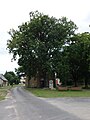 Friedenseiche Klandorf 2020 N.jpg 3,648 × 4,864; 4.36 MB
-
 Gartensternwarte Klandorf 2020 E.jpg 4,864 × 3,648; 6.03 MB
-
 Klandorf, Mittelflurhaus.JPG 2,272 × 1,704; 2.49 MB
-
 Ortstafel Klandorf 2020.jpg 4,864 × 3,648; 5.14 MB


