Category:Kirkwood, Coatbridge
Jump to navigation
Jump to search
Subcategories
This category has the following 3 subcategories, out of 3 total.
Media in category "Kirkwood, Coatbridge"
The following 19 files are in this category, out of 19 total.
-
 Blaes - geograph.org.uk - 1221062.jpg 640 × 446; 104 KB
-
 Braehead Roundabout - geograph.org.uk - 1815529.jpg 1,024 × 768; 680 KB
-
 Dunbar Avenue, Kirkwood - geograph.org.uk - 725255.jpg 640 × 480; 64 KB
-

-
 High flats near Kirkwood railway station - geograph.org.uk - 724342.jpg 480 × 640; 158 KB
-
 House in Coatbridge - geograph.org.uk - 725258.jpg 640 × 480; 74 KB
-
 Line of Drumpeller railway - geograph.org.uk - 1815555.jpg 1,024 × 768; 859 KB
-
 Manse Avenue, Coatbridge - geograph.org.uk - 725256.jpg 640 × 480; 83 KB
-

-
 Path beside the Luggie Burn - geograph.org.uk - 1221015.jpg 640 × 480; 131 KB
-
 Path beside the Luggie Burn - geograph.org.uk - 1221018.jpg 640 × 480; 126 KB
-

-
 Rock outcrop - geograph.org.uk - 1464304.jpg 640 × 319; 65 KB
-
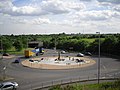 Roundabout, Coatbridge - geograph.org.uk - 1936095.jpg 640 × 480; 70 KB
-
 Row of shops, Kirkwood, Coatbridge - geograph.org.uk - 725242.jpg 640 × 480; 65 KB
-
 Shops in Coatbridge - geograph.org.uk - 725247.jpg 640 × 480; 59 KB
-
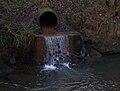 The Bishop Burn - geograph.org.uk - 1464302.jpg 640 × 483; 65 KB
-
 Tower Block UK photo cl1-36 (Coatbridge Kirkwood 1983).jpg 2,610 × 1,761; 1.03 MB
-
 Viewfield Road - geograph.org.uk - 1221049.jpg 640 × 480; 74 KB


.jpg)
