Category:Kirkinner
Jump to navigation
Jump to search
village in Dumfries and Galloway, Scotland, UK  | |||||
| Upload media | |||||
| Instance of | |||||
|---|---|---|---|---|---|
| Location |
| ||||
 | |||||
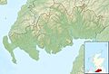
Kirkinner is a village in Dumfries and Galloway, Scotland.
Subcategories
This category has the following 4 subcategories, out of 4 total.
Media in category "Kirkinner"
The following 72 files are in this category, out of 72 total.
-
 A714 outside Kirkinner - geograph.org.uk - 492331.jpg 640 × 480; 120 KB
-
 Agricultural engineers at Whauphill - geograph.org.uk - 322642.jpg 640 × 480; 60 KB
-
 B7052 near Sloehabbert - geograph.org.uk - 322644.jpg 640 × 480; 96 KB
-
 Baldoon Airfield Runway - geograph.org.uk - 562071.jpg 640 × 480; 118 KB
-
 Baldoon Mains Farm - geograph.org.uk - 562070.jpg 640 × 480; 132 KB
-
 Ballaird farm - geograph.org.uk - 606409.jpg 640 × 463; 60 KB
-
 Ballaird Loch - geograph.org.uk - 606399.jpg 480 × 640; 120 KB
-
 Barlae Bridge - geograph.org.uk - 619389.jpg 640 × 480; 170 KB
-
 Barn at Kirwaugh Farm - geograph.org.uk - 555907.jpg 640 × 480; 136 KB
-
 Barnbarroch House - geograph.org.uk - 1277835.jpg 640 × 480; 82 KB
-
 Barnbarroch House.jpg 3,648 × 2,736; 4.6 MB
-
 Bladnoch Ind Est. - geograph.org.uk - 866198.jpg 640 × 480; 89 KB
-
 Braehead - geograph.org.uk - 458819.jpg 640 × 480; 109 KB
-
 Braehead - geograph.org.uk - 562084.jpg 640 × 480; 138 KB
-
 Bridge over the Malzie Burn - geograph.org.uk - 453228.jpg 640 × 480; 120 KB
-
 Bungalow near Whauphill - geograph.org.uk - 322637.jpg 640 × 480; 66 KB
-
 Cairnfield - geograph.org.uk - 322628.jpg 640 × 480; 72 KB
-
 Cattle from Barlae Farm - geograph.org.uk - 555898.jpg 640 × 480; 115 KB
-
 Cottage, Low Barness - geograph.org.uk - 588286.jpg 640 × 480; 82 KB
-
 Crook of Baldoon - North - geograph.org.uk - 818388.jpg 640 × 480; 86 KB
-
 Crook of Baldoon - South - geograph.org.uk - 818396.jpg 640 × 480; 82 KB
-
 Crouse - geograph.org.uk - 322605.jpg 640 × 480; 87 KB
-
 Culmalzie - geograph.org.uk - 322616.jpg 640 × 480; 99 KB
-
 Culmalzie farmhouse - geograph.org.uk - 452354.jpg 640 × 480; 104 KB
-
 Dismantled Railway Bridge at Baldoon - geograph.org.uk - 562078.jpg 640 × 480; 171 KB
-
 Driveway to Barvernochan - geograph.org.uk - 322630.jpg 480 × 640; 70 KB
-
 East Mains of Baldoon Farm - geograph.org.uk - 562073.jpg 640 × 480; 136 KB
-
 Farmhouse at Kirkland of Longcastle - geograph.org.uk - 322610.jpg 640 × 480; 71 KB
-
 Farmland near Culmalzie - geograph.org.uk - 452347.jpg 640 × 480; 59 KB
-
 Farmland near March Farm - geograph.org.uk - 322635.jpg 640 × 480; 60 KB
-
 Field gate near Ballaird Loch - geograph.org.uk - 606419.jpg 640 × 446; 89 KB
-
 Hill fort at North Balfern - geograph.org.uk - 500524.jpg 640 × 480; 91 KB
-
 Jacobs Ladder - geograph.org.uk - 556201.jpg 640 × 480; 146 KB
-
 Kirkinner Bus Depot - geograph.org.uk - 458814.jpg 640 × 480; 122 KB
-

-
 Kirkinner Parish Church.jpg 3,648 × 2,736; 4.33 MB
-
 Kirkland of Longcastle - geograph.org.uk - 165544.jpg 640 × 480; 68 KB
-
 Longcastle - geograph.org.uk - 322625.jpg 640 × 480; 67 KB
-
 Looking along Wood Hill to Round Hill - geograph.org.uk - 753438.jpg 478 × 640; 114 KB
-
 Machars Cycle Route - geograph.org.uk - 165887.jpg 640 × 480; 78 KB
-
 Mapa Chille Chaineir DG 02.jpg 2,004 × 1,363; 598 KB
-
 Mapa Chille Chaineir DG.jpg 2,004 × 1,363; 599 KB
-
 Mausoleum Kirkinner Church Yard - geograph.org.uk - 852668.jpg 640 × 480; 101 KB
-
 Milldriggan mill, burn and bridge.jpg 517 × 640; 83 KB
-
 Newtonhill Farm Road - geograph.org.uk - 555892.jpg 640 × 480; 143 KB
-
 Old Railway line - geograph.org.uk - 500603.jpg 640 × 480; 127 KB
-
 Old railway wagon - geograph.org.uk - 165879.jpg 640 × 480; 77 KB
-
 Orchardton Farm, Kirkinner - geograph.org.uk - 818463.jpg 640 × 480; 92 KB
-
 Ploughed field near South Clutag - geograph.org.uk - 322612.jpg 640 × 480; 107 KB
-
 Primroses - geograph.org.uk - 748349.jpg 640 × 480; 132 KB
-
 Reed Mace - geograph.org.uk - 453269.jpg 480 × 640; 63 KB
-
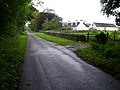
 Road junction leading to Kirkinner - geograph.org.uk - 555891.jpg 640 × 480; 128 KB
-
 Road to Barlae Farm - geograph.org.uk - 588290.jpg 640 × 480; 85 KB
-
 Ruin at Hillhead - geograph.org.uk - 322632.jpg 640 × 480; 108 KB
-
 Sheep pasture near Culmalzie - geograph.org.uk - 452350.jpg 640 × 333; 36 KB
-
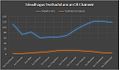 Sileadh agus Teothachd ann an Cill Chainneir.jpg 574 × 336; 36 KB
-
 Silo at Sheep Park, near Whauphill - geograph.org.uk - 165880.jpg 640 × 480; 68 KB
-
 South Clutag - geograph.org.uk - 165884.jpg 640 × 480; 97 KB
-

-
 Switchback dyke - geograph.org.uk - 453244.jpg 640 × 480; 140 KB
-
 Telephone Box and purple village hall - geograph.org.uk - 663371.jpg 640 × 480; 111 KB
-
 The A714 at Moorpark of Baldoon - geograph.org.uk - 562080.jpg 640 × 480; 127 KB
-
 The B7052 at Airies Hill Plantation - geograph.org.uk - 562124.jpg 640 × 480; 119 KB
-
 The Crouse Stone - geograph.org.uk - 450940.jpg 640 × 480; 52 KB
-
 The Forest at Knockencurr - geograph.org.uk - 562088.jpg 640 × 480; 160 KB
-
 The Hole Stone, Crouse - geograph.org.uk - 165893.jpg 640 × 480; 62 KB
-
 The lodge to Barnbarroch - geograph.org.uk - 322639.jpg 640 × 480; 77 KB
-

-
 The Whaup Hotel - geograph.org.uk - 663378.jpg 640 × 480; 56 KB
-
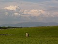
 View from the slopes of Kilsture Hill - geograph.org.uk - 735890.jpg 640 × 450; 58 KB
-
 Water of Malzie - geograph.org.uk - 322622.jpg 640 × 480; 106 KB
-
 Yellow flag - geograph.org.uk - 453262.jpg 500 × 640; 39 KB


