Category:Kirkham, North Yorkshire
Jump to navigation
Jump to search
village in North Yorkshire, England, UK  | |||||
| Upload media | |||||
| Instance of | |||||
|---|---|---|---|---|---|
| Location | Westow, Ryedale, North Yorkshire, Yorkshire and the Humber, England | ||||
 | |||||
English: Kirkham is a village in North Yorkshire, England, close to Malton, situated in the Howardian Hills alongside the River Derwent, and is notable for the nearby ruins of Kirkham Priory, an Augustinian establishment.
Subcategories
This category has the following 4 subcategories, out of 4 total.
K
- Kirkham Bridge, North Yorkshire (24 F)
- Kirkham Priory (105 F)
M
- Kirkham Manor Farm (2 F)
S
- Stone Trough Inn, Kirkham (9 F)
Media in category "Kirkham, North Yorkshire"
The following 33 files are in this category, out of 33 total.
-
 4468 Kirkham Abbey.jpg 1,196 × 1,799; 1.02 MB
-
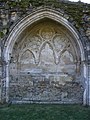 Carved arcade in the Lavatorium - geograph.org.uk - 1226728.jpg 480 × 640; 98 KB
-
-
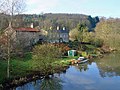
 Cottages by the river - geograph.org.uk - 1712209.jpg 2,448 × 3,264; 1.68 MB
-
 Country level crossing at Crambeck - geograph.org.uk - 201643.jpg 640 × 480; 173 KB
-
 Cross Stump - geograph.org.uk - 1226833.jpg 640 × 480; 118 KB
-
 Derwent Valley at Kirkham.JPG 2,048 × 1,536; 760 KB
-
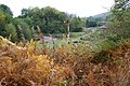
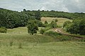
 Farmland near the Hall, Kirkham - geograph.org.uk - 2011935.jpg 640 × 480; 115 KB
-
 Kirkham Abbey railway station (site), Yorkshire (geograph 3255378).jpg 1,024 × 768; 232 KB
-

-
 Kirkham IMG 7533 - panoramio.jpg 1,100 × 731; 279 KB
-
 Kirkham Weir on River Derwent - geograph.org.uk - 297583.jpg 640 × 464; 81 KB
-
 Kirkham, River Derwent IMG 7322 - panoramio.jpg 1,100 × 733; 402 KB
-
 Railway Signal, Kirkham - geograph.org.uk - 74847.jpg 640 × 427; 196 KB
-
 River Derwent - geograph.org.uk - 189432.jpg 640 × 479; 55 KB
-
 River Derwent in flood at Kirkham.JPG 2,048 × 1,536; 683 KB
-
 River Derwent, Kirkham - geograph.org.uk - 133037.jpg 640 × 480; 117 KB
-
 The River Derwent at Kirkham - geograph.org.uk - 769632.jpg 640 × 480; 140 KB
-
 The River Derwent at Kirkham, upstream - geograph.org.uk - 769653.jpg 640 × 480; 217 KB
-
 The River Derwent below Kirkham - geograph.org.uk - 837896.jpg 640 × 480; 231 KB
-

-
 Weir on River Derwent near Kirkham Abbey - geograph.org.uk - 986456.jpg 640 × 617; 122 KB
-
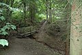
 Woodland Edge - geograph.org.uk - 527907.jpg 640 × 449; 95 KB
-
 York to Scarborough Railway - geograph.org.uk - 615116.jpg 640 × 426; 55 KB
-
 A64 - geograph.org.uk - 189430.jpg 640 × 479; 50 KB
-
 Copper Beech Trees, Kirkham - geograph.org.uk - 527925.jpg 640 × 480; 93 KB
-
 Crambeck Junction - geograph.org.uk - 243828.jpg 640 × 434; 49 KB
-

-
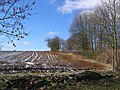 Firby Farmland - geograph.org.uk - 133030.jpg 640 × 480; 133 KB
-
 Kirkham - geograph.org.uk - 189435.jpg 640 × 479; 55 KB
-
 Kirkham Valley - geograph.org.uk - 189444.jpg 640 × 479; 51 KB
-
 Looking towards Kirkham - geograph.org.uk - 189426.jpg 640 × 479; 50 KB
-
 The Abbey Montessori - geograph.org.uk - 133040.jpg 640 × 480; 104 KB


,_Yorkshire_(geograph_3255378).jpg)


