
Category:Kirkby Stephen
market town in Cumbria, England  | |||||
| Upload media | |||||
| Instance of | |||||
|---|---|---|---|---|---|
| Location | Eden, Cumbria, North West England, England | ||||
| Population |
| ||||
| Said to be the same as | Kirkby Stephen (Wikimedia duplicated page, civil parish) | ||||
| official website | |||||
 | |||||
For Kirkby Stephen Railway Station see Wharton, Cumbria
English: Kirkby Stephen is a small market town and civil parish in Cumbria, in North West England which historially, is part of Westmorland (whose name is preserved by the neighbouring town, Appleby-in-Westmorland which is 12 miles (19 km) to the north west).
Subcategories
This category has the following 14 subcategories, out of 14 total.
Media in category "Kirkby Stephen"
The following 200 files are in this category, out of 626 total.
(previous page) (next page)-
 'Passage' - the second Eden Benchmarks sculpture - geograph.org.uk - 6795161.jpg 1,024 × 768; 624 KB
-
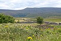
 352m top of Birkett Common - geograph.org.uk - 1028112.jpg 640 × 480; 82 KB
-
 A barn on Ash Fell - geograph.org.uk - 4184295.jpg 1,024 × 683; 202 KB
-
 A bath for the horses - geograph.org.uk - 2342137.jpg 1,024 × 768; 190 KB
-
 A dry declivity - geograph.org.uk - 1984961.jpg 3,872 × 2,480; 3.45 MB
-
 A Frazer Nash on Wiseber Brow - geograph.org.uk - 5900080.jpg 1,211 × 1,600; 272 KB
-
 A pair of houses and McColl's store, Kirkby Stephen - geograph.org.uk - 6903945.jpg 2,000 × 1,508; 1.07 MB
-
 A snow-arched path - geograph.org.uk - 2181857.jpg 480 × 640; 150 KB
-
 A683 at Three Milestone Quarry - geograph.org.uk - 6597421.jpg 4,288 × 2,848; 1.9 MB
-

-
 A683 near Three Milestone Quarry - geograph.org.uk - 6572164.jpg 1,024 × 734; 195 KB
-
 A683 nearing the A685 junction - geograph.org.uk - 6572174.jpg 1,024 × 769; 215 KB
-
 A683 outside Kirkby Stephen - geograph.org.uk - 4610168.jpg 1,024 × 768; 549 KB
-
 A683 rail overbridge at Kirkby Stephen - geograph.org.uk - 6572180.jpg 1,024 × 742; 195 KB
-
 A683 towards Kirkby Stephen - geograph.org.uk - 6818374.jpg 800 × 600; 123 KB
-
 A683 towards Kirkby Stephen - geograph.org.uk - 6818376.jpg 800 × 439; 85 KB
-
 A683 towards Kirkby Stephen - geograph.org.uk - 6818381.jpg 800 × 600; 94 KB
-
 A685 approaching Kirkby Stephen from southwest - geograph.org.uk - 6885107.jpg 586 × 1,024; 320 KB
-
 A685 approaching Kirkby Stephen railway station - geograph.org.uk - 5645879.jpg 1,499 × 950; 1.37 MB
-
 A685 Ash Fell Road approaching Lane Head - geograph.org.uk - 4182248.jpg 1,024 × 683; 183 KB
-
 A685 east entering Kirkby Stephen - geograph.org.uk - 2960036.jpg 640 × 410; 61 KB
-
 A685 entering Kirkby Stephen centre - geograph.org.uk - 2960038.jpg 640 × 479; 63 KB
-
 A685 from the railway bridge at Kirkby Stephen - geograph.org.uk - 6275040.jpg 1,024 × 683; 142 KB
-
 A685 heads north out of Kirkby Stephen - geograph.org.uk - 6572206.jpg 1,024 × 780; 192 KB
-
 A685 into Kirkby Stephen - geograph.org.uk - 6830798.jpg 640 × 480; 55 KB
-
 A685 near Kirkby Stephen - geograph.org.uk - 6833618.jpg 640 × 391; 68 KB
-
 A685 Wiseber Brow at Kirkby Stephen boundary - geograph.org.uk - 6572187.jpg 1,024 × 722; 217 KB
-
 Access and footpath to Easegill Head - geograph.org.uk - 5801325.jpg 1,600 × 1,200; 537 KB
-
 AEC Reliance At Kirkby Stephen - geograph.org.uk - 3941207.jpg 3,448 × 4,592; 2.84 MB
-
 AEC Reliance Climbing Up The A685 - geograph.org.uk - 5353738.jpg 1,600 × 1,201; 470 KB
-
 AEC Reliance Manoeuvring In Kirkby Stephen - geograph.org.uk - 3941085.jpg 4,592 × 3,448; 2.92 MB
-
 AEC Routemaster entering Kirkby Stephen - geograph.org.uk - 6134474.jpg 1,200 × 1,600; 498 KB
-
 Agricultural building at Greenriggs - geograph.org.uk - 5758582.jpg 1,024 × 768; 182 KB
-

-

-
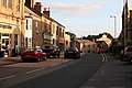
 Along the high street - geograph.org.uk - 1483332.jpg 640 × 427; 67 KB
-
 An AEC Reliance 690 In Kirkby Stephen - geograph.org.uk - 3392637.jpg 4,592 × 3,448; 3.13 MB
-
 Appleby Road (B6259), Eastfield Bridge - geograph.org.uk - 6829959.jpg 800 × 600; 103 KB
-

-

-
 Approaching the A685 - geograph.org.uk - 6103840.jpg 2,569 × 1,355; 1.32 MB
-
 April Poem on Poetry Path Kirkby Stephen - panoramio.jpg 1,024 × 1,820; 254 KB
-
 Arcade Royal, Kirkby Stephen - geograph.org.uk - 2001459.jpg 640 × 480; 123 KB
-
 Arcade Royal, Kirkby Stephen - geograph.org.uk - 2001460.jpg 640 × 480; 117 KB
-
 Ash Fell Road - geograph.org.uk - 6809439.jpg 6,000 × 3,554; 1.77 MB
-
 At Three Milestone Quarry - geograph.org.uk - 6597518.jpg 4,288 × 2,848; 2.23 MB
-
 At Three Milestone Quarry - geograph.org.uk - 6597526.jpg 3,112 × 1,978; 1.05 MB
-
 At Three Milestone Quarry - geograph.org.uk - 6597535.jpg 4,288 × 2,848; 2.26 MB
-
 Atlantean around the corner - geograph.org.uk - 5900029.jpg 1,199 × 1,600; 543 KB
-
 Atlantean on the A685 - geograph.org.uk - 6134369.jpg 1,200 × 1,600; 553 KB
-
 August Poem on Poetry Path Kirkby Stephen - panoramio (1).jpg 1,024 × 576; 258 KB
-
 August Poem on Poetry Path Kirkby Stephen - panoramio.jpg 1,024 × 576; 257 KB
-
 Avenue of trees - panoramio.jpg 3,072 × 1,728; 2.55 MB
-
 B6259 approaching Stenkrith bridge - geograph.org.uk - 2960043.jpg 640 × 453; 89 KB
-
 B6259 south out of Kirkby Stephen - geograph.org.uk - 2960042.jpg 640 × 448; 98 KB
-

-
 Barclays Bank, Kirkby Stephen - geograph.org.uk - 6903981.jpg 2,000 × 1,325; 935 KB
-
 Barclays, Kirkby Stephen - geograph.org.uk - 1532902.jpg 640 × 479; 61 KB
-
 Barn and Buttercups - geograph.org.uk - 5421759.jpg 2,700 × 1,620; 3.79 MB
-
 Barn beside A685 below Petty Brow - geograph.org.uk - 4184388.jpg 1,024 × 683; 174 KB
-
 Barn in a field - geograph.org.uk - 1984968.jpg 3,872 × 2,480; 3.57 MB
-
 BBC comes to town - geograph.org.uk - 2345597.jpg 640 × 480; 92 KB
-

-
 Benchmark at entrance to Local Links offices - geograph.org.uk - 6552022.jpg 683 × 1,024; 231 KB
-
 Benchmark on bank beside A685 - geograph.org.uk - 4182233.jpg 683 × 1,024; 292 KB
-
 Benchmark on Barn beside A685 below Petty Brow - geograph.org.uk - 4184373.jpg 1,024 × 683; 268 KB
-

-
 Benchmark on Bollam Cottage, Nateby Road - geograph.org.uk - 6393638.jpg 683 × 1,024; 289 KB
-

-

-
 Benchmark on Kirkby Stephen Methodist Church - geograph.org.uk - 7333242.jpg 569 × 1,024; 216 KB
-
 Benchmark on Kirkby Stephen Primary School - geograph.org.uk - 6551957.jpg 642 × 1,024; 158 KB
-
 Benchmark on Masonic Hall - geograph.org.uk - 6531030.jpg 683 × 1,024; 315 KB
-

-

-
 Benchmark on Sunsoar Paragliding Centre - geograph.org.uk - 4291721.jpg 683 × 1,024; 282 KB
-
 Benchmark on SW face of ^45 South Street - geograph.org.uk - 7322140.jpg 546 × 1,024; 258 KB
-
 Benchmark on the Clock Museum, Mellbecks - geograph.org.uk - 6551992.jpg 1,024 × 683; 252 KB
-
 Benchmark on tower of St Stephen's Church - geograph.org.uk - 6531004.jpg 665 × 1,024; 281 KB
-

-
 Benchmark on ^2 Nateby Road - geograph.org.uk - 6551920.jpg 1,024 × 660; 246 KB
-
 Benchmark on ^7 Park Terrace - geograph.org.uk - 6552050.jpg 661 × 1,024; 272 KB
-
 Bend at Easgill Head - geograph.org.uk - 2960030.jpg 640 × 446; 69 KB
-
 Black Bull Hotel, Market Street - geograph.org.uk - 6551813.jpg 1,024 × 680; 155 KB
-
 Black Bull Hotel, Market Street, Kirkby Stephen - geograph.org.uk - 3411556.jpg 1,024 × 641; 195 KB
-
 Bloody Bones Lane - geograph.org.uk - 1398673.jpg 640 × 480; 254 KB
-
 Bloody Bones Lane - geograph.org.uk - 2188207.jpg 640 × 480; 109 KB
-
 Boar tusk, Kirkby Stephen Church - geograph.org.uk - 3617464.jpg 640 × 494; 105 KB
-
 Bollam Bridge - geograph.org.uk - 2181836.jpg 640 × 480; 113 KB
-
 Bollam Cottage, Nateby Road - geograph.org.uk - 6393660.jpg 1,024 × 683; 215 KB
-

-

-
 Brand new - geograph.org.uk - 269479.jpg 640 × 480; 214 KB
-
 Brian Saunders Memorial Seat - geograph.org.uk - 39413.jpg 450 × 600; 83 KB
-
 Bridge and bridleway over Scandal Beck - geograph.org.uk - 1622997.jpg 640 × 425; 289 KB
-

-
 Bridge taking minor road over dismantled railway - geograph.org.uk - 6886400.jpg 1,024 × 571; 173 KB
-
 Bridleway crossing Scandal Beck - geograph.org.uk - 619914.jpg 640 × 480; 94 KB
-
 Bridleway to Sandwath Bridge - geograph.org.uk - 2596112.jpg 640 × 480; 112 KB
-
 Bridleway to Stennerskeugh - geograph.org.uk - 1623007.jpg 640 × 425; 295 KB
-
 Bristol VRT pursued by a Leyland Lion - geograph.org.uk - 5900019.jpg 1,412 × 1,600; 523 KB
-
 Broken down drystone wall, west of Wiseber Hill - geograph.org.uk - 3942280.jpg 1,024 × 768; 136 KB
-
 Buildings on north side of Stoneshot - geograph.org.uk - 6579490.jpg 1,999 × 1,207; 2.37 MB
-

-

-

-
 Businesses on Market Street, Kirkby Stephen - geograph.org.uk - 6831771.jpg 1,024 × 690; 161 KB
-
 Butcher's Shop, Market Street, Kirkby Stephen - geograph.org.uk - 3410865.jpg 1,024 × 768; 195 KB
-
 CA17 331 (3066848492).jpg 960 × 1,280; 237 KB
-
 Central Buildings, Nateby Road, Kirkby Stephen - geograph.org.uk - 3410873.jpg 1,024 × 768; 196 KB
-
 Charity shop on North Road, Kirkby Stephen - geograph.org.uk - 6828685.jpg 1,024 × 668; 128 KB
-
 Christian Head water pumping station - geograph.org.uk - 1398684.jpg 640 × 480; 242 KB
-

-
 Church tower and shops - geograph.org.uk - 6356237.jpg 1,944 × 2,592; 1.39 MB
-
 Churchyard path, Kirkby Stephen - geograph.org.uk - 1398880.jpg 640 × 480; 136 KB
-
 Clock Museum, Mellbecks - geograph.org.uk - 6551999.jpg 1,024 × 683; 155 KB
-
 Co-op in Kirkby Stephen - geograph.org.uk - 6615895.jpg 6,528 × 4,896; 6.56 MB
-

-
 Coast to Coast, Kirkby Stephen - geograph.org.uk - 1531598.jpg 640 × 479; 44 KB
-
 Coopkarnel, under the road bridge, Kirkby Stephen (geograph 2341006).jpg 1,024 × 768; 216 KB
-
 Costa Coffee, Kirkby Stephen - geograph.org.uk - 6830804.jpg 800 × 597; 103 KB
-
 Covered reservoir beside the A685 - geograph.org.uk - 6833619.jpg 640 × 426; 50 KB
-
 Croft Street - geograph.org.uk - 7211134.jpg 481 × 640; 111 KB
-
 Croft Street, Kirkby Stephen - geograph.org.uk - 1398843.jpg 640 × 479; 115 KB
-
 Croft Street, Kirkby Stephen - geograph.org.uk - 1532609.jpg 478 × 640; 116 KB
-
 Croglam Lane, Kirkby Stephen - geograph.org.uk - 1398820.jpg 640 × 480; 255 KB
-

-
 Cumbria, Kirkby Stephen, Stenkreth.jpg 587 × 800; 205 KB
-

-
 Dense wood surrounding Stobars Hall - geograph.org.uk - 1965446.jpg 640 × 480; 90 KB
-
 Derelict house at the top of High Street - geograph.org.uk - 1398611.jpg 640 × 480; 116 KB
-
 Destination, Ayr^ - geograph.org.uk - 4418192.jpg 4,592 × 3,448; 3.49 MB
-

-
 Disused limekiln on north side of Intake Lane - geograph.org.uk - 6885111.jpg 1,024 × 580; 232 KB
-
 Drinking Macaw - geograph.org.uk - 3329117.jpg 4,592 × 3,448; 4.1 MB
-
 Dry pond, Jubilee Park, Kirkby Stephen - geograph.org.uk - 6830796.jpg 800 × 600; 150 KB
-

-
 Dry stone walls - geograph.org.uk - 5845263.jpg 1,600 × 1,067; 393 KB
-

-
 Dry-stone wall, Windy Hill - geograph.org.uk - 7395213.jpg 640 × 480; 125 KB
-
 Drystone Walled Enclosures on Windy Hill - geograph.org.uk - 6377798.jpg 3,264 × 1,468; 1.11 MB
-
 Ducks by the river at Frank's Bridge - geograph.org.uk - 943638.jpg 640 × 480; 125 KB
-
 Easegill Head - geograph.org.uk - 6810166.jpg 5,936 × 3,561; 1.73 MB
-
 Edenbridge House - geograph.org.uk - 1529400.jpg 640 × 400; 77 KB
-
 Electricity Sub Station - geograph.org.uk - 236454.jpg 640 × 480; 217 KB
-

-

-
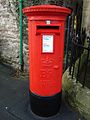
 Elizabeth II postbox on Appleby Road - geograph.org.uk - 6828695.jpg 1,189 × 1,600; 484 KB
-

-
 Elizabeth II postbox on North Road, Kirkby Stephen - geograph.org.uk - 6828684.jpg 1,045 × 1,600; 437 KB
-

-

-

-
 Enterber - geograph.org.uk - 1965434.jpg 640 × 480; 90 KB
-

-

-

-
-
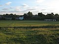 Evening shadows over the cricket field - geograph.org.uk - 1398940.jpg 640 × 480; 112 KB
-
 Exercising the dogs by Halfpenny House - geograph.org.uk - 2593391.jpg 1,024 × 664; 116 KB
-
 Faraday Road, Kirkby Stephen - geograph.org.uk - 1701068.jpg 640 × 480; 73 KB
-
 Farm store - geograph.org.uk - 2188153.jpg 640 × 480; 90 KB
-
 Farm track - geograph.org.uk - 2188158.jpg 640 × 480; 113 KB
-
 Fenced field, west of Wiseber Hill - geograph.org.uk - 3942268.jpg 1,024 × 768; 118 KB
-

-

-
 Field on east side of A683 - geograph.org.uk - 4170388.jpg 1,500 × 571; 921 KB
-
 Field path - geograph.org.uk - 4639539.jpg 800 × 533; 108 KB
-
 Field with a bowser but no gate - geograph.org.uk - 2342119.jpg 1,024 × 768; 132 KB
-
 Fields by the A683 - geograph.org.uk - 6401219.jpg 2,792 × 1,123; 788 KB
-
 Fields near Kirkby Stephen - geograph.org.uk - 3750823.jpg 640 × 480; 82 KB
-

-

-
 Flags for sale, Kirkby Stephen - geograph.org.uk - 1532906.jpg 640 × 479; 64 KB
-
 Fly Orchid (Ophrys insectifera) - geograph.org.uk - 5421676.jpg 2,462 × 3,077; 6.92 MB
-
 Footbridge over River Eden - geograph.org.uk - 1533270.jpg 640 × 480; 117 KB
-
 Footbridge over the River Eden - geograph.org.uk - 4639586.jpg 800 × 533; 194 KB
-
 Footpath in Kirkby Stephen - geograph.org.uk - 2188176.jpg 640 × 480; 78 KB
-
 Footpath junction at Frank's Bridge - geograph.org.uk - 943634.jpg 640 × 480; 90 KB
-
 Footpath near High Dolphinsty - geograph.org.uk - 2021628.jpg 2,048 × 1,536; 1.14 MB
-
-
 Footpath to Sandwath - geograph.org.uk - 1965400.jpg 2,592 × 1,944; 1.22 MB
-
 Footpath, Kirkby Stephen - geograph.org.uk - 2188225.jpg 640 × 480; 148 KB
-
 Ford at Beckfoot, Winton - geograph.org.uk - 3894066.jpg 3,872 × 2,592; 4.7 MB
-
 Ford on the bridge - geograph.org.uk - 5900042.jpg 1,223 × 1,600; 285 KB
-
 Ford on the River Eden - geograph.org.uk - 6945554.jpg 4,032 × 3,024; 6.21 MB
-
 Ford over Long Gill - geograph.org.uk - 1622993.jpg 640 × 425; 300 KB
-
 Former Ford at Kirkby Stephen - geograph.org.uk - 3894132.jpg 3,872 × 2,592; 4.83 MB
-

-
 Fountain, Kirkby Stephen - geograph.org.uk - 1531602.jpg 640 × 479; 86 KB
-
 Frank's Bridge - geograph.org.uk - 2181280.jpg 640 × 480; 75 KB
-
 Frank's Bridge - geograph.org.uk - 2484324.jpg 1,280 × 960; 757 KB
-
 Frank's Bridge - geograph.org.uk - 4610163.jpg 1,024 × 768; 660 KB
-
 Frank's Bridge - geograph.org.uk - 4633520.jpg 800 × 533; 127 KB
-
 Frank's Bridge - geograph.org.uk - 4780157.jpg 640 × 480; 105 KB
-
 Frank's Bridge, Kirkby Stephen - geograph.org.uk - 943626.jpg 640 × 480; 77 KB
-

-
 Frank's Bridge, River Eden - geograph.org.uk - 2484335.jpg 1,280 × 960; 670 KB
-
 Fuel Filling Station near Kirkby Stephen - geograph.org.uk - 6401222.jpg 2,153 × 971; 785 KB
-


,_Eastfield_Bridge_-_geograph.org.uk_-_6829959.jpg)


.jpg)


.jpg)


.jpg)


_-_geograph.org.uk_-_5421676.jpg)


