Category:Kirchgasse 66 (Alfter)
Jump to navigation
Jump to search
| Object location | | View all coordinates using: OpenStreetMap |
|---|
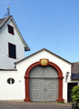
| This category shows a heritage building in Germany, located in the North Rhine-Westphalian municipality Alfter (no. 5). |
Media in category "Kirchgasse 66 (Alfter)"
The following 10 files are in this category, out of 10 total.
-
 Gielsdorf (06).png 2,739 × 1,809; 6.06 MB
-
 Gielsdorf (07).png 1,926 × 2,646; 5.52 MB
-
 Gielsdorf (08).png 2,859 × 1,923; 6.15 MB
-
 Gielsdorf (09).png 2,896 × 1,936; 7.25 MB
-
 Gielsdorf (10).png 1,748 × 2,427; 5.17 MB
-
 Gielsdorf Kirchgasse 66 (09).png 2,878 × 1,819; 5.33 MB
-
 Gielsdorf Statthalterhof Kirchgasse 66 (07).png 1,931 × 2,841; 6.17 MB
-
 Gielsdorf Statthalterhof Kirchgasse 66 (08).png 2,896 × 1,936; 7.01 MB
-
 Gielsdorf(Alfter) 5356.jpg 2,023 × 2,590; 3.81 MB
-
 Gielsdorf(Alfter)5357.JPG 3,888 × 2,592; 8.75 MB
.png)
.png)
.png)
.png)
.png)
.png)
.png)
.png)
_5356.jpg)
5357.JPG)