Category:Kirche zu Gruna (Laußig)
Jump to navigation
Jump to search
| Object location | | View all coordinates using: OpenStreetMap |
|---|
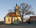
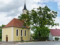
church building in Laußig, Germany   | |||||
| Upload media | |||||
| Instance of | |||||
|---|---|---|---|---|---|
| Location | Gruna, Laußig, Nordsachsen, Saxony, Germany | ||||
| Street address |
| ||||
| Heritage designation | |||||
| Inception |
| ||||
 | |||||
Subcategories
This category has the following 2 subcategories, out of 2 total.
G
Media in category "Kirche zu Gruna (Laußig)"
The following 14 files are in this category, out of 14 total.
-
 Gruhna Radfahrerkirche-01.jpg 4,963 × 3,722; 7.09 MB
-
 Gruhna Radfahrerkirche-02.jpg 5,135 × 3,851; 7.28 MB
-
 Gruhna Radfahrerkirche.jpg 4,752 × 3,802; 1.1 MB
-
 Gruna Eiche vor Kirche-01.jpg 4,897 × 3,673; 7.97 MB
-
 Gruna Eiche vor Kirche-02.jpg 5,215 × 3,911; 6.83 MB
-
 Gruna Eiche vor Kirche-03.jpg 5,136 × 3,852; 8.27 MB
-
 Gruna Eiche vor Kirche.jpg 5,333 × 4,000; 8.87 MB
-
 Kirche Gruna.JPG 2,144 × 2,864; 551 KB
-
 Kirche gruna.JPG 3,264 × 2,448; 1.86 MB
-
 Kirche gruna2.JPG 2,448 × 3,264; 1.91 MB
-
 Laußig Gruna - Dorfstraße + Radfahrerkirche 01 ies.jpg 5,616 × 3,744; 15.76 MB
-
 Laußig Gruna - Dorfstraße + Radfahrerkirche 02 ies.jpg 5,616 × 3,745; 16.06 MB
-
 Laußig Gruna - Dorfstraße - Radfahrerkirche 01 ies.jpg 5,616 × 3,743; 13.28 MB
-
 Laußig Gruna - Dorfstraße - Radfahrerkirche 02 ies.jpg 3,743 × 5,616; 15.64 MB


