Category:Kirche Toppel
Jump to navigation
Jump to search
| Object location | | View all coordinates using: OpenStreetMap |
|---|
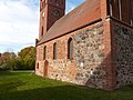
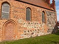
church building in Havelberg, Germany  | |||||
| Upload media | |||||
| Instance of | |||||
|---|---|---|---|---|---|
| Location | Toppel, Havelberg, Stendal District, Saxony-Anhalt, Germany | ||||
 | |||||
Media in category "Kirche Toppel"
The following 6 files are in this category, out of 6 total.
-
 L1050068 Toppel.JPG 4,000 × 3,000; 5.12 MB
-
 L1050069 Toppel.JPG 4,000 × 3,000; 4.67 MB
-
 L1050070 Toppel.JPG 3,000 × 4,000; 4.75 MB
-
 L1050071 Toppel.JPG 4,000 × 3,000; 4.66 MB
-
 L1050072 Toppel.JPG 4,000 × 3,000; 4.68 MB
-
 ToppelKirche.jpg 2,165 × 1,624; 1.84 MB


