Category:Kirche Sangernboden
Jump to navigation
Jump to search
| Object location | | View all coordinates using: OpenStreetMap |
|---|
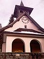
church building in Guggisberg, Switzerland _182.jpg) | |||||
| Upload media | |||||
| Instance of | |||||
|---|---|---|---|---|---|
| Part of | |||||
| Location | Sangernboden, Bern-Mittelland administrative district, Bernese Mittelland administrative region, Bern, Switzerland | ||||
| Street address |
| ||||
| Heritage designation |
| ||||
| Inception |
| ||||
| Elevation above sea level |
| ||||
 | |||||
Media in category "Kirche Sangernboden"
The following 3 files are in this category, out of 3 total.
-
 Sangernboden Preghejo (Foto Dietrich Michael Weidmann) 161.jpg 1,600 × 1,200; 335 KB
-
 Sangernboden Preghejo (Foto Dietrich Michael Weidmann) 182.jpg 1,200 × 1,600; 356 KB
-
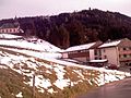 Sangernboden Preghejo kaj lernejo (Foto Dietrich Michael Weidmann) 204.jpg 1,600 × 1,200; 446 KB
_161.jpg)
_204.jpg)