Category:Kirche Hohendolsleben
Jump to navigation
Jump to search
| Object location | | View all coordinates using: OpenStreetMap |
|---|
 | |||||
| Upload media | |||||
| Instance of | |||||
|---|---|---|---|---|---|
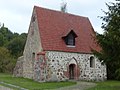
| Location | Hohendolsleben, Dähre, Altmarkkreis Salzwedel, Saxony-Anhalt, Germany | ||||
| Heritage designation | |||||
 | |||||
This is the category of the Saxony-Anhalt Kulturdenkmal (cultural heritage monument) with the ID 09497657 (Wikidata)
|
Media in category "Kirche Hohendolsleben"
The following 2 files are in this category, out of 2 total.
-
 L1040676Hohendolsleben Kirche v S.jpg 632 × 474; 253 KB
-
 L1040677Hohendolsleben Kirche v N.JPG 4,000 × 3,000; 4.85 MB
