Category:Kirby Knowle
Jump to navigation
Jump to search
village and civil parish in North Yorkshire, United Kingdom  | |||||
| Upload media | |||||
| Instance of | |||||
|---|---|---|---|---|---|
| Location | Hambleton, North Yorkshire, Yorkshire and the Humber, England | ||||
| Population |
| ||||
 | |||||
English: Kirby Knowle is a village and civil parish in Hambleton district of North Yorkshire, England, on the border of the North Yorkshire Moors and near Upsall, about 4 miles north east of Thirsk.
Subcategories
This category has only the following subcategory.
W
Media in category "Kirby Knowle"
The following 120 files are in this category, out of 120 total.
-
 A quiet corner of Yorkshire - geograph.org.uk - 878702.jpg 640 × 382; 52 KB
-

-
 Approaching Kirby Knowle from the West - geograph.org.uk - 5669703.jpg 5,152 × 3,864; 6.52 MB
-
 Bend in National Cycle Route 65 - geograph.org.uk - 6610949.jpg 1,024 × 768; 131 KB
-
 Birk Bank, Kirby Knowle - geograph.org.uk - 2713622.jpg 2,885 × 1,632; 826 KB
-
 Black Plantation - geograph.org.uk - 6610968.jpg 1,024 × 768; 200 KB
-
 Bridleway above Brickshed Cottage - geograph.org.uk - 5823939.jpg 3,239 × 4,319; 4.73 MB
-
 Bridleway down through Black Plantation - geograph.org.uk - 2326266.jpg 3,264 × 2,448; 2.82 MB
-

-
 Bridleway on Birk Bank - geograph.org.uk - 5823912.jpg 4,320 × 3,240; 5.03 MB
-
 Bridleway past Wind Egg Plantation - geograph.org.uk - 4086573.jpg 640 × 427; 89 KB
-

-
-

-
 Cattle grazing near Primrose Hill - geograph.org.uk - 6610951.jpg 1,024 × 768; 141 KB
-
 Cattle in the sun - geograph.org.uk - 5823874.jpg 4,101 × 2,727; 3.4 MB
-
 Cattle, Ing Dale - geograph.org.uk - 6610961.jpg 1,024 × 739; 135 KB
-

-
 Cycling Up Hambleton Street. - geograph.org.uk - 891604.jpg 640 × 480; 95 KB
-
 Double gate into field below Pallet Hill - geograph.org.uk - 6263153.jpg 480 × 640; 139 KB
-

-
 Elizabeth II postbox , Manor Farm, Kirby Knowle - geograph.org.uk - 6613716.jpg 526 × 1,024; 173 KB
-
 Entering Kirby Knowle - geograph.org.uk - 6610955.jpg 1,024 × 768; 265 KB
-
 Entering Kirby Knowle, North Yorkshire - geograph.org.uk - 2526338.jpg 800 × 600; 285 KB
-
 Far Hill - geograph.org.uk - 5098352.jpg 800 × 531; 192 KB
-
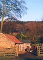
 Farm Outbuilding near Kirby Knowle - geograph.org.uk - 5669684.jpg 5,152 × 3,864; 6.37 MB
-
 Farm track near Primrose Hill - geograph.org.uk - 6610952.jpg 1,024 × 768; 197 KB
-

-
 Farmland and forest near Cowesby - geograph.org.uk - 2713587.jpg 2,853 × 1,632; 892 KB
-
 Footpath to Wind Egg Plantation - geograph.org.uk - 2903293.jpg 2,208 × 1,729; 659 KB
-
 Gated track to Pallet Hill - geograph.org.uk - 6610947.jpg 1,024 × 768; 192 KB
-

-
 Grazing near the Nevison Beck - geograph.org.uk - 6610942.jpg 1,024 × 663; 91 KB
-
 Grazing, Pallet Hill - geograph.org.uk - 6610945.jpg 1,024 × 768; 130 KB
-
 Heather on Cote Hill - geograph.org.uk - 891702.jpg 640 × 480; 89 KB
-
 Holme House in Kirby Knowle - geograph.org.uk - 2901020.jpg 3,407 × 2,510; 2.06 MB
-
 Information sign at Wind Egg - geograph.org.uk - 5823922.jpg 3,239 × 4,319; 4.79 MB
-
 Ingdale Lane - geograph.org.uk - 2713593.jpg 3,041 × 1,859; 1.47 MB
-
 Ingdale Lane - geograph.org.uk - 5981187.jpg 2,048 × 1,536; 1.46 MB
-
 Ingdale Lane - geograph.org.uk - 6610966.jpg 1,024 × 768; 185 KB
-

-
 Ingdale Lane near Kirby Knowle - geograph.org.uk - 1046063.jpg 640 × 480; 76 KB
-

-
 Kirby Knowle - geograph.org.uk - 5098357.jpg 800 × 531; 230 KB
-
 Kirby Knowle - geograph.org.uk - 5981188.jpg 2,048 × 1,536; 1.37 MB
-
 Kirby Knowle - geograph.org.uk - 6653551.jpg 1,600 × 1,200; 693 KB
-
 Kirby Knowle Castle from Knowle Lane - geograph.org.uk - 4086568.jpg 640 × 427; 55 KB
-

-
 Knowle Hill from Knowle Lane - geograph.org.uk - 4086566.jpg 640 × 427; 56 KB
-
 Knowle Lane - geograph.org.uk - 1730637.jpg 1,280 × 959; 346 KB
-
 Knowle Lane - geograph.org.uk - 5098364.jpg 800 × 531; 239 KB
-
 Knowle Lane - geograph.org.uk - 5098365.jpg 800 × 531; 170 KB
-
 Knowle Lane - geograph.org.uk - 6028402.jpg 4,320 × 2,941; 2.35 MB
-
 Knowle Lane - geograph.org.uk - 6610953.jpg 640 × 480; 57 KB
-
 Knowle Lane, entering Kirby Knowle - geograph.org.uk - 4086569.jpg 640 × 427; 68 KB
-
 Lane to Boltby - geograph.org.uk - 6028405.jpg 3,240 × 4,320; 3.6 MB
-
 Line of trees below Gutta Wood - geograph.org.uk - 878717.jpg 640 × 480; 72 KB
-
 Looking south towards Lawn House - geograph.org.uk - 2526377.jpg 800 × 600; 285 KB
-
 Manor Farm, Kirby Knowle - geograph.org.uk - 6613717.jpg 4,190 × 3,002; 1.92 MB
-
 Meadow near Felixkirk - geograph.org.uk - 1910812.jpg 1,636 × 2,178; 985 KB
-
 Minor road, Kirby Knowle - geograph.org.uk - 6613718.jpg 4,978 × 3,185; 3.24 MB
-
 Moor edge path - geograph.org.uk - 5823932.jpg 3,239 × 4,319; 5.66 MB
-
 Moor Lane towards Black Plantation - geograph.org.uk - 2526323.jpg 800 × 600; 303 KB
-
 Moor Road and fields to the south - geograph.org.uk - 4086580.jpg 640 × 427; 52 KB
-
 More mud. - geograph.org.uk - 891687.jpg 480 × 640; 124 KB
-
 More Wool, Woolmoor - geograph.org.uk - 878690.jpg 558 × 640; 90 KB
-
 National Cycle Route 65 - geograph.org.uk - 6610944.jpg 1,024 × 768; 152 KB
-
 National Cycle Route 65 - geograph.org.uk - 6610970.jpg 1,024 × 768; 264 KB
-
 Near Canvers Farm - geograph.org.uk - 2712113.jpg 1,024 × 768; 260 KB
-
 Newbygill - geograph.org.uk - 5669905.jpg 5,152 × 3,864; 6.29 MB
-
 Oaks below Storth Wood - geograph.org.uk - 2713605.jpg 3,264 × 2,448; 2.5 MB
-

-

-
 Pastures near Kirby Knowle - geograph.org.uk - 2713612.jpg 2,421 × 2,177; 969 KB
-
 Path below the hill - geograph.org.uk - 2750236.jpg 3,068 × 1,632; 894 KB
-
 Ripening Barley Kirby Knowle - geograph.org.uk - 878986.jpg 640 × 480; 88 KB
-
 Ruddings Lane, Cowesby - geograph.org.uk - 5098345.jpg 800 × 531; 170 KB
-
 Sandstone cottages at Kirby Knowle - geograph.org.uk - 5823868.jpg 3,953 × 2,976; 3.9 MB
-
 Scrub on Cowesby Moor - geograph.org.uk - 2326260.jpg 3,264 × 2,448; 3.46 MB
-
 Sheep grazing towards Gutta Wood - geograph.org.uk - 6610963.jpg 1,024 × 768; 182 KB
-
 Sheep in the shade - geograph.org.uk - 5823944.jpg 3,239 × 4,319; 5 MB
-
 Sheep pasture near Primrose Hill farm - geograph.org.uk - 6028400.jpg 4,320 × 2,845; 2.36 MB
-
 Sheep pasture, Kirby Knowle - geograph.org.uk - 5379386.jpg 4,320 × 3,240; 4.5 MB
-
 Signpost on the bridleway - geograph.org.uk - 5823934.jpg 3,238 × 4,318; 5.19 MB
-

-
 Snow on the Hambledon Hills - geograph.org.uk - 1706077.jpg 1,280 × 959; 297 KB
-
 St Wilfred's - geograph.org.uk - 5098362.jpg 800 × 531; 190 KB
-
 St Wilfred's at Kirby Knowle - geograph.org.uk - 3777824.jpg 2,276 × 2,480; 1.34 MB
-
 St Wilfred's Kirby Knowle - geograph.org.uk - 5379358.jpg 4,165 × 2,663; 2.26 MB
-
 St. Wilfred's Church, Kirby Knowle - geograph.org.uk - 5669697.jpg 5,152 × 3,864; 5.93 MB
-
 Steep path in Windegg Plantation - geograph.org.uk - 5823884.jpg 3,240 × 3,852; 3.91 MB
-
 Sunken Track above Brickshed Cottage - geograph.org.uk - 2326277.jpg 3,264 × 2,448; 2.73 MB
-

-
 The northern slopes of Woolmoor - geograph.org.uk - 878684.jpg 480 × 640; 65 KB
-
 The road to Boltby - geograph.org.uk - 733683.jpg 640 × 480; 71 KB
-
 The road to Kirby Knowle - geograph.org.uk - 2713617.jpg 2,789 × 1,632; 1,019 KB
-

-

-
 Track to Wind Egg Plantation - geograph.org.uk - 4086576.jpg 640 × 427; 86 KB
-
 Upsal Castle Farm - geograph.org.uk - 5839679.jpg 5,472 × 3,648; 2.26 MB
-
 View from the bridleway on Birk Bank - geograph.org.uk - 5823905.jpg 4,201 × 2,548; 1.44 MB
-
 View from Wandhill Lane - geograph.org.uk - 5981190.jpg 2,048 × 1,536; 838 KB
-
 View North From Moor Road - geograph.org.uk - 89979.jpg 640 × 480; 68 KB
-
 View North From the Unclassified Road - geograph.org.uk - 89990.jpg 640 × 480; 46 KB
-
 View to Kirby Knowle castle - geograph.org.uk - 6263155.jpg 480 × 640; 145 KB
-
 View towards Birk Bank - geograph.org.uk - 5668963.jpg 5,152 × 3,864; 6.78 MB
-
 View towards Knowle Hill - geograph.org.uk - 5098366.jpg 800 × 531; 158 KB
-
 View towards Thirsk - geograph.org.uk - 5839721.jpg 5,472 × 3,648; 3.69 MB
-
 View towards Upsal - geograph.org.uk - 5839707.jpg 5,472 × 3,648; 3.89 MB
-
 Wandhill Lane - geograph.org.uk - 5981189.jpg 2,048 × 1,536; 1.29 MB
-
 Wandhill Wood - geograph.org.uk - 5379380.jpg 3,240 × 4,320; 4.42 MB
-
 Wheat field near Pallet Hill - geograph.org.uk - 5098372.jpg 800 × 531; 181 KB
-
 Wheat field near Pallet Hill - geograph.org.uk - 5098376.jpg 800 × 531; 173 KB
-
 Whinmoor Hill, Kirby Knowle - geograph.org.uk - 6610960.jpg 1,024 × 768; 283 KB
-
 Woodland footpath along Birk Bank - geograph.org.uk - 2903312.jpg 3,648 × 2,736; 4.9 MB
-
 Woolmoor from the edge of Little Moor - geograph.org.uk - 6673729.jpg 5,073 × 3,183; 2.29 MB
-
 Horses at Kirby Knowle - geograph.org.uk - 324184.jpg 460 × 640; 105 KB
-
 Kirby Knowle - geograph.org.uk - 217703.jpg 640 × 480; 110 KB
-
 Knowle Hill - geograph.org.uk - 136718.jpg 640 × 480; 102 KB
-
 Pylons Near Atley Field Farm - geograph.org.uk - 475876.jpg 640 × 480; 55 KB


,_from_Knowle_Lane_-_geograph.org.uk_-_2526358.jpg)


