Category:Kirby Cane
Jump to navigation
Jump to search
English: Kirby Cane is a village and civil parish situated two miles (3.2 km) northwest of Beccles in Norfolk. It covers an area of and had a population of 375 in 152 households as of the 2001 census.
village in the United Kingdom  | |||||
| Upload media | |||||
| Instance of | |||||
|---|---|---|---|---|---|
| Location | South Norfolk, Norfolk, East of England, England | ||||
| Population |
| ||||
| Area |
| ||||
 | |||||
Subcategories
This category has the following 5 subcategories, out of 5 total.
Media in category "Kirby Cane"
The following 200 files are in this category, out of 211 total.
(previous page) (next page)-

-
 A crop of oilseed rape - geograph.org.uk - 1342427.jpg 640 × 480; 100 KB
-
 A143 Yarmouth Road, Kirby Cane - geograph.org.uk - 3893866.jpg 3,072 × 2,304; 1.43 MB
-
 A143 Yarmouth Road, Kirby Cane - geograph.org.uk - 3893868.jpg 3,072 × 2,304; 1,019 KB
-
 A143 Yarmouth Road, Kirby Cane - geograph.org.uk - 3894712.jpg 3,072 × 2,304; 1.79 MB
-
 All Saints Church Notice Board - geograph.org.uk - 3893946.jpg 2,260 × 3,017; 1.66 MB
-
 All Saints Church, Kirby Cane - geograph.org.uk - 3073108.jpg 3,264 × 2,448; 2.24 MB
-
 All Saints Church, Kirby Cane - geograph.org.uk - 3893944.jpg 3,072 × 2,304; 2.02 MB
-
 All Saints Church, Kirby Cane - geograph.org.uk - 3893950.jpg 3,072 × 2,304; 1.87 MB
-
 All Saints Church, Kirby Cane - geograph.org.uk - 3893954.jpg 3,072 × 2,304; 1.62 MB
-
 All Saints Church, Kirby Cane - geograph.org.uk - 3893967.jpg 3,072 × 2,304; 1.51 MB
-
 All Saints' church, Kirby Cane - geograph.org.uk - 5966207.jpg 4,032 × 2,268; 5.34 MB
-

-
 Approaching the crossroads on Old Bungay Road - geograph.org.uk - 3073105.jpg 3,264 × 2,448; 2.1 MB
-
 Barn beside Bungay Road - geograph.org.uk - 5512384.jpg 640 × 623; 427 KB
-
 Barns at Litchmere Farm - geograph.org.uk - 5522092.jpg 640 × 480; 316 KB
-
 Barns by Litchmere Farm - geograph.org.uk - 5522097.jpg 640 × 467; 336 KB
-
 Bridleway through the trees, Leet Hill, Kirby Cane - geograph.org.uk - 5549976.jpg 2,480 × 2,480; 4.47 MB
-
 Bridleway to Hall Farm - geograph.org.uk - 5522130.jpg 640 × 480; 288 KB
-
 Bridleway ^ entrance to Sheepwalk Farm - geograph.org.uk - 3893462.jpg 2,304 × 3,072; 1.9 MB
-
 Buildings near Litchmere Farm, Kirby Cane - geograph.org.uk - 5726850.jpg 2,859 × 1,767; 2.09 MB
-
 Bungay Road past "Sunnyside" - geograph.org.uk - 5512409.jpg 640 × 460; 303 KB
-
 Cattle pasture adjoining Magdalen Wood - geograph.org.uk - 1342503.jpg 640 × 480; 111 KB
-
 Cedar Tree, near Kirby Cane Church - geograph.org.uk - 5726852.jpg 2,565 × 3,206; 3.01 MB
-
 Chapel Lane, Kirby Cane - geograph.org.uk - 3896254.jpg 3,011 × 2,262; 1.29 MB
-
 Church Road sign - geograph.org.uk - 3892614.jpg 3,072 × 2,304; 2.08 MB
-
 Church Road, Kirby Cane - geograph.org.uk - 3892604.jpg 3,072 × 2,304; 1.22 MB
-
 Church Road, Kirby Cane - geograph.org.uk - 3892623.jpg 3,072 × 2,304; 1.42 MB
-
 Church Road, Kirby Cane - geograph.org.uk - 3893558.jpg 3,072 × 2,304; 2.08 MB
-
 Church Road, Kirby Cane - geograph.org.uk - 3893565.jpg 2,965 × 2,228; 1.58 MB
-
 Church Road, Kirby Cane - geograph.org.uk - 3893716.jpg 3,072 × 2,304; 1.77 MB
-
 Church Road, Kirby Cane - geograph.org.uk - 3893767.jpg 3,072 × 2,304; 2.08 MB
-
 Church Road, Kirby Cane - geograph.org.uk - 3893772.jpg 3,072 × 2,304; 1.94 MB
-
 Church Road, Kirby Cane - geograph.org.uk - 3893784.jpg 3,072 × 2,304; 1.02 MB
-
 Church Road, Kirby Cane - geograph.org.uk - 3960723.jpg 3,072 × 2,304; 922 KB
-
 Church Road, Kirby Cane - geograph.org.uk - 3960733.jpg 3,072 × 2,304; 997 KB
-
 Common orache (Atriplex patula) - geograph.org.uk - 5512445.jpg 593 × 640; 583 KB
-
 Common orache (Atriplex patula) - geograph.org.uk - 5512450.jpg 588 × 640; 364 KB
-

-
 Cottage in Bungay Road - geograph.org.uk - 5512400.jpg 640 × 458; 301 KB
-
 Cottage on Kirby Cane School Road - geograph.org.uk - 451070.jpg 640 × 480; 123 KB
-
 Crop field by Litchmere Plantation - geograph.org.uk - 5522106.jpg 640 × 480; 301 KB
-
 Crop field east of Litchmere Road - geograph.org.uk - 5522136.jpg 640 × 469; 299 KB
-
 Crop field south of Kirby Green - geograph.org.uk - 5522059.jpg 640 × 480; 304 KB
-
 Crop field south of School Road - geograph.org.uk - 5522062.jpg 640 × 479; 353 KB
-
 Crop fields south of Hales Hall - geograph.org.uk - 5522143.jpg 640 × 480; 314 KB
-
 Datestone on a house in Bungay Road - geograph.org.uk - 5512392.jpg 626 × 640; 405 KB
-
 Digger parked at the end of a farm track - geograph.org.uk - 1342532.jpg 640 × 480; 100 KB
-
 Door into a farm shed - geograph.org.uk - 5522099.jpg 519 × 640; 388 KB
-
 Dwellings in Well Terrace - geograph.org.uk - 5512383.jpg 640 × 462; 252 KB
-

-
 Ellingham Village Name sign - geograph.org.uk - 3894708.jpg 2,223 × 2,967; 2.02 MB
-
 Entering Ellingham on the A143 Yarmouth Road - geograph.org.uk - 3894700.jpg 3,030 × 2,276; 1.47 MB
-
 Entrance to The Hall - geograph.org.uk - 3893971.jpg 3,072 × 2,304; 2.12 MB
-
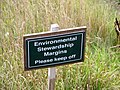 Environmental Stewardship Margins - geograph.org.uk - 5522149.jpg 640 × 480; 337 KB
-

-
 Farm shed in Litchmere Road - geograph.org.uk - 5522077.jpg 640 × 575; 378 KB
-
 Farm track following a field's edge - geograph.org.uk - 1342543.jpg 480 × 640; 108 KB
-
 Field beside Church Road - geograph.org.uk - 1342412.jpg 640 × 480; 96 KB
-
 Field colonised by orache - geograph.org.uk - 5512444.jpg 640 × 636; 625 KB
-
 Fields by Kirby Green - geograph.org.uk - 5522063.jpg 640 × 480; 312 KB
-
 Fields by Litchmere Farm - geograph.org.uk - 5522081.jpg 640 × 575; 371 KB
-
 Fields by Litchmere Farm - geograph.org.uk - 5522107.jpg 640 × 480; 341 KB
-
 Fields east of Litchmere Road - geograph.org.uk - 3636405.jpg 640 × 480; 181 KB
-
 Fields off Church Road - geograph.org.uk - 3893756.jpg 3,072 × 2,304; 1.79 MB
-
 Footbridge to the permissive bridleway off Church Road - geograph.org.uk - 3893718.jpg 3,072 × 2,304; 2.65 MB
-

-

-
 Footpath to Furze Grove - geograph.org.uk - 1940183.jpg 640 × 480; 59 KB
-
 Footpath, Kirby Cane - geograph.org.uk - 911028.jpg 640 × 480; 111 KB
-
 Former Methodist Chapel on Mill Road - geograph.org.uk - 3896232.jpg 3,072 × 2,304; 1.4 MB
-
 Four-way junction - geograph.org.uk - 1342402.jpg 640 × 480; 93 KB
-
 From Wash Lane to Litchmere Road - geograph.org.uk - 1342500.jpg 640 × 480; 74 KB
-
 Galls on oak tree - geograph.org.uk - 5522129.jpg 640 × 592; 433 KB
-

-
 Guard dragon - geograph.org.uk - 5512435.jpg 640 × 623; 262 KB
-
 Harvested field south of Rayner's Lane - geograph.org.uk - 5522071.jpg 640 × 480; 370 KB
-
 Hawksbeard and orache - geograph.org.uk - 5512448.jpg 587 × 640; 570 KB
-
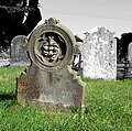 Headstone in All Saints' churchyard - geograph.org.uk - 5189172.jpg 640 × 634; 503 KB
-
 Headstone in All Saints' churchyard - geograph.org.uk - 5189176.jpg 624 × 640; 479 KB
-

-
 Honeypot Lane sign - geograph.org.uk - 3893991.jpg 2,965 × 2,227; 2.77 MB
-
 Honeypot Lane, Kirby Green - geograph.org.uk - 3893987.jpg 3,072 × 2,304; 1.58 MB
-

-
 Houses in Bungay Road - geograph.org.uk - 5512387.jpg 640 × 463; 342 KB
-
 Houses in Bungay Road - geograph.org.uk - 5512389.jpg 640 × 547; 401 KB
-

-

-
 Junction of four roads, near Kirby Cane - geograph.org.uk - 5966206.jpg 4,032 × 2,268; 5.47 MB
-
 K6 telephone box at Well Terrace - geograph.org.uk - 5512399.jpg 480 × 640; 343 KB
-
 Kirby Cane (Norfolk) Village Sign - geograph.org.uk - 1940171.jpg 640 × 480; 53 KB
-
 Kirby Cane All Saints church - geograph.org.uk - 2189850.jpg 640 × 480; 151 KB
-
 Kirby Cane Memorial Hall - geograph.org.uk - 6198802.jpg 4,032 × 2,268; 3.86 MB
-
 Kirby Cane Village Hall - geograph.org.uk - 3868903.jpg 3,072 × 2,304; 1.25 MB
-
 Kirby Cane Village Hall - geograph.org.uk - 3896305.jpg 3,049 × 2,141; 1.32 MB
-
 Kirby Cane Village Name sign - geograph.org.uk - 3893879.jpg 3,072 × 2,304; 2.08 MB
-
 Kirby Cane Village Name sign on Church Road - geograph.org.uk - 3893763.jpg 3,072 × 2,304; 2.41 MB
-
 Kirby Cane Village sign - geograph.org.uk - 3869082.jpg 2,304 × 3,072; 944 KB
-
 Kirby Cane Village sign - geograph.org.uk - 3869086.jpg 2,304 × 3,072; 929 KB
-
 Kirby Cane Village Store ^ Post Office - geograph.org.uk - 3868698.jpg 3,072 × 2,304; 1.13 MB
-
 Kirby Cane Village Store ^ Post Office - geograph.org.uk - 3868791.jpg 3,072 × 2,304; 1.17 MB
-
 Leethill Farm, Kirby Cane - geograph.org.uk - 3742108.jpg 640 × 480; 216 KB
-
 Litchmere Farm (farmhouse) - geograph.org.uk - 5522089.jpg 640 × 471; 289 KB
-
 Litchmere Farm (farmhouse) - geograph.org.uk - 5522095.jpg 640 × 475; 324 KB
-
 Litchmere Farm - geograph.org.uk - 1940178.jpg 640 × 480; 55 KB
-
 Litchmere Lane past Hungry Hill - geograph.org.uk - 3636396.jpg 527 × 640; 227 KB
-
 Litchmere Lane sign - geograph.org.uk - 3892511.jpg 3,049 × 2,290; 3.42 MB
-
 Litchmere Lane, Ellingham - geograph.org.uk - 3892574.jpg 3,072 × 2,304; 1.56 MB
-
 Litchmere Road - geograph.org.uk - 3636403.jpg 640 × 480; 217 KB
-
 Litchmere Road past Litchmere Farm - geograph.org.uk - 5522086.jpg 640 × 587; 369 KB
-
 Loddon Road past All Saints church - geograph.org.uk - 1342229.jpg 640 × 480; 86 KB
-
 Loddon Road, Kirby Cane - geograph.org.uk - 3892605.jpg 3,072 × 2,304; 1.83 MB
-
 Loddon Road, Kirby Green - geograph.org.uk - 3893930.jpg 3,072 × 2,304; 1.58 MB
-
 Loddon Road, Kirby Green - geograph.org.uk - 3893936.jpg 3,072 × 2,304; 1.59 MB
-
 Loddon Road, Kirby Green - geograph.org.uk - 3893966.jpg 3,072 × 2,304; 2.29 MB
-
 Loddon Road, Kirby Green - geograph.org.uk - 3893985.jpg 3,072 × 2,304; 1.53 MB
-
 Loddon Road, Kirby Green - geograph.org.uk - 3894680.jpg 3,072 × 2,304; 1.67 MB
-

-
 Memorial Hall - geograph.org.uk - 1940148.jpg 640 × 480; 56 KB
-
 Mill Road Post Office George VI Postbox - geograph.org.uk - 3868818.jpg 2,304 × 3,072; 1.29 MB
-
 Mill Road Post Office George VI Postbox - geograph.org.uk - 3868831.jpg 2,304 × 3,072; 1.01 MB
-
 Mill Road, Kirby Cane - geograph.org.uk - 3868748.jpg 3,072 × 2,304; 1.18 MB
-
 Mill Road, Kirby Cane - geograph.org.uk - 3868898.jpg 3,072 × 2,304; 834 KB
-
 Mill Road, Kirby Cane - geograph.org.uk - 3896174.jpg 3,072 × 2,304; 1,022 KB
-
 Newgate, Kirby Cane - geograph.org.uk - 3868716.jpg 3,048 × 2,284; 842 KB
-
 Oak marble galls - geograph.org.uk - 5522115.jpg 625 × 640; 437 KB
-
 Oak marble galls - geograph.org.uk - 5522119.jpg 605 × 640; 413 KB
-
 Oak marble galls - geograph.org.uk - 5522120.jpg 640 × 618; 286 KB
-
 Oak trees beside Litchmere Road - geograph.org.uk - 3636409.jpg 640 × 480; 210 KB
-
 Old Bungay Road past Birtwick Park - geograph.org.uk - 5512415.jpg 640 × 480; 410 KB
-
 Old Bungay Road sign - geograph.org.uk - 3892580.jpg 3,030 × 2,276; 3.46 MB
-
 Old Bungay Road sign - geograph.org.uk - 3892598.jpg 3,029 × 2,276; 2.66 MB
-
 Old Bungay Road, Ellingham - geograph.org.uk - 3892560.jpg 3,072 × 2,304; 2.04 MB
-
 Old Bungay Road, Ellingham - geograph.org.uk - 3892582.jpg 3,072 × 2,304; 995 KB
-
 Old Bungay Road, Kirby Cane - geograph.org.uk - 3892594.jpg 3,072 × 2,304; 1.76 MB
-
 Old gravestone in All Saints' churchyard - geograph.org.uk - 5189169.jpg 639 × 640; 592 KB
-

-
 Old headstone in All Saints' churchyard - geograph.org.uk - 5189178.jpg 640 × 480; 303 KB
-
 Path past Hall Farm - geograph.org.uk - 1342510.jpg 640 × 480; 108 KB
-
 Path past Sheepwalk Farm - geograph.org.uk - 1342433.jpg 480 × 640; 122 KB
-
 Permissive Access Map off Church Road - geograph.org.uk - 3893728.jpg 2,260 × 3,017; 1.2 MB
-
 Permissive bridleway along Church Road - geograph.org.uk - 3893736.jpg 3,072 × 2,304; 2.13 MB
-
 Plaque on the Kirby Cane Memorial Hall - geograph.org.uk - 6198804.jpg 4,032 × 2,268; 1.85 MB
-
 Pole Transformer - geograph.org.uk - 1940190.jpg 640 × 480; 54 KB
-
 Post office and general store - geograph.org.uk - 473730.jpg 640 × 480; 72 KB
-
 Public Footpath through Woodland, nr The Lodge, Kirby Cane - geograph.org.uk - 5726851.jpg 3,648 × 2,736; 5.29 MB
-
 Rayner's Lane, Ellingham - geograph.org.uk - 3892584.jpg 3,072 × 2,304; 1.32 MB
-
 Road-side Nature Reserve - geograph.org.uk - 1940197.jpg 640 × 480; 109 KB
-
 Road-side Nature Reserve - geograph.org.uk - 1940207.jpg 640 × 480; 98 KB
-
 Roadsign on Church Road - geograph.org.uk - 3892612.jpg 2,304 × 3,072; 1.43 MB
-
 Roadsign on Church Road - geograph.org.uk - 3893553.jpg 2,304 × 3,072; 2.9 MB
-
 Roadsign on the A143 Yarmouth Road - geograph.org.uk - 3894723.jpg 2,279 × 3,042; 1.62 MB
-
 Roadsign on Yarmouth Road - geograph.org.uk - 3888274.jpg 2,304 × 3,072; 1.28 MB
-
 Roadsigns on the A143 Yarmouth Road - geograph.org.uk - 3893787.jpg 2,206 × 2,944; 1.58 MB
-
 School Road sign - geograph.org.uk - 3892620.jpg 3,072 × 2,304; 2.14 MB
-
 School Road ^ Sheepwalk Postbox - geograph.org.uk - 3893455.jpg 3,072 × 2,304; 2 MB
-
 School Road, Kirby Cane - geograph.org.uk - 3893453.jpg 3,072 × 2,304; 2.13 MB
-
 Shed by Litchmere Farm - geograph.org.uk - 5522075.jpg 640 × 480; 323 KB
-
 Sheepwalk Postbox - geograph.org.uk - 3893458.jpg 3,072 × 2,304; 2.33 MB
-
 Sheepwalk Postbox - geograph.org.uk - 3893460.jpg 3,072 × 2,304; 2.71 MB
-
 Sheepwalk Postbox - geograph.org.uk - 3893463.jpg 2,304 × 3,072; 2.85 MB
-
 Sheepwalk Postbox - geograph.org.uk - 3896379.jpg 2,304 × 3,072; 2.43 MB
-
 Sheepwalk Postbox - geograph.org.uk - 3896383.jpg 2,304 × 3,072; 2.13 MB
-
 Skirting a field's edge - geograph.org.uk - 1342506.jpg 640 × 480; 82 KB
-
 Stockton, Rayners Lane, Crop harvesting at Abbots Farm - geograph.org.uk - 5450683.jpg 5,379 × 3,587; 4.95 MB
-
 Stockton, Rayners Lane, Crop harvesting at Abbots Farm - geograph.org.uk - 5450685.jpg 5,520 × 3,680; 5.99 MB
-
 Stubble field east of Litchmere Lane - geograph.org.uk - 3636398.jpg 640 × 480; 204 KB
-
 Stubble fields west of Litchmere Road - geograph.org.uk - 5522140.jpg 640 × 480; 288 KB
-
 Sugarbeet crop field by Litchmere Farm - geograph.org.uk - 5522104.jpg 640 × 480; 339 KB
-
 Sugarbeet field south of Hares' Grove - geograph.org.uk - 5522147.jpg 640 × 480; 330 KB
-
 The Lodge, Old Bungay Road, Kirby Cane - geograph.org.uk - 2213122.jpg 640 × 467; 197 KB
-
 The WW2 Memorial plaque at Kirby Cane - geograph.org.uk - 4419782.jpg 1,024 × 768; 205 KB
-
 This way to School Road - geograph.org.uk - 1342441.jpg 480 × 640; 100 KB
-
 This way to Sheepwalk Farm - geograph.org.uk - 1342423.jpg 640 × 480; 95 KB
-
 This way to Wash Lane - geograph.org.uk - 1342515.jpg 640 × 480; 90 KB
-
 To Litchmere Road on Rayner's Lane - geograph.org.uk - 5522069.jpg 640 × 480; 318 KB
-
 Track from School Road to the A143 - geograph.org.uk - 1342416.jpg 640 × 480; 121 KB
-

-
 Track into field east of Dull's Road - geograph.org.uk - 3636386.jpg 640 × 480; 241 KB
-
 Track to Litchmere Plantation - geograph.org.uk - 5522105.jpg 640 × 480; 368 KB
-
 Tree growing in a field boundary hedge - geograph.org.uk - 5512453.jpg 640 × 598; 438 KB
-
 Trees growing in a field boundary hedge - geograph.org.uk - 5522142.jpg 640 × 480; 305 KB
-
 Turnstone House - geograph.org.uk - 5512422.jpg 640 × 567; 473 KB
-
 Turnstone House - geograph.org.uk - 5512426.jpg 640 × 480; 379 KB
-
 View across a crop of wheat - geograph.org.uk - 1342538.jpg 640 × 480; 81 KB
-
 View across a wheat field - geograph.org.uk - 1342516.jpg 640 × 480; 116 KB
-
 View across the churchyard at Kirby Cane - geograph.org.uk - 3066653.jpg 640 × 480; 166 KB
-
 View along Rayner's Lane - geograph.org.uk - 5522067.jpg 640 × 480; 296 KB
-
 View along Well Terrace - geograph.org.uk - 5512380.jpg 640 × 469; 260 KB
-
 View east along School Road - geograph.org.uk - 1342407.jpg 640 × 480; 96 KB
-

-
 View north along Litchmere Road - geograph.org.uk - 5522109.jpg 640 × 480; 334 KB
-
 View south along Loddon Road - geograph.org.uk - 1342231.jpg 640 × 480; 96 KB
-
 View towards Dragon Cottage - geograph.org.uk - 5512431.jpg 640 × 603; 427 KB
-
 View towards Furze Grove - geograph.org.uk - 5522133.jpg 640 × 480; 291 KB
-
 Wardley Hill Road - geograph.org.uk - 6146498.jpg 4,032 × 2,268; 5.3 MB
-
 Wheat - geograph.org.uk - 1342522.jpg 480 × 640; 135 KB
-
 Where five roads meet at Kirby Cane - geograph.org.uk - 3073104.jpg 3,264 × 2,448; 2.29 MB
-
 WW1 memorial at Kirby Cane - geograph.org.uk - 4419789.jpg 1,024 × 768; 243 KB
-
 Yarmouth Road sign - geograph.org.uk - 3869057.jpg 3,072 × 2,304; 952 KB


_-_geograph.org.uk_-_5512445.jpg)
_-_geograph.org.uk_-_5512450.jpg)


_Village_Sign_-_geograph.org.uk_-_1940171.jpg)


_-_geograph.org.uk_-_5522089.jpg)
_-_geograph.org.uk_-_5522095.jpg)


