
Category:Kiplin
village in North Yorkshire, England, UK  | |||||
| Upload media | |||||
| Instance of | |||||
|---|---|---|---|---|---|
| Location | Hambleton, North Yorkshire, Yorkshire and the Humber, England | ||||
| Population |
| ||||
 | |||||
English: Kiplin is the small hamlet that accompanies Kiplin Hall to form the civil parish of Kiplin in the Hambleton district of North Yorkshire, England.

Media in category "Kiplin"
The following 39 files are in this category, out of 39 total.
-
 18thC Farmhouse in Kiplin. - geograph.org.uk - 1107056.jpg 640 × 480; 69 KB
-
 Across the lake to Kiplin Hall - geograph.org.uk - 5867086.jpg 3,239 × 4,319; 3.79 MB
-
 B6271 towards Bolton on Swale - geograph.org.uk - 2711033.jpg 640 × 480; 90 KB
-
 B6271 towards Bolton on Swale - geograph.org.uk - 2711043.jpg 640 × 480; 100 KB
-
 Benchmark on a barn in Kiplin - geograph.org.uk - 6248315.jpg 3,024 × 4,032; 3.85 MB
-
 Benchmark on Kiplin Hall Park Wall - geograph.org.uk - 6248229.jpg 4,032 × 3,024; 5.33 MB
-
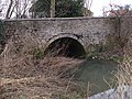 Brick and Cobble Bridge at Kiplin - geograph.org.uk - 1107027.jpg 640 × 480; 127 KB
-
 Bridleway at woodland edge - geograph.org.uk - 2850293.jpg 2,448 × 3,264; 2.29 MB
-
 Coach house and fruit store, Kiplin House - geograph.org.uk - 4739512.jpg 3,008 × 2,000; 2.57 MB
-
 Double bend, double trouble - geograph.org.uk - 1161948.jpg 640 × 480; 86 KB
-
 Estate Cottages at Kiplin - geograph.org.uk - 1107017.jpg 640 × 409; 63 KB
-
 Farm building, Low Kipling - geograph.org.uk - 2711031.jpg 1,600 × 1,200; 334 KB
-
 Farmland, Kiplin - geograph.org.uk - 2711035.jpg 640 × 480; 33 KB
-
 Flooded gravel pit, Kiplin - geograph.org.uk - 4740073.jpg 3,008 × 2,000; 2.57 MB
-
 Harmire, Whitwell - geograph.org.uk - 4527299.jpg 4,000 × 2,250; 2.4 MB
-
 Herb garden, Kiplin Hall - geograph.org.uk - 4740056.jpg 3,008 × 2,000; 2.77 MB
-
 House near Kiplin Hall - geograph.org.uk - 2711042.jpg 640 × 480; 84 KB
-
 Kiplin Beck - geograph.org.uk - 1107038.jpg 558 × 640; 113 KB
-

-
 Lime Trees in Kiplin Park - geograph.org.uk - 1107011.jpg 640 × 355; 49 KB
-
 Low Gilpin farm house near Great Langton - geograph.org.uk - 2629210.jpg 3,648 × 2,736; 1.77 MB
-
 North West Gateway to Kiplin Hall - geograph.org.uk - 2630693.jpg 640 × 480; 111 KB
-
 North Yorkshire Police Safety Camera Van on B6271 - geograph.org.uk - 5543052.jpg 5,152 × 3,864; 5.09 MB
-
 Quiet country property, some updating required - geograph.org.uk - 2850275.jpg 2,993 × 2,134; 1.68 MB
-
 Rawcar Bridge - geograph.org.uk - 2966289.jpg 4,000 × 3,000; 2.91 MB
-
 Road over Rawcar Bridge - geograph.org.uk - 2850299.jpg 3,264 × 2,448; 2.74 MB
-
 Roses - geograph.org.uk - 4739514.jpg 3,008 × 2,000; 2.85 MB
-
 Sheep grazing under trees - geograph.org.uk - 2032224.jpg 1,024 × 768; 200 KB
-
 Swale floodbank at Kiplin - geograph.org.uk - 1106070.jpg 640 × 480; 94 KB
-
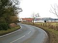 The B6271 at Low Kiplin - geograph.org.uk - 1161943.jpg 640 × 480; 80 KB
-
 The Bungalow seen from minor road near Whitwell - geograph.org.uk - 3643462.jpg 3,470 × 2,478; 3.47 MB
-
 Track near the Swale - geograph.org.uk - 1106081.jpg 640 × 480; 69 KB
-
 Track to Kiplin Farm - geograph.org.uk - 2711037.jpg 640 × 480; 133 KB
-
 Track to Kiplin Hall - geograph.org.uk - 2711040.jpg 640 × 480; 109 KB
-
 Track to Stanhowe - geograph.org.uk - 2711149.jpg 640 × 480; 58 KB
-
 Track to The Smallholding - geograph.org.uk - 2829304.jpg 2,448 × 3,264; 2.47 MB
-

-
 Wildlife pond, Stanhowe - geograph.org.uk - 2850268.jpg 3,256 × 1,903; 2.2 MB
-
 Woodland track near Ladybank House - geograph.org.uk - 2850287.jpg 2,448 × 3,264; 3.31 MB


