Category:Kinson
Jump to navigation
Jump to search
village in Dorset, England  | |||||
| Upload media | |||||
| Instance of | |||||
|---|---|---|---|---|---|
| Location |
| ||||
 | |||||
Subcategories
This category has the following 2 subcategories, out of 2 total.
K
W
- West Howe, Kinson Cemetery (9 F)
Media in category "Kinson"
The following 200 files are in this category, out of 223 total.
(previous page) (next page)-
 A348 crosses Longham Bridge - geograph.org.uk - 4250428.jpg 3,648 × 2,736; 1.01 MB
-
 Ash trunk - geograph.org.uk - 2082649.jpg 683 × 1,024; 260 KB
-
 Bear Cross, 1200-1202 Ringwood Road - geograph.org.uk - 3032438.jpg 640 × 480; 57 KB
-
 Betting shop next to music shop, Kinson - geograph.org.uk - 1168014.jpg 640 × 480; 194 KB
-
 Church, Bournemouth - geograph.org.uk - 149555.jpg 640 × 481; 110 KB
-
 Bournemouth , Kinson Manor Farm - geograph.org.uk - 1290611.jpg 640 × 480; 74 KB
-
 Bournemouth , View over Kinson - geograph.org.uk - 1746296.jpg 6,932 × 2,090; 3.72 MB
-
 Bournemouth's longest road - geograph.org.uk - 4851406.jpg 1,787 × 1,325; 647 KB
-

-
 Bournemouth, UK - panoramio - Sławomir Hutryk (6).jpg 2,304 × 1,728; 702 KB
-
 East Howe, Aldridge Road - geograph.org.uk - 6446815.jpg 640 × 640; 157 KB
-
 East Howe, approach to footpath E37 - geograph.org.uk - 5023712.jpg 640 × 480; 172 KB
-

-
 East Howe, Brook Road - geograph.org.uk - 6452380.jpg 640 × 640; 128 KB
-

-

-
 East Howe, footpath E37 to Puck’s Dell - geograph.org.uk - 4989384.jpg 640 × 480; 103 KB
-

-

-

-
 East Howe, Highlands Crescent - geograph.org.uk - 6499456.jpg 640 × 640; 104 KB
-
 East Howe, kissing gate on footpath E34 - geograph.org.uk - 5023797.jpg 480 × 640; 175 KB
-

-
 East Howe, referendum polling station - geograph.org.uk - 5006941.jpg 640 × 480; 116 KB
-

-
 Entrance to waste and recycling centre - geograph.org.uk - 2082631.jpg 1,024 × 683; 217 KB
-
 Furniture Store - geograph.org.uk - 2785156.jpg 640 × 480; 83 KB
-
 Gateway in constant use... - geograph.org.uk - 944605.jpg 640 × 480; 68 KB
-

-

-
 House on Wimborne Rd - geograph.org.uk - 2784471.jpg 640 × 480; 94 KB
-
 Kinson Manor Farm - geograph.org.uk - 1183317.jpg 640 × 480; 54 KB
-
 Kinson Manor Playing Fields - geograph.org.uk - 1182660.jpg 640 × 480; 50 KB
-
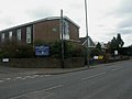 Kinson Methodist Church - geograph.org.uk - 1182706.jpg 640 × 480; 50 KB
-
 Kinson Primary School - geograph.org.uk - 1182760.jpg 640 × 480; 59 KB
-

-
 Kinson, a gargoyle guards footpath E12 - geograph.org.uk - 5029992.jpg 640 × 480; 162 KB
-

-

-
 Kinson, Berrans Avenue - geograph.org.uk - 6448363.jpg 640 × 640; 104 KB
-

-

-
 Kinson, Bramley Road - geograph.org.uk - 6449287.jpg 640 × 640; 109 KB
-
 Kinson, bridge - geograph.org.uk - 1169371.jpg 640 × 480; 103 KB
-
 Kinson, Brook Road allotments - geograph.org.uk - 5099382.jpg 640 × 481; 61 KB
-
 Kinson, bungalows - geograph.org.uk - 1183454.jpg 640 × 480; 58 KB
-
 Kinson, Burcombe Road - geograph.org.uk - 6452386.jpg 640 × 640; 109 KB
-
 Kinson, bus stop on Wimborne Road - geograph.org.uk - 3977817.jpg 640 × 480; 53 KB
-
 Kinson, car park behind The Hub - geograph.org.uk - 3977789.jpg 640 × 480; 72 KB
-

-
 Kinson, Common reed - geograph.org.uk - 1169521.jpg 640 × 480; 102 KB
-

-
 Kinson, cottages - geograph.org.uk - 1183357.jpg 640 × 480; 81 KB
-
 Kinson, crocuses - geograph.org.uk - 1182772.jpg 640 × 480; 92 KB
-

-

-
 Kinson, Durdells Avenue - geograph.org.uk - 6459715.jpg 640 × 640; 127 KB
-
 Kinson, Durdells Gardens - geograph.org.uk - 6459723.jpg 640 × 640; 104 KB
-
 Kinson, eastern arm of Hyde Road - geograph.org.uk - 5183990.jpg 640 × 480; 48 KB
-
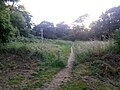
 Kinson, emerging from woods on the common - geograph.org.uk - 926076.jpg 640 × 480; 121 KB
-
 Kinson, flooding at Millhams Mead - geograph.org.uk - 3032341.jpg 640 × 480; 92 KB
-

-
 Kinson, footpath E12 enters open space - geograph.org.uk - 5029998.jpg 480 × 640; 163 KB
-
 Kinson, footpath E12 from Vince Close - geograph.org.uk - 5030009.jpg 640 × 480; 140 KB
-

-
 Kinson, footpath E12 reaches Vince Close - geograph.org.uk - 5030007.jpg 640 × 480; 163 KB
-
 Kinson, footpath E13 from Wakely Road - geograph.org.uk - 5014460.jpg 640 × 480; 126 KB
-
 Kinson, footpath E13 to Wakely Road - geograph.org.uk - 5014465.jpg 640 × 480; 127 KB
-

-

-

-

-
 Kinson, footpath E23 to Berrans Avenue - geograph.org.uk - 5015852.jpg 640 × 482; 145 KB
-

-
 Kinson, footpath E24 from Wakely Road - geograph.org.uk - 5015874.jpg 640 × 480; 146 KB
-
 Kinson, footpath E24 from Wimborne Road - geograph.org.uk - 5015868.jpg 479 × 640; 159 KB
-

-

-

-

-

-

-

-

-

-

-

-

-

-

-

-

-

-

-
 Kinson, footpath E46 from Hyde Road - geograph.org.uk - 5007915.jpg 640 × 480; 110 KB
-

-

-

-

-
 Kinson, footpath E47 from Wicket Road - geograph.org.uk - 5007905.jpg 640 × 480; 142 KB
-

-
-
 Kinson, footpath E48 from Kitscroft Road - geograph.org.uk - 5007862.jpg 640 × 480; 118 KB
-

-

-

-

-

-

-

-

-

-
 Kinson, footpath E52 on Kinson Green - geograph.org.uk - 4995047.jpg 640 × 480; 78 KB
-

-

-
 Kinson, footpath E54 to Bramley Road - geograph.org.uk - 4995028.jpg 640 × 480; 87 KB
-

-

-
-
 Kinson, Fryer Close - geograph.org.uk - 6476843.jpg 640 × 640; 141 KB
-
 Kinson, Glenmeadows Drive - geograph.org.uk - 6482318.jpg 640 × 640; 107 KB
-

-
 Kinson, Griffiths Gardens - geograph.org.uk - 6492080.jpg 640 × 640; 124 KB
-
 Kinson, Gulliver's Tavern - geograph.org.uk - 1109253.jpg 640 × 480; 62 KB
-
 Kinson, health club - geograph.org.uk - 1183335.jpg 640 × 480; 53 KB
-
 Kinson, Kinson Common - geograph.org.uk - 926089.jpg 640 × 480; 107 KB
-
 Kinson, Kinson Green - geograph.org.uk - 3977782.jpg 640 × 480; 87 KB
-
 Kinson, kissing gate on footpath E34 - geograph.org.uk - 5007892.jpg 480 × 640; 88 KB
-

-
 Kinson, lollipop lady on Kinson Road - geograph.org.uk - 3977795.jpg 640 × 480; 72 KB
-
 Kinson, Longham Bridge from footpath E28 - geograph.org.uk - 5014531.jpg 480 × 640; 190 KB
-
 Kinson, looking back on footpath E26 - geograph.org.uk - 5014497.jpg 640 × 480; 159 KB
-

-

-
 Kinson, midway along footpath E23 - geograph.org.uk - 5015856.jpg 480 × 640; 193 KB
-

-
 Kinson, molehills - geograph.org.uk - 1183270.jpg 640 × 480; 60 KB
-
 Kinson, my initials, but not my doing - geograph.org.uk - 5099380.jpg 640 × 480; 119 KB
-

-

-
 Kinson, Pelhams - geograph.org.uk - 1183118.jpg 640 × 480; 101 KB
-
 Kinson, Pelhams Clinic - geograph.org.uk - 1183085.jpg 640 × 480; 67 KB
-
 Kinson, Pelhams Park - geograph.org.uk - 1183244.jpg 640 × 480; 109 KB
-

-

-
 Kinson, pond on the common - geograph.org.uk - 926096.jpg 640 × 480; 127 KB
-
 Kinson, ponies on the common - geograph.org.uk - 5199975.jpg 640 × 480; 71 KB
-
 Kinson, post office - geograph.org.uk - 891862.jpg 640 × 480; 71 KB
-

-

-

-

-

-
 Kinson, public conveniences - geograph.org.uk - 1183385.jpg 640 × 480; 82 KB
-
 Kinson, public footpath E14 - geograph.org.uk - 5014470.jpg 640 × 480; 147 KB
-
 Kinson, public toilets on the green - geograph.org.uk - 3977792.jpg 640 × 480; 117 KB
-
 Kinson, pylons - geograph.org.uk - 1169562.jpg 480 × 640; 78 KB
-
 Kinson, Selwood Park - geograph.org.uk - 1183440.jpg 640 × 480; 58 KB
-

-
 Kinson, small footbridge on the common - geograph.org.uk - 926064.jpg 480 × 640; 136 KB
-

-
 Kinson, southern end of footpath E25 - geograph.org.uk - 5315819.jpg 640 × 481; 75 KB
-
 Kinson, stench pipe - geograph.org.uk - 1183409.jpg 480 × 640; 89 KB
-
 Kinson, stocks on the green - geograph.org.uk - 3977784.jpg 480 × 640; 128 KB
-
 Kinson, Tesco - geograph.org.uk - 4549510.jpg 640 × 360; 34 KB
-
 Kinson, Tesco on a rainy night - geograph.org.uk - 4762345.jpg 640 × 360; 59 KB
-
 Kinson, Tesco store opened in 2015 - geograph.org.uk - 4549514.jpg 640 × 360; 54 KB
-

-

-
 Kinson, the end of footpath E26 - geograph.org.uk - 5014505.jpg 640 × 480; 170 KB
-

-

-
 Kinson, the Kinson Hub - geograph.org.uk - 2421225.jpg 640 × 480; 66 KB
-
 Kinson, the main road - geograph.org.uk - 2421219.jpg 640 × 480; 58 KB
-

-
 Kinson, the old library - geograph.org.uk - 1056711.jpg 640 × 480; 58 KB
-
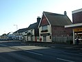
 Kinson, The Royal Oak - geograph.org.uk - 1183033.jpg 640 × 480; 83 KB
-
 Kinson, the Royal Oak - geograph.org.uk - 2421244.jpg 640 × 481; 79 KB
-
 Kinson, the Royal Oak from the north - geograph.org.uk - 2421248.jpg 640 × 480; 59 KB
-
 Kinson, The Royal Oak, sign - geograph.org.uk - 1183065.jpg 640 × 480; 78 KB
-
 Kinson, the Smuggler’s Wain - geograph.org.uk - 3977809.jpg 640 × 480; 73 KB
-
 Kinson, the start of footpath E26 - geograph.org.uk - 5014476.jpg 640 × 480; 148 KB
-

-

-
 Kinson, toppled trees on the common - geograph.org.uk - 926070.jpg 640 × 480; 141 KB
-
 Kinson, unusual tree - geograph.org.uk - 926075.jpg 480 × 640; 120 KB
-

-

-
 Kinson, war graves - geograph.org.uk - 1169492.jpg 640 × 480; 129 KB
-
 Kinson, waterfall in common - geograph.org.uk - 926102.jpg 640 × 480; 129 KB
-
 Kinson, Westdown Road - geograph.org.uk - 5014616.jpg 640 × 480; 104 KB
-

-

-

-

-
 Longham Bridge - geograph.org.uk - 2082565.jpg 1,024 × 683; 190 KB
-
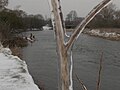
 Longham, a very swollen River Stour - geograph.org.uk - 3032404.jpg 640 × 480; 54 KB
-
 Longham, Longham Bridge - geograph.org.uk - 3032400.jpg 640 × 480; 63 KB
-
 Meadow near St Andrew's - geograph.org.uk - 2082726.jpg 1,024 × 683; 260 KB
-
 Millhams Mead Nature Reserve - geograph.org.uk - 2082682.jpg 1,024 × 683; 380 KB


.jpg)


_-_geograph.org.uk_-_3386272.jpg)
_-_geograph.org.uk_-_3386273.jpg)


_-_geograph.org.uk_-_3830322.jpg)


_on_the_River_Stour_-_geograph.org.uk_-_2082596.jpg)
_on_the_River_Stour_-_geograph.org.uk_-_2082622.jpg)


