Category:Kingsweston (ward)
Jump to navigation
Jump to search
suburb and former electoral ward in Bristol, England  | |||||
| Upload media | |||||
| Instance of |
| ||||
|---|---|---|---|---|---|
| Location | City of Bristol, South West England, England | ||||
 | |||||
Subcategories
This category has the following 2 subcategories, out of 2 total.
K
S
- Sea Mills Viaduct (38 F)
Media in category "Kingsweston (ward)"
The following 200 files are in this category, out of 284 total.
(previous page) (next page)-
 A beacon by Crabtree Slip Wood - geograph.org.uk - 6693002.jpg 2,472 × 3,296; 1.78 MB
-
 A beacon near Horseshoe Point - geograph.org.uk - 6693005.jpg 3,296 × 2,472; 1.91 MB
-
 A fun mooring post - geograph.org.uk - 6692981.jpg 2,472 × 3,296; 1.74 MB
-
 A pair of eyes on the towing path - geograph.org.uk - 6692997.jpg 3,296 × 2,472; 1.94 MB
-

-
 A4 dual carriageway near Sea Mills - geograph.org.uk - 6041630.jpg 4,288 × 3,216; 7.67 MB
-
 A4 Portway at Sea Mills - geograph.org.uk - 5124614.jpg 1,600 × 901; 651 KB
-
 A4 Portway near Sylvan Way - geograph.org.uk - 5818599.jpg 1,024 × 768; 182 KB
-
 Abbeywood Drive, Sea Mills, Bristol - geograph.org.uk - 3029343.jpg 640 × 434; 66 KB
-
 Abbots Leigh , Footpath - geograph.org.uk - 6519993.jpg 6,000 × 4,000; 7.8 MB
-
 Abbots Leigh , Footpath - geograph.org.uk - 6520006.jpg 6,000 × 4,000; 5.69 MB
-
 Abbots Leigh , Grassy Field - geograph.org.uk - 6520000.jpg 6,000 × 4,000; 6.23 MB
-
 Abbots Leigh , Grassy Field - geograph.org.uk - 6520008.jpg 6,000 × 4,000; 5.96 MB
-
 Abbots Leigh , River Avon - geograph.org.uk - 6519994.jpg 6,000 × 4,000; 6.23 MB
-
 Abbots Leigh , River Avon - geograph.org.uk - 6519996.jpg 6,000 × 4,000; 5.94 MB
-
 Abbots Leigh , River Avon - geograph.org.uk - 6519998.jpg 6,000 × 4,000; 5.18 MB
-
 Abbots Leigh , River Avon - geograph.org.uk - 6520001.jpg 5,253 × 3,502; 3.43 MB
-
 Abbots Leigh , River Avon - geograph.org.uk - 6520003.jpg 5,833 × 3,889; 4.64 MB
-
 Abbots Leigh , River Avon - geograph.org.uk - 6520009.jpg 6,000 × 4,000; 5.88 MB
-
 Abbots Leigh , River Avon - geograph.org.uk - 6520012.jpg 6,000 × 4,000; 6.4 MB
-
 Abbots Leigh , River Avon - geograph.org.uk - 6520013.jpg 6,000 × 4,000; 6.87 MB
-
 Abbots Leigh , River Avon - geograph.org.uk - 6520015.jpg 6,000 × 4,000; 6.62 MB
-
 Abbots Leigh, by the river Avon - geograph.org.uk - 2674686.jpg 640 × 427; 469 KB
-
 Abbots Leigh, navigation light - geograph.org.uk - 2674696.jpg 640 × 427; 357 KB
-
 Abbots Leigh, River Avon on the ebb - geograph.org.uk - 2674702.jpg 640 × 427; 424 KB
-
 All ways to Sea Mills - geograph.org.uk - 6692976.jpg 3,296 × 2,472; 1.88 MB
-

-
 Antares in the mud - geograph.org.uk - 2157447.jpg 1,280 × 855; 187 KB
-
 Approaching Sea Mills station - geograph.org.uk - 6692966.jpg 3,296 × 2,472; 1.88 MB
-
 Arriving at Sea Mills - geograph.org.uk - 2157414.jpg 1,280 × 856; 206 KB
-
 At Sea Mills - geograph.org.uk - 4717669.jpg 4,971 × 3,268; 6.79 MB
-
 Autumn colours by Lawrence Weston Road - geograph.org.uk - 5559831.jpg 5,700 × 3,800; 7.37 MB
-
 Avon Chapel Pill Outfall - geograph.org.uk - 6692989.jpg 3,296 × 2,472; 1.9 MB
-
 Avon from a beacon - geograph.org.uk - 5453828.jpg 640 × 427; 232 KB
-
 Avon Way, Bristol - geograph.org.uk - 3919613.jpg 1,920 × 1,300; 430 KB
-
 Avonmouth from Kings Weston Estate - geograph.org.uk - 6042125.jpg 4,288 × 3,216; 7.23 MB
-
 Aylminton Walk - geograph.org.uk - 5560466.jpg 6,000 × 4,000; 4.14 MB
-
 Beside the A4, Portway - geograph.org.uk - 5124633.jpg 1,600 × 901; 699 KB
-
 Bewys Cross in its present location at Kingsweston.jpg 4,288 × 3,216; 4.64 MB
-
 Boundary Stone - geograph.org.uk - 6324367.jpg 576 × 1,024; 138 KB
-
 Boundary Stone - geograph.org.uk - 6324374.jpg 576 × 1,024; 214 KB
-
 Branscombe Road, Sea Mills - geograph.org.uk - 3919881.jpg 1,920 × 1,388; 364 KB
-
 Bridge and harbour well, Sea Mills - geograph.org.uk - 3920151.jpg 1,920 × 1,440; 561 KB
-
 Bridges over the Trym - geograph.org.uk - 3920399.jpg 1,920 × 2,367; 852 KB
-
 Bristol , Hadrian Close - geograph.org.uk - 4502200.jpg 4,427 × 3,321; 5.33 MB
-

-
 Bristol MMB «39 Rivers Avon and Trym.jpg 2,400 × 1,436; 1.6 MB
-
 Bristol MMB «41 River Trym.jpg 2,335 × 1,524; 2.19 MB
-
 Bristol MMB «43 River Avon.jpg 2,400 × 1,600; 698 KB
-
 Bristol MMB «45 Rivers Avon and Trym.jpg 1,600 × 2,400; 696 KB
-
 Bristol MMB «47 River Trym.jpg 2,400 × 1,600; 2.25 MB
-
 Bristol MMB «D7 Rivers Avon and Trym.jpg 3,936 × 2,624; 3.33 MB
-
 Bristol MMB «D8 River Trym.jpg 2,344 × 3,660; 3.34 MB
-
 Bristol MMB «E2 River Trym and A4 Portway.jpg 3,826 × 2,415; 4.26 MB
-
 Bristol MMB «E3 River Trym.jpg 3,865 × 2,541; 4.36 MB
-
 Bristol MMB «E4 River Trym.jpg 3,888 × 2,581; 4.8 MB
-
 Bristol MMB «E5 River Trym.jpg 2,624 × 3,936; 4.56 MB
-
 Bristol MMB «E6 River Trym.jpg 2,585 × 3,896; 4.02 MB
-
 Bristol MMB «E7 River Trym.jpg 3,258 × 2,064; 2.73 MB
-
 Bus stop on Portway near Riverleaze - geograph.org.uk - 6041627.jpg 4,288 × 3,216; 7.21 MB
-
 Cafe and bus stop on Shirehampton Road - geograph.org.uk - 6630369.jpg 1,024 × 766; 154 KB
-

-

-
 Church of our lady of the rosary, Kings Weston - geograph.org.uk - 6343085.jpg 1,024 × 811; 134 KB
-

-

-
 Coombe Dale, Coombe Dingle - geograph.org.uk - 6169851.jpg 1,812 × 1,088; 1,014 KB
-
 Coombe Dingle car park - geograph.org.uk - 6041552.jpg 4,288 × 3,216; 7.32 MB
-
 Coombe Lane at the junction of Canford Road - geograph.org.uk - 6170284.jpg 1,920 × 1,280; 1.31 MB
-
 Crossroads on Shirehampton Road - geograph.org.uk - 6342498.jpg 1,024 × 743; 122 KB
-
 Crossroads on Sylvan Way, Coombe Dingle - geograph.org.uk - 6177654.jpg 1,920 × 1,280; 1,013 KB
-
 Cut benchmark in lane - geograph.org.uk - 6476123.jpg 1,600 × 1,280; 1.2 MB
-
 Cut Mark, Westbury-on-Trym, The Dingle Bridge - geograph.org.uk - 6330712.jpg 960 × 1,280; 534 KB
-
 Cut Mark, Westbury-on-Trym, The Dingle Bridge - geograph.org.uk - 6330717.jpg 1,280 × 960; 459 KB
-
 Cycle path - Pill to Bristol - geograph.org.uk - 395560.jpg 480 × 640; 122 KB
-
 Damaged benchmark on a house - geograph.org.uk - 6476129.jpg 1,600 × 1,280; 1.15 MB
-
 Derelict building on Kings Weston Road - geograph.org.uk - 6342587.jpg 1,024 × 768; 223 KB
-
 Dingle Road, Coombe Dingle - geograph.org.uk - 6177653.jpg 1,920 × 1,280; 1.18 MB
-
 Direction Sign – Signpost - geograph.org.uk - 6576776.jpg 1,024 × 695; 137 KB
-

-
 Entrance to Lawrence Rovers Football Club - geograph.org.uk - 5560459.jpg 6,000 × 4,000; 7.3 MB
-

-
 Entrance, Blaise Nursery - geograph.org.uk - 6342586.jpg 1,024 × 774; 180 KB
-
 Failand Crescent, Sea Mills, Bristol - geograph.org.uk - 3029374.jpg 640 × 469; 60 KB
-
 Failand Walk - geograph.org.uk - 5564196.jpg 6,000 × 4,000; 5.74 MB
-
 Flight of steps on the Severn Way - geograph.org.uk - 5564175.jpg 6,000 × 4,000; 5.72 MB
-
 Footbridge across the Trym - geograph.org.uk - 3919910.jpg 1,920 × 1,440; 577 KB
-
 Footbridge across the Trym - geograph.org.uk - 3920731.jpg 1,920 × 2,560; 812 KB
-
 Footbridge over Kings Weston Road - geograph.org.uk - 6042146.jpg 4,288 × 3,216; 6.56 MB
-
 Footbridge over the River Trym - geograph.org.uk - 6041588.jpg 4,288 × 3,216; 7.22 MB
-
 Footpath heading towards the Portway Bridge - geograph.org.uk - 6041619.jpg 4,288 × 3,216; 7.91 MB
-
 Footpath near Coombe Dingle - geograph.org.uk - 6041555.jpg 4,288 × 3,216; 6.74 MB
-
 Footpath through Shirehampton Park Golf Club - geograph.org.uk - 6041886.jpg 4,288 × 3,216; 6.93 MB
-
 Footpath through Three Acres Covert - geograph.org.uk - 6041651.jpg 4,288 × 3,216; 7.11 MB
-
 Former Lodge, Sneyd Park - geograph.org.uk - 3359504.jpg 1,697 × 1,427; 687 KB
-

-
 Gated level crossing, Sea Mills, Bristol - geograph.org.uk - 3024212.jpg 640 × 523; 100 KB
-
 Green, Branscombe Road, Sea Mills - geograph.org.uk - 3919890.jpg 1,920 × 1,305; 327 KB
-
 Harbour walls of Sea Mills Docks - geograph.org.uk - 3920138.jpg 1,920 × 1,440; 581 KB
-
 Henbury , Arbutus Walk - geograph.org.uk - 6618398.jpg 6,000 × 4,000; 6.41 MB
-
 Henbury , Arbutus Walk - geograph.org.uk - 6618400.jpg 6,000 × 4,000; 6.89 MB
-
 Henbury , Footpath - geograph.org.uk - 6617942.jpg 6,000 × 4,000; 6.84 MB
-
 Henbury , Footpath - geograph.org.uk - 6617945.jpg 6,000 × 4,000; 6.65 MB
-
 Henbury , Footpath - geograph.org.uk - 6617951.jpg 6,000 × 4,000; 7.47 MB
-
 Henbury , Footpath - geograph.org.uk - 6617952.jpg 6,000 × 4,000; 6.85 MB
-
 Henbury , Footpath - geograph.org.uk - 6617959.jpg 6,000 × 4,000; 7.76 MB
-
 Henbury , Footpath - geograph.org.uk - 6617961.jpg 6,000 × 4,000; 6.48 MB
-
 Henbury , Footpath - geograph.org.uk - 6617965.jpg 6,000 × 4,000; 7.7 MB
-
 Henbury , Footpath - geograph.org.uk - 6617968.jpg 6,000 × 4,000; 6.7 MB
-
 Henbury , Footpath - geograph.org.uk - 6617970.jpg 6,000 × 4,000; 7.73 MB
-
 Henbury , Footpath - geograph.org.uk - 6617973.jpg 6,000 × 4,000; 7.62 MB
-
 Henbury , Footpath - geograph.org.uk - 6617975.jpg 4,000 × 6,000; 6.04 MB
-
 Henbury , Footpath - geograph.org.uk - 6617976.jpg 6,000 × 4,000; 6.48 MB
-
 Henbury , Footpath - geograph.org.uk - 6617978.jpg 6,000 × 4,000; 6.17 MB
-
 Henbury , Footpath - geograph.org.uk - 6618405.jpg 6,000 × 4,000; 6.84 MB
-
 Henbury , Footpath - geograph.org.uk - 6618411.jpg 6,000 × 4,000; 6.07 MB
-
 Henbury , Grassy Field - geograph.org.uk - 6617944.jpg 6,000 × 4,000; 7.84 MB
-
 Henbury , Grassy Field - geograph.org.uk - 6618404.jpg 6,000 × 4,000; 7.85 MB
-
 Henbury , Grassy Field - geograph.org.uk - 6618412.jpg 6,000 × 4,000; 6.38 MB
-
 Henbury , Grassy Field - geograph.org.uk - 6618413.jpg 6,000 × 4,000; 6.77 MB
-
 Henbury , Grassy Field - geograph.org.uk - 6618726.jpg 6,000 × 4,000; 6.94 MB
-
 Henbury , Grassy Field - geograph.org.uk - 6618727.jpg 6,000 × 4,000; 7.24 MB
-
 Henbury , Grassy Field - geograph.org.uk - 6618728.jpg 6,000 × 4,000; 7.26 MB
-
 Henbury , Grassy Field - geograph.org.uk - 6618729.jpg 6,000 × 4,000; 6.6 MB
-
 Henbury , Grassy Field - geograph.org.uk - 6618731.jpg 6,000 × 4,000; 5.93 MB
-
 Henbury , Hazel Brook - geograph.org.uk - 6617933.jpg 4,000 × 6,000; 6.76 MB
-
 Henbury , Hazel Brook - geograph.org.uk - 6617939.jpg 4,000 × 6,000; 6.89 MB
-
 Henbury , Kings Weston Hill Fort - geograph.org.uk - 6618410.jpg 6,000 × 4,000; 7.73 MB
-
 Henbury , Limekiln Wood - geograph.org.uk - 6618402.jpg 6,000 × 4,000; 7.75 MB
-
 Henbury , Mast - geograph.org.uk - 6618732.jpg 4,000 × 6,000; 6.73 MB
-
 Henbury , River Trym - geograph.org.uk - 6617892.jpg 6,000 × 4,000; 6.75 MB
-
 Henbury Grassy Field - geograph.org.uk - 6618725.jpg 4,000 × 6,000; 6.47 MB
-

-
 Into Blaise estate - geograph.org.uk - 6476121.jpg 1,600 × 1,200; 1.18 MB
-
 Kings Weston Hillfort - geograph.org.uk - 6042191.jpg 4,288 × 3,216; 7.06 MB
-
 Kings Weston House - geograph.org.uk - 6042046.jpg 4,288 × 3,216; 6.92 MB
-
 Kings Weston House - geograph.org.uk - 6042123.jpg 4,131 × 3,099; 1.68 MB
-
 Kings Weston House from the east - geograph.org.uk - 6042134.jpg 4,149 × 3,111; 2.5 MB
-
 Kings Weston Lane - geograph.org.uk - 5560489.jpg 5,711 × 3,807; 4.96 MB
-
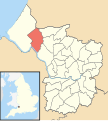 Kingsweston Bristol UK ward map.svg 1,138 × 1,266; 709 KB
-
 Kingsweston House entrance hall.jpeg 2,613 × 2,613; 2.13 MB
-
 Kingsweston House, cafe and bistro entrance - geograph.org.uk - 6066040.jpg 5,202 × 3,465; 3.65 MB
-
 Lawrence-Weston-Flats.jpg 450 × 306; 45 KB
-
 Leafy walk through Lawrence Weston - geograph.org.uk - 5560476.jpg 6,000 × 4,000; 5.9 MB
-
 Leigh Woods (11) - geograph.org.uk - 5192755.jpg 4,223 × 3,167; 3.81 MB
-

-
 Lighting the way - geograph.org.uk - 4717755.jpg 4,714 × 3,144; 5.64 MB
-
 Long Cross roundabout - geograph.org.uk - 5560493.jpg 6,000 × 4,000; 5.22 MB
-
 Long Cross, Lawrence Weston - geograph.org.uk - 6342594.jpg 1,024 × 768; 193 KB
-
 Looking across the River Avon near Sea Mills - geograph.org.uk - 3341567.jpg 1,500 × 980; 98 KB
-
 Marker beacon - geograph.org.uk - 5453829.jpg 427 × 640; 268 KB
-

-
 Mosaics at Sea Mills - geograph.org.uk - 2157425.jpg 1,280 × 855; 125 KB
-
 Motorway link road, near Shirehampton - geograph.org.uk - 6343109.jpg 1,024 × 787; 174 KB
-
 Mouth of River Trym - geograph.org.uk - 3920170.jpg 1,920 × 1,308; 484 KB
-
 Mouth of the River Trym - geograph.org.uk - 4717680.jpg 5,643 × 3,598; 5.92 MB
-
 Mouth of the River Trym - geograph.org.uk - 6630315.jpg 1,024 × 768; 193 KB
-
 Mud and railway bridge, Sea Mills - geograph.org.uk - 3439217.jpg 1,024 × 768; 163 KB
-
 Mudbanks, River Trym - geograph.org.uk - 3920047.jpg 1,920 × 1,440; 720 KB
-
 National Trust sign at Shirehampton Park - geograph.org.uk - 6041889.jpg 3,216 × 4,286; 3.21 MB
-

-

-
 Old Boundary Marker - geograph.org.uk - 6436504.jpg 445 × 792; 173 KB
-
 Old Boundary Marker - geograph.org.uk - 6599121.jpg 940 × 940; 630 KB
-

-

-
 Old Sneed Park, Sneyd Park - geograph.org.uk - 3919529.jpg 1,920 × 1,440; 776 KB
-
 Old Sneed Park, Sneyd Park - geograph.org.uk - 3919540.jpg 1,920 × 1,360; 674 KB
-
 Overlooking the Avon - geograph.org.uk - 4717742.jpg 6,000 × 4,000; 4.93 MB
-
 Panorama from Kings Weston gardens - geograph.org.uk - 6042120.jpg 4,800 × 1,216; 1.46 MB
-
 Parkland at Sea Mills - geograph.org.uk - 6533874.jpg 2,592 × 1,944; 2.29 MB
-
 Path on King Weston Hill - geograph.org.uk - 6042186.jpg 4,288 × 3,216; 7.24 MB
-
 Path under Dingle Road (A4162) - geograph.org.uk - 6041559.jpg 4,288 × 3,216; 6.54 MB
-

-
 Path, Sneyd Park - geograph.org.uk - 3919565.jpg 1,920 × 1,440; 727 KB
-
 Path, Three Acre Covert - geograph.org.uk - 3920931.jpg 1,920 × 2,560; 1.47 MB
-
 Pillar outside Kingsweston House - geograph.org.uk - 6066042.jpg 5,202 × 3,465; 5.94 MB
-

-

-
 Portway, Bristol - geograph.org.uk - 3274037.jpg 640 × 627; 97 KB
-
 Portway, Sea Mills - geograph.org.uk - 2157796.jpg 1,280 × 856; 301 KB
-
 Portway-Sylvan Way junction - geograph.org.uk - 5124638.jpg 1,600 × 901; 722 KB
-

-
 Rabbit beside the cyclepath - geograph.org.uk - 396999.jpg 640 × 516; 158 KB
-

-
 Railway Bridge, Sea Mills - geograph.org.uk - 5368014.jpg 1,600 × 1,200; 578 KB
-
 Railway by the Avon - geograph.org.uk - 5564168.jpg 6,000 × 4,000; 4.97 MB
-

-
 Remains of pond at Kings Weston School - geograph.org.uk - 6343065.jpg 1,024 × 768; 196 KB
-
 River Avon - geograph.org.uk - 6041893.jpg 4,288 × 3,216; 6.54 MB
-
 River Avon - geograph.org.uk - 6041896.jpg 4,288 × 3,216; 5.98 MB
-
 River Avon at Low Tide - geograph.org.uk - 5445993.jpg 640 × 416; 265 KB
-
 River Avon below Old Sneed Park - geograph.org.uk - 4509788.jpg 1,920 × 1,440; 760 KB
-

-

-
 River Trym - geograph.org.uk - 5564221.jpg 6,000 × 4,000; 7.27 MB
-
 River Trym at Sea Mills - geograph.org.uk - 3919949.jpg 1,920 × 1,312; 637 KB
-
 River Trym at Sea Mills - geograph.org.uk - 3920737.jpg 1,920 × 2,560; 1.72 MB
-
 River Trym at Sea Mills - geograph.org.uk - 3920811.jpg 1,920 × 2,560; 1.1 MB
-


_-_geograph.org.uk_-_6558657.jpg)
_-_geograph.org.uk_-_6558662.jpg)


_-_geograph.org.uk_-_5192755.jpg)


_-_geograph.org.uk_-_6041559.jpg)


&filefrom=River+Trym+upstream+from+Trym+Cross+Road%2C+Sea+Mills%2C+Bristol+-+geograph.org.uk+-+3029353.jpg#mw-category-media)